

- Forecast
- Maps
- Live
- Weather State
- Spot Information

Surf Forecasts
Point
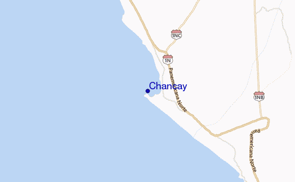
Chancay surf Forecast / Lima / Peru
48hr Weather and Surf, issued 6 am Wednesday 24 Apr 2024 -05
Forecast update in hr min s Update imminent
Chancay surf forecast is for near shore open water. Breaking waves will often be smaller at less exposed spots.
Today's Chancay sea temperature is 18.3°C (Statistics for 24 Apr 1981-2005 - mean: 20.2 °C max: 23.7 °C min: 18.5 °C)
- Map Icons:
 Break
Break Live Wave Height (m)
 Live Wind Speed (km/h)
 Surf Rating (10 Max)
 Ocean Swells (m)
- Wind Speed (km/h)
Chancay surf forecast is for near shore open water. Breaking waves will often be smaller at less exposed spots.
Today's Chancay sea temperature is 18.3°C (Statistics for 24 Apr 1981-2005 - mean: 20.2 °C max: 23.7 °C min: 18.5 °C)
How big are the waves at Chancay today?
The current surf forecast for Chancay at 9AM is: 0.9m 12s primary swell from a South-southwest direction and 0.6m 6s secondary swell from a South direction (forecast issued at 06:00am April 24). The wind direction is predicted to be cross-offshore and the swell rating is 2.
| Time (-05) & Date | Wave Height | Wave Period |
|---|---|---|
| Morning (24 Apr) | 3ft (0.9m) | 12s |
| Afternoon (24 Apr) | 2ft (0.6m) | 18s |
| Evening (24 Apr) | 2.5ft (0.7m) | 18s |
Table - waves today at Chancay. (Swell directed towards the surf break)
Updates in hr min s Update imminent
Wednesday 24 | Thursday 25 | Friday 26 | Saturday 27 | Sunday 28 | Monday 29 | Tuesday 30 | Wednesday 01 | |||||||||||||||||||||||||||||||||||||||||||||||||||||
| 4 AM | 7 AM | 10 AM | 1 PM | 4 PM | 7 PM | 10 PM | 1 AM | 4 AM | 7 AM | 10 AM | 1 PM | 4 PM | 7 PM | 10 PM | 1 AM | 4 AM | 7 AM | 10 AM | 1 PM | 4 PM | 7 PM | 10 PM | 1 AM | 4 AM | 7 AM | 10 AM | 1 PM | 4 PM | 7 PM | 10 PM | 1 AM | 4 AM | 7 AM | 10 AM | 1 PM | 4 PM | 7 PM | 10 PM | 1 AM | 4 AM | 7 AM | 10 AM | 1 PM | 4 PM | 7 PM | 10 PM | 1 AM | 4 AM | 7 AM | 10 AM | 1 PM | 4 PM | 7 PM | 10 PM | 1 AM | 4 AM | 7 AM | 10 AM | 1 PM | |
Rating (10 max) | ||||||||||||||||||||||||||||||||||||||||||||||||||||||||||||
Swell Height Map |    |  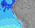 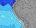 | 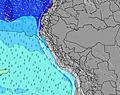 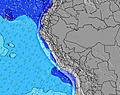 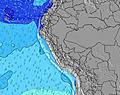 | 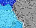  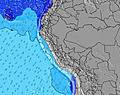 | 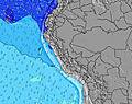   |   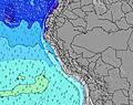 | 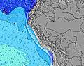 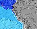 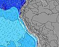 | 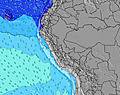 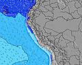 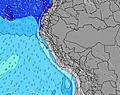 | ||||||||||||||||||||||||||||||||||||||||||||||||||||
| Wave Height (m) & direction (?) | ||||||||||||||||||||||||||||||||||||||||||||||||||||||||||||
| Period(s) (?) | 12 | 12 | 19 | 19 | 18 | 18 | 18 | 18 | 18 | 12 | 16 | 16 | 16 | 16 | 16 | 16 | 16 | 15 | 15 | 15 | 15 | 15 | 15 | 16 | 16 | 16 | 15 | 15 | 14 | 14 | 14 | 14 | 14 | 14 | 14 | 14 | 14 | 14 | 17 | 16 | 16 | 16 | 16 | 15 | 15 | 15 | 14 | 14 | 14 | 14 | 14 | 14 | 14 | 13 | 13 | 13 | 13 | 13 | 18 | 17 |
Wave (?)Graph | ||||||||||||||||||||||||||||||||||||||||||||||||||||||||||||
| Energy (?) | 247 | 247 | 293 | 222 | 203 | 199 | 304 | 370 | 300 | 290 | 264 | 371 | 366 | 498 | 498 | 492 | 480 | 380 | 600 | 576 | 574 | 581 | 512 | 532 | 783 | 546 | 525 | 479 | 466 | 466 | 346 | 459 | 459 | 407 | 447 | 336 | 407 | 638 | 1235 | 1122 | 1081 | 1141 | 1126 | 1083 | 1014 | 911 | 899 | 886 | 785 | 722 | 702 | 672 | 643 | 586 | 499 | 491 | 491 | 378 | 373 | 429 |
Wind (km/h) | ||||||||||||||||||||||||||||||||||||||||||||||||||||||||||||
| Wind State (?) onshore cross-onshore cross-shore cross-offshore offshore glassy | cross- off | cross- off | cross | cross | cross | cross- off | cross- off | cross- off | cross- off | cross- off | cross- off | cross | cross- off | cross- off | cross- off | cross- off | cross- off | cross- off | cross | cross | cross | cross- off | cross- off | cross- off | cross- off | cross- off | cross | cross | cross | cross- off | cross- off | cross- off | cross- off | cross- off | cross | cross | cross | glass | cross- off | cross- off | cross- off | cross- off | cross | cross | cross | cross- off | glass | glass | glass | cross- off | cross | cross | cross | glass | cross- off | cross- off | cross- off | cross- off | cross | cross |
High Tide / height (m) | 6:08AM 0.86 | 5:34PM 0.68 | 6:40AM 0.87 | 5:56PM 0.63 | 7:15AM 0.86 | 6:18PM 0.59 | 7:54AM 0.84 | 6:39PM 0.54 | 8:42AM 0.82 | 7:01PM 0.51 | 9:42AM 0.81 | 7:33PM 0.46 | 10:51AM 0.82 | 9:36PM 0.43 | 12:00PM 0.85 | |||||||||||||||||||||||||||||||||||||||||||||
Low Tide / height (m) | 12:15PM 0.32 | 11:52PM 0.12 | 12:53PM 0.35 | 12:15AM 0.12 | 1:33PM 0.38 | 12:39AM 0.13 | 2:20PM 0.42 | 1:08AM 0.15 | 3:23PM 0.45 | 1:42AM 0.17 | 5:17PM 0.45 | 2:29AM 0.21 | 7:17PM 0.42 | 3:40AM 0.25 | ||||||||||||||||||||||||||||||||||||||||||||||
Wednesday 24 | Thursday 25 | Friday 26 | Saturday 27 | Sunday 28 | Monday 29 | Tuesday 30 | Wednesday 01 | |||||||||||||||||||||||||||||||||||||||||||||||||||||
| Sunrise | - | 6:13 | - | - | - | - | - | - | - | 6:13 | - | - | - | - | - | - | - | 6:13 | - | - | - | - | - | - | - | 6:13 | - | - | - | - | - | - | - | 6:15 | - | - | - | - | - | - | - | 6:15 | - | - | - | - | - | - | - | 6:15 | - | - | - | - | - | - | - | 6:15 | - | - |
| Sunset | - | - | - | - | 5:59 | - | - | - | - | - | - | - | 5:59 | - | - | - | - | - | - | - | 5:58 | - | - | - | - | - | - | - | 5:58 | - | - | - | - | - | - | - | 5:57 | - | - | - | - | - | - | - | 5:57 | - | - | - | - | - | - | - | 5:57 | - | - | - | - | - | - | - |
Rain (mm) | - | - | - | - | - | - | - | - | - | - | - | - | - | - | - | - | - | - | - | - | - | - | - | - | - | - | - | - | - | - | - | - | - | - | - | - | - | - | - | - | - | - | - | - | - | - | - | - | - | - | - | - | - | - | - | - | - | - | - | - |
| Temp. °C | 20 | 19 | 20 | 21 | 21 | 20 | 19 | 19 | 19 | 19 | 21 | 22 | 21 | 20 | 20 | 20 | 19 | 19 | 21 | 22 | 21 | 20 | 20 | 19 | 19 | 19 | 21 | 21 | 21 | 19 | 19 | 19 | 19 | 19 | 21 | 22 | 21 | 19 | 19 | 19 | 19 | 19 | 21 | 22 | 21 | 20 | 19 | 19 | 19 | 19 | 21 | 22 | 20 | 20 | 19 | 19 | 19 | 19 | 21 | 21 |
| Feels °C (?) | 22 | 20 | 21 | 22 | 22 | 22 | 20 | 21 | 20 | 20 | 22 | 23 | 21 | 21 | 21 | 22 | 20 | 21 | 22 | 23 | 22 | 21 | 22 | 20 | 20 | 20 | 22 | 21 | 22 | 20 | 20 | 20 | 20 | 20 | 22 | 23 | 22 | 21 | 20 | 20 | 20 | 20 | 21 | 22 | 22 | 22 | 21 | 21 | 21 | 20 | 22 | 22 | 20 | 22 | 20 | 20 | 20 | 20 | 22 | 21 |
FREE! Surf-Forecast.com widget for your website
The surf report / weather widget below is available to embed on third party websites free of charge and provides a summary of our Chancay surf forecast. Simply grab the html code snippet that we provide and paste it into your own site. You can choose your preferred language and metric/imperial units for the surf forecast feed to suit users of your site. Click here to get the code.


 Nearest