

- Forecast
- Maps
- Live
- Weather State
- Spot Information

Surf Forecasts
Reef
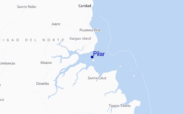
Pilar surf Forecast / Siargao Islands / Philippines
48hr Weather and Surf, issued 1 pm Friday 19 Apr 2024 PST
Forecast update in hr min s Update imminent
Pilar surf forecast is for near shore open water. Breaking waves will often be smaller at less exposed spots.
Today's Pilar sea temperature is 29.2°C (Statistics for 19 Apr 1981-2005 - mean: 28.7 °C max: 29.4 °C min: 27.9 °C)
- Map Icons:
 Break
Break Live Wave Height (m)
 Live Wind Speed (km/h)
 Surf Rating (10 Max)
 Ocean Swells (m)
- Wind Speed (km/h)
Pilar surf forecast is for near shore open water. Breaking waves will often be smaller at less exposed spots.
Today's Pilar sea temperature is 29.2°C (Statistics for 19 Apr 1981-2005 - mean: 28.7 °C max: 29.4 °C min: 27.9 °C)
How big are the waves at Pilar today?
The current surf forecast for Pilar at 5PM is: 1.3m 14s primary swell from a East-northeast direction and 0.4m 9s secondary swell from a Northeast direction (forecast issued at 01:00pm April 19). The wind direction is predicted to be onshore and the swell rating is 2.
| Time (PST) & Date | Wave Height | Wave Period |
|---|---|---|
| Morning (19 Apr) | 3.5ft (1.1m) | 11s |
| Afternoon (19 Apr) | 2.5ft (0.8m) | 14s |
| Evening (19 Apr) | 4.5ft (1.3m) | 13s |
Table - waves today at Pilar. (Swell directed towards the surf break)
Updates in hr min s Update imminent
Friday 19 | Saturday 20 | Sunday 21 | Monday 22 | Tuesday 23 | Wednesday 24 | Thursday 25 | Friday 26 | |||||||||||||||||||||||||||||||||||||||||||||||||||||
| 11 AM | 2 PM | 5 PM | 8 PM | 11 PM | 2 AM | 5 AM | 8 AM | 11 AM | 2 PM | 5 PM | 8 PM | 11 PM | 2 AM | 5 AM | 8 AM | 11 AM | 2 PM | 5 PM | 8 PM | 11 PM | 2 AM | 5 AM | 8 AM | 11 AM | 2 PM | 5 PM | 8 PM | 11 PM | 2 AM | 5 AM | 8 AM | 11 AM | 2 PM | 5 PM | 8 PM | 11 PM | 2 AM | 5 AM | 8 AM | 11 AM | 2 PM | 5 PM | 8 PM | 11 PM | 2 AM | 5 AM | 8 AM | 11 AM | 2 PM | 5 PM | 8 PM | 11 PM | 2 AM | 5 AM | 8 AM | 11 AM | 2 PM | 5 PM | 8 PM | |
Rating (10 max) | ||||||||||||||||||||||||||||||||||||||||||||||||||||||||||||
Swell Height Map |    | 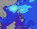 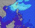 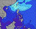 | 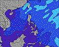   |   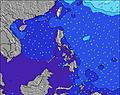 | 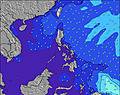 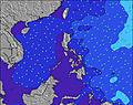 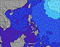 | 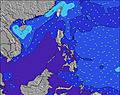 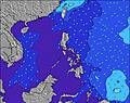 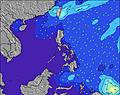 | 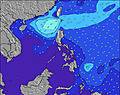 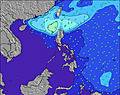 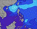 | 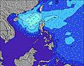 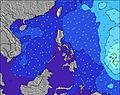 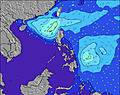 | ||||||||||||||||||||||||||||||||||||||||||||||||||||
| Wave Height (m) & direction (?) | ||||||||||||||||||||||||||||||||||||||||||||||||||||||||||||
| Period(s) (?) | 11 | 14 | 14 | 13 | 13 | 13 | 13 | 13 | 13 | 13 | 13 | 13 | 13 | 13 | 13 | 13 | 13 | 13 | 12 | 12 | 12 | 12 | 12 | 12 | 12 | 12 | 7 | 7 | 7 | 7 | 8 | 8 | 8 | 8 | 8 | 8 | 8 | 8 | 8 | 8 | 8 | 8 | 8 | 8 | 8 | 8 | 7 | 7 | 7 | 8 | 8 | 8 | 8 | 8 | 8 | 8 | 8 | 8 | 6 | 7 |
Wave (?)Graph | ||||||||||||||||||||||||||||||||||||||||||||||||||||||||||||
| Energy (?) | 286 | 253 | 604 | 615 | 615 | 606 | 606 | 606 | 451 | 451 | 388 | 346 | 341 | 335 | 330 | 281 | 286 | 286 | 273 | 260 | 212 | 209 | 209 | 169 | 167 | 190 | 186 | 238 | 203 | 215 | 221 | 233 | 273 | 263 | 263 | 314 | 284 | 291 | 291 | 219 | 219 | 187 | 153 | 153 | 149 | 120 | 108 | 108 | 108 | 127 | 195 | 241 | 201 | 165 | 140 | 140 | 140 | 133 | 113 | 127 |
Wind (km/h) | ||||||||||||||||||||||||||||||||||||||||||||||||||||||||||||
| Wind State (?) onshore cross-onshore cross-shore cross-offshore offshore glassy | cross- on | on | on | on | cross- on | on | on | on | cross- on | cross- on | cross- on | cross- on | cross- on | cross- on | on | on | cross- on | on | cross- on | cross- on | cross- on | cross- on | cross- on | cross- on | cross- on | cross- on | cross- on | cross- on | cross- on | cross- on | cross- on | cross- on | cross- on | cross- on | cross- on | cross- on | cross- on | cross- on | cross- on | cross- on | cross- on | cross- on | on | cross- on | cross- on | cross- on | cross- on | cross- on | cross | cross- on | cross | cross- on | cross- on | cross | cross- on | cross- on | cross- on | cross- on | cross- on | cross- on |
High Tide / height (m) | 3:26PM 1.51 | 4:05AM 1.62 | 4:08PM 1.61 | 4:28AM 1.71 | 4:44PM 1.70 | 4:52AM 1.79 | 5:18PM 1.76 | 5:15AM 1.85 | 5:50PM 1.80 | 5:39AM 1.89 | 6:22PM 1.80 | 6:03AM 1.91 | 6:55PM 1.77 | 6:29AM 1.91 | 7:29PM 1.71 | |||||||||||||||||||||||||||||||||||||||||||||
Low Tide / height (m) | 9:43PM 0.58 | 10:09AM 0.66 | 10:16PM 0.54 | 10:38AM 0.51 | 10:45PM 0.52 | 11:06AM 0.37 | 11:13PM 0.52 | 11:34AM 0.26 | 11:40PM 0.54 | 12:03PM 0.19 | 12:07AM 0.58 | 12:32PM 0.15 | 12:35AM 0.64 | 1:04PM 0.15 | ||||||||||||||||||||||||||||||||||||||||||||||
Friday 19 | Saturday 20 | Sunday 21 | Monday 22 | Tuesday 23 | Wednesday 24 | Thursday 25 | Friday 26 | |||||||||||||||||||||||||||||||||||||||||||||||||||||
| Sunrise | - | - | - | - | - | - | - | 5:22 | - | - | - | - | - | - | - | 5:22 | - | - | - | - | - | - | - | 5:20 | - | - | - | - | - | - | - | 5:20 | - | - | - | - | - | - | - | 5:20 | - | - | - | - | - | - | - | 5:20 | - | - | - | - | - | - | - | 5:20 | - | - | - | - |
| Sunset | - | - | 5:45 | - | - | - | - | - | - | - | 5:45 | - | - | - | - | - | - | - | 5:45 | - | - | - | - | - | - | - | 5:45 | - | - | - | - | - | - | - | 5:45 | - | - | - | - | - | - | - | 5:45 | - | - | - | - | - | - | - | 5:45 | - | - | - | - | - | - | - | 5:45 | - |
Rain (mm) | - | - | - | - | - | - | 1 | 2 | 1 | - | - | - | - | - | - | 1 | 5 | 5 | 6 | 4 | 2 | 2 | 1 | 2 | - | - | - | - | 1 | 1 | 1 | 1 | 1 | 1 | - | - | 1 | 2 | 2 | 1 | - | - | - | 2 | 2 | 3 | 2 | 1 | 2 | 1 | 1 | - | - | - | - | - | - | - | - | - |
| Temp. °C | 28 | 28 | 28 | 27 | 28 | 27 | 27 | 28 | 28 | 28 | 28 | 28 | 28 | 28 | 28 | 28 | 27 | 27 | 27 | 27 | 27 | 27 | 27 | 28 | 28 | 28 | 28 | 28 | 28 | 28 | 27 | 28 | 28 | 28 | 28 | 28 | 28 | 27 | 27 | 27 | 28 | 28 | 28 | 28 | 28 | 27 | 27 | 27 | 27 | 28 | 27 | 26 | 27 | 27 | 27 | 27 | 28 | 28 | 28 | 28 |
| Feels °C (?) | 30 | 30 | 30 | 29 | 30 | 30 | 30 | 30 | 29 | 29 | 29 | 30 | 30 | 30 | 30 | 30 | 28 | 29 | 29 | 29 | 29 | 30 | 30 | 30 | 30 | 30 | 30 | 30 | 31 | 31 | 29 | 30 | 31 | 30 | 30 | 30 | 30 | 29 | 29 | 29 | 30 | 30 | 30 | 31 | 31 | 30 | 30 | 30 | 30 | 31 | 30 | 30 | 32 | 31 | 31 | 30 | 31 | 30 | 30 | 31 |
FREE! Surf-Forecast.com widget for your website
The surf report / weather widget below is available to embed on third party websites free of charge and provides a summary of our Pilar surf forecast. Simply grab the html code snippet that we provide and paste it into your own site. You can choose your preferred language and metric/imperial units for the surf forecast feed to suit users of your site. Click here to get the code.


 Nearest