

- Forecast
- Maps
- Live
- Weather State
- Spot Information

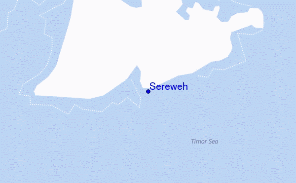
Sereweh surf Forecast / Lombok – South / Indonesia
- Map Icons:
 Break
Break Live Wave Height (m)
 Live Wind Speed (km/h)
 Surf Rating (10 Max)
 Ocean Swells (m)
- Wind Speed (km/h)
How big are the waves at Sereweh today?
The current surf forecast for Sereweh at 3AM is: 1.0m 16s primary swell from a Southwest direction and 0.7m 12s secondary swell from a Southwest direction, 1.1m 6s secondary swell from a Southeast direction (forecast issued at 01:00am April 19). The wind direction is predicted to be cross-onshore and the swell rating is 2.
| Time (WITA) & Date | Wave Height | Wave Period |
|---|---|---|
| Morning (19 Apr) | 3.5ft (1.0m) | 16s |
| Afternoon (19 Apr) | 3.5ft (1.1m) | 16s |
| Evening (19 Apr) | 3.5ft (1.1m) | 15s |
Table - waves today at Sereweh. (Swell directed towards the surf break)
Friday 19 | Saturday 20 | Sunday 21 | Monday 22 | Tuesday 23 | Wednesday 24 | Thursday 25 | Friday 26 | |||||||||||||||||||||||||||||||||||||||||||||||||||||
| 11 PM | 2 AM | 5 AM | 8 AM | 11 AM | 2 PM | 5 PM | 8 PM | 11 PM | 2 AM | 5 AM | 8 AM | 11 AM | 2 PM | 5 PM | 8 PM | 11 PM | 2 AM | 5 AM | 8 AM | 11 AM | 2 PM | 5 PM | 8 PM | 11 PM | 2 AM | 5 AM | 8 AM | 11 AM | 2 PM | 5 PM | 8 PM | 11 PM | 2 AM | 5 AM | 8 AM | 11 AM | 2 PM | 5 PM | 8 PM | 11 PM | 2 AM | 5 AM | 8 AM | 11 AM | 2 PM | 5 PM | 8 PM | 11 PM | 2 AM | 5 AM | 8 AM | 11 AM | 2 PM | 5 PM | 8 PM | 11 PM | 2 AM | 5 AM | 8 AM | |
Rating (10 max) | ||||||||||||||||||||||||||||||||||||||||||||||||||||||||||||
Swell Height Map |    |    |    |    |    |   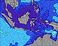 |  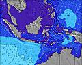 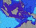 |  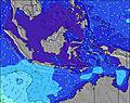 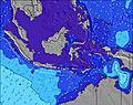 | 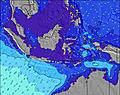 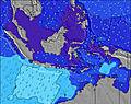 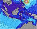 | |||||||||||||||||||||||||||||||||||||||||||||||||||
| Wave Height (m) & direction (?) | ||||||||||||||||||||||||||||||||||||||||||||||||||||||||||||
| Period(s) (?) | 17 | 16 | 16 | 16 | 16 | 16 | 16 | 15 | 15 | 15 | 15 | 16 | 15 | 15 | 15 | 14 | 14 | 8 | 8 | 8 | 8 | 8 | 13 | 7 | 13 | 8 | 14 | 17 | 15 | 15 | 16 | 16 | 16 | 16 | 16 | 16 | 15 | 14 | 14 | 14 | 14 | 14 | 14 | 14 | 16 | 16 | 16 | 16 | 15 | 15 | 14 | 14 | 14 | 14 | 14 | 13 | 13 | 13 | 13 | 13 |
Wave (?)Graph | ||||||||||||||||||||||||||||||||||||||||||||||||||||||||||||
| Energy (?) | 389 | 511 | 581 | 581 | 437 | 504 | 603 | 519 | 505 | 505 | 525 | 532 | 505 | 485 | 355 | 350 | 350 | 435 | 413 | 375 | 345 | 253 | 250 | 225 | 250 | 345 | 350 | 555 | 385 | 453 | 864 | 875 | 553 | 502 | 502 | 964 | 844 | 821 | 821 | 821 | 821 | 742 | 742 | 639 | 1239 | 1239 | 1373 | 1339 | 1083 | 974 | 947 | 947 | 934 | 862 | 802 | 669 | 615 | 606 | 528 | 528 |
Wind (km/h) | ||||||||||||||||||||||||||||||||||||||||||||||||||||||||||||
| Wind State (?) onshore cross-onshore cross-shore cross-offshore offshore glassy | on | cross- on | cross- on | cross- on | on | on | on | cross- on | cross- on | cross- on | cross- on | on | on | on | on | on | on | cross- on | cross- on | cross- on | on | on | on | on | on | cross- on | cross- on | glass | glass | on | on | cross | cross- off | cross- off | cross- off | cross- off | cross- on | on | on | cross- on | cross | cross- off | cross- off | glass | glass | on | cross- on | glass | glass | cross- on | cross- on | cross | glass | glass | cross- on | cross- on | glass | on | on | on |
High Tide / height (m) | 8:45AM 1.68 | 8:12PM 1.72 | 9:02AM 1.87 | 8:56PM 1.85 | 9:21AM 2.05 | 9:31PM 1.96 | 9:40AM 2.21 | 10:02PM 2.04 | 10:01AM 2.35 | 10:31PM 2.08 | 10:23AM 2.45 | 10:59PM 2.08 | 10:47AM 2.51 | 11:27PM 2.04 | ||||||||||||||||||||||||||||||||||||||||||||||
Low Tide / height (m) | 2:06AM 0.83 | 2:38PM 1.09 | 2:43AM 0.74 | 3:10PM 0.87 | 3:10AM 0.67 | 3:38PM 0.65 | 3:35AM 0.61 | 4:04PM 0.46 | 3:58AM 0.58 | 4:30PM 0.29 | 4:21AM 0.56 | 4:57PM 0.17 | 4:44AM 0.57 | 5:24PM 0.10 | 5:08AM 0.59 | |||||||||||||||||||||||||||||||||||||||||||||
Friday 19 | Saturday 20 | Sunday 21 | Monday 22 | Tuesday 23 | Wednesday 24 | Thursday 25 | Friday 26 | |||||||||||||||||||||||||||||||||||||||||||||||||||||
| Sunrise | - | - | - | 6:16 | - | - | - | - | - | - | - | 6:16 | - | - | - | - | - | - | - | 6:16 | - | - | - | - | - | - | - | 6:16 | - | - | - | - | - | - | - | 6:16 | - | - | - | - | - | - | - | 6:16 | - | - | - | - | - | - | - | 6:16 | - | - | - | - | - | - | - | 6:16 |
| Sunset | - | - | - | - | - | - | 6:08 | - | - | - | - | - | - | - | 6:07 | - | - | - | - | - | - | - | 6:07 | - | - | - | - | - | - | - | 6:07 | - | - | - | - | - | - | - | 6:07 | - | - | - | - | - | - | - | 6:07 | - | - | - | - | - | - | - | 6:06 | - | - | - | - | - |
Rain (mm) | - | - | - | - | - | - | 1 | 1 | - | - | - | - | - | - | 3 | 1 | 1 | 2 | - | - | 1 | 1 | 1 | 2 | 2 | 1 | 2 | - | - | 1 | 3 | 3 | 1 | - | - | - | 1 | 1 | 1 | 3 | 1 | 1 | - | - | - | - | 1 | 2 | - | - | - | - | - | 1 | 2 | 3 | 3 | 2 | 4 | 3 |
| Temp. °C | 27 | 27 | 27 | 27 | 28 | 29 | 29 | 28 | 27 | 27 | 27 | 27 | 29 | 29 | 28 | 28 | 27 | 27 | 27 | 27 | 28 | 29 | 28 | 28 | 27 | 27 | 27 | 27 | 28 | 28 | 28 | 27 | 27 | 27 | 26 | 27 | 28 | 28 | 28 | 27 | 27 | 26 | 26 | 27 | 28 | 29 | 29 | 27 | 27 | 26 | 27 | 27 | 28 | 29 | 29 | 28 | 27 | 26 | 26 | 27 |
| Feels °C (?) | 29 | 29 | 30 | 31 | 31 | 30 | 31 | 31 | 30 | 31 | 32 | 30 | 32 | 29 | 29 | 30 | 28 | 30 | 30 | 30 | 31 | 30 | 30 | 30 | 30 | 30 | 31 | 32 | 33 | 31 | 31 | 30 | 31 | 31 | 30 | 31 | 32 | 31 | 31 | 30 | 31 | 30 | 30 | 32 | 33 | 34 | 33 | 32 | 32 | 30 | 31 | 31 | 33 | 33 | 33 | 32 | 32 | 30 | 30 | 31 |
FREE! Surf-Forecast.com widget for your website
The surf report / weather widget below is available to embed on third party websites free of charge and provides a summary of our Sereweh surf forecast. Simply grab the html code snippet that we provide and paste it into your own site. You can choose your preferred language and metric/imperial units for the surf forecast feed to suit users of your site. Click here to get the code.


 Nearest