

- Forecast
- Maps
- Live
- Weather State
- Spot Information

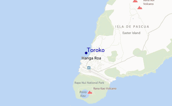
Toroko surf Forecast / Easter Island / Chile
- Map Icons:
 Break
Break Live Wave Height (m)
 Live Wind Speed (km/h)
 Surf Rating (10 Max)
 Ocean Swells (m)
- Wind Speed (km/h)
How big are the waves at Toroko today?
The current surf forecast for Toroko at 2AM is: 1.6m 14s primary swell from a Southwest direction and 0.3m 12s secondary swell from a Northwest direction, 0.8m 7s secondary swell from a South-southeast direction (forecast issued at 11:00pm April 24). The wind direction is predicted to be offshore and the swell rating is 4.
| Time (-06) & Date | Wave Height | Wave Period |
|---|---|---|
| Morning (25 Apr) | 5ft (1.6m) | 14s |
| Afternoon (25 Apr) | 4.5ft (1.4m) | 13s |
| Evening (25 Apr) | 4.5ft (1.4m) | 14s |
Table - waves today at Toroko. (Swell directed towards the surf break)
Thursday 25 | Friday 26 | Saturday 27 | Sunday 28 | Monday 29 | Tuesday 30 | Wednesday 01 | Thursday 02 | |||||||||||||||||||||||||||||||||||||||||||||||||||||
| 9 PM | 0 AM | 3 AM | 6 AM | 9 AM | 12 PM | 3 PM | 6 PM | 9 PM | 0 AM | 3 AM | 6 AM | 9 AM | 12 PM | 3 PM | 6 PM | 9 PM | 0 AM | 3 AM | 6 AM | 9 AM | 12 PM | 3 PM | 6 PM | 9 PM | 0 AM | 3 AM | 6 AM | 9 AM | 12 PM | 3 PM | 6 PM | 9 PM | 0 AM | 3 AM | 6 AM | 9 AM | 12 PM | 3 PM | 6 PM | 9 PM | 0 AM | 3 AM | 6 AM | 9 AM | 12 PM | 3 PM | 6 PM | 9 PM | 0 AM | 3 AM | 6 AM | 9 AM | 12 PM | 3 PM | 6 PM | 9 PM | 0 AM | 3 AM | 6 AM | |
Rating (10 max) | ||||||||||||||||||||||||||||||||||||||||||||||||||||||||||||
Swell Height Map |    |  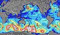 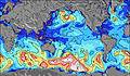 | 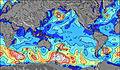 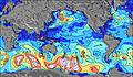  |    | 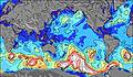 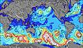 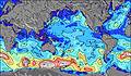 | 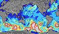 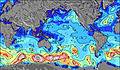 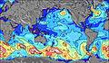 | 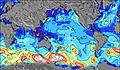 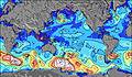 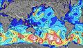 | 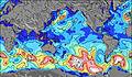 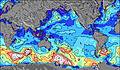 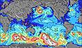 | 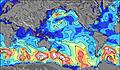 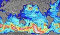 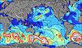 | |||||||||||||||||||||||||||||||||||||||||||||||||||
| Wave Height (m) & direction (?) | ||||||||||||||||||||||||||||||||||||||||||||||||||||||||||||
| Period(s) (?) | 14 | 14 | 14 | 14 | 14 | 13 | 13 | 13 | 14 | 14 | 14 | 14 | 14 | 14 | 14 | 16 | 8 | 16 | 15 | 15 | 15 | 8 | 14 | 8 | 8 | 9 | 9 | 8 | 9 | 9 | 11 | 9 | 9 | 9 | 8 | 11 | 14 | 14 | 17 | 16 | 16 | 16 | 16 | 15 | 14 | 14 | 14 | 14 | 14 | 13 | 13 | 13 | 13 | 14 | 14 | 14 | 14 | 14 | 14 | 16 |
Wave (?)Graph | ||||||||||||||||||||||||||||||||||||||||||||||||||||||||||||
| Energy (?) | 1283 | 961 | 907 | 979 | 889 | 837 | 623 | 569 | 661 | 681 | 621 | 639 | 630 | 612 | 518 | 598 | 655 | 706 | 818 | 857 | 857 | 574 | 613 | 551 | 899 | 769 | 679 | 613 | 628 | 493 | 459 | 612 | 308 | 393 | 277 | 284 | 297 | 281 | 342 | 437 | 421 | 416 | 406 | 542 | 506 | 387 | 387 | 382 | 327 | 290 | 282 | 196 | 286 | 245 | 248 | 245 | 361 | 407 | 415 | 671 |
Wind (km/h) | ||||||||||||||||||||||||||||||||||||||||||||||||||||||||||||
| Wind State (?) onshore cross-onshore cross-shore cross-offshore offshore glassy | off | off | off | off | off | off | off | off | off | off | off | off | off | off | off | off | off | off | off | off | off | cross- off | cross- off | off | off | off | cross- off | off | cross- off | cross | cross | cross- off | cross- off | cross- off | cross- off | cross- off | cross- off | cross- off | cross- off | cross- off | cross- off | cross- off | cross- off | cross- off | cross- off | cross- off | cross- off | cross- off | cross- off | cross- off | cross- off | cross- off | cross- off | cross- off | cross- off | cross- off | cross- off | cross- off | cross- off | cross- off |
High Tide / height (m) | 6:10AM 0.72 | 6:37PM 0.58 | 6:54AM 0.70 | 7:25PM 0.54 | 7:43AM 0.69 | 8:21PM 0.52 | 8:41AM 0.67 | 9:24PM 0.51 | 9:45AM 0.66 | 10:32PM 0.53 | 10:52AM 0.67 | 11:38PM 0.58 | 11:58AM 0.70 | 12:38AM 0.64 | ||||||||||||||||||||||||||||||||||||||||||||||
Low Tide / height (m) | 11:35PM 0.30 | 12:20PM 0.27 | 12:13AM 0.32 | 1:07PM 0.29 | 12:58AM 0.35 | 2:03PM 0.30 | 1:56AM 0.37 | 3:08PM 0.31 | 3:07AM 0.38 | 4:16PM 0.29 | 4:23AM 0.36 | 5:20PM 0.26 | 5:33AM 0.31 | 6:17PM 0.21 | ||||||||||||||||||||||||||||||||||||||||||||||
Thursday 25 | Friday 26 | Saturday 27 | Sunday 28 | Monday 29 | Tuesday 30 | Wednesday 01 | Thursday 02 | |||||||||||||||||||||||||||||||||||||||||||||||||||||
| Sunrise | - | - | - | - | 7:39 | - | - | - | - | - | - | - | 7:39 | - | - | - | - | - | - | - | 7:41 | - | - | - | - | - | - | - | 7:41 | - | - | - | - | - | - | - | 7:41 | - | - | - | - | - | - | - | 7:41 | - | - | - | - | - | - | - | 7:43 | - | - | - | - | - | - | - |
| Sunset | - | - | - | - | - | - | - | 6:50 | - | - | - | - | - | - | - | 6:49 | - | - | - | - | - | - | - | 6:47 | - | - | - | - | - | - | - | 6:46 | - | - | - | - | - | - | - | 6:46 | - | - | - | - | - | - | - | 6:45 | - | - | - | - | - | - | - | 6:45 | - | - | - | - |
Rain (mm) | - | - | - | - | - | 1 | - | - | - | - | - | - | - | - | - | - | 1 | 1 | 2 | 2 | 2 | 2 | 2 | 1 | - | - | 2 | 1 | 1 | - | - | - | - | - | - | - | 1 | - | - | - | - | - | - | 1 | 2 | 1 | - | - | - | - | - | - | - | - | - | - | - | - | - | - |
| Temp. °C | 20 | 20 | 20 | 20 | 20 | 20 | 20 | 20 | 20 | 21 | 20 | 20 | 20 | 20 | 20 | 19 | 19 | 20 | 19 | 19 | 20 | 20 | 20 | 20 | 20 | 20 | 19 | 20 | 20 | 21 | 21 | 21 | 21 | 22 | 21 | 21 | 21 | 22 | 22 | 22 | 22 | 21 | 21 | 21 | 21 | 21 | 21 | 21 | 21 | 22 | 22 | 22 | 21 | 21 | 21 | 22 | 22 | 22 | 22 | 21 |
| Feels °C (?) | 16 | 17 | 17 | 17 | 17 | 17 | 17 | 16 | 15 | 17 | 16 | 17 | 17 | 17 | 16 | 13 | 12 | 14 | 14 | 14 | 15 | 15 | 15 | 14 | 15 | 16 | 16 | 18 | 20 | 19 | 18 | 19 | 19 | 20 | 19 | 20 | 19 | 20 | 20 | 20 | 19 | 18 | 19 | 17 | 16 | 15 | 15 | 16 | 16 | 18 | 18 | 18 | 17 | 16 | 17 | 18 | 18 | 18 | 19 | 19 |
FREE! Surf-Forecast.com widget for your website
The surf report / weather widget below is available to embed on third party websites free of charge and provides a summary of our Toroko surf forecast. Simply grab the html code snippet that we provide and paste it into your own site. You can choose your preferred language and metric/imperial units for the surf forecast feed to suit users of your site. Click here to get the code.


 Nearest