

- Forecast
- Maps
- Live
- Weather State
- Spot Information

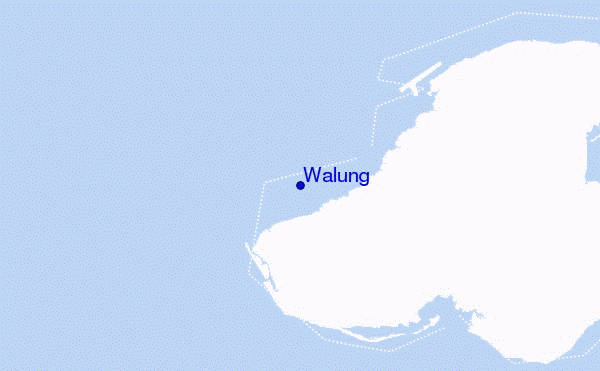
Walung surf Forecast / Kosrae / Micronesia
- Map Icons:
 Break
Break Live Wave Height (m)
 Live Wind Speed (km/h)
 Surf Rating (10 Max)
 Ocean Swells (m)
- Wind Speed (km/h)
How big are the waves at Walung today?
The current surf forecast for Walung at 11PM is: 0.8m 13s primary swell from a North-northwest direction (forecast issued at 10:00pm April 23). An open ocean swell of 1.1m 9s is not directed at the surf break, a second open ocean swell of 1.0m 8s is not directed at the surf break. The wind direction is predicted to be cross-offshore and the swell rating is 2.
| Time (+11) & Date | Wave Height | Wave Period |
|---|---|---|
| Morning (23 Apr) | - | - |
| Afternoon (23 Apr) | - | - |
| Evening (23 Apr) | 2.5ft (0.7m) | 13s |
Table - waves today at Walung. (Swell directed towards the surf break)
Tue 23 | Wednesday 24 | Thursday 25 | Friday 26 | Saturday 27 | Sunday 28 | Monday 29 | Tuesday 30 | Wed 01 | ||||||||||||||||||||||||||||||||||||||||||||||||||||
| 8 PM | 11 PM | 2 AM | 5 AM | 8 AM | 11 AM | 2 PM | 5 PM | 8 PM | 11 PM | 2 AM | 5 AM | 8 AM | 11 AM | 2 PM | 5 PM | 8 PM | 11 PM | 2 AM | 5 AM | 8 AM | 11 AM | 2 PM | 5 PM | 8 PM | 11 PM | 2 AM | 5 AM | 8 AM | 11 AM | 2 PM | 5 PM | 8 PM | 11 PM | 2 AM | 5 AM | 8 AM | 11 AM | 2 PM | 5 PM | 8 PM | 11 PM | 2 AM | 5 AM | 8 AM | 11 AM | 2 PM | 5 PM | 8 PM | 11 PM | 2 AM | 5 AM | 8 AM | 11 AM | 2 PM | 5 PM | 8 PM | 11 PM | 2 AM | 5 AM | |
Rating (10 max) | ||||||||||||||||||||||||||||||||||||||||||||||||||||||||||||
Swell Height Map |   |  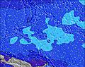 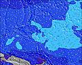 | 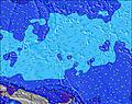  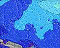 | 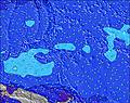 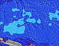 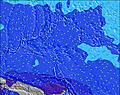 | 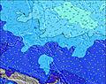 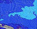 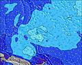 | 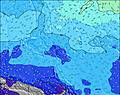 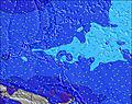  |    | 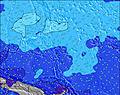 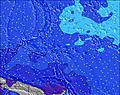 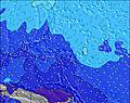 | 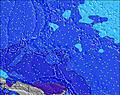 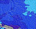 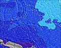 | |||||||||||||||||||||||||||||||||||||||||||||||||||
| Wave Height (m) & direction (?) | ||||||||||||||||||||||||||||||||||||||||||||||||||||||||||||
| Period(s) (?) | 13 | 13 | 13 | 13 | 13 | 12 | 14 | 13 | 13 | 14 | 13 | 13 | 12 | 12 | 12 | 12 | 12 | 12 | 11 | 11 | 11 | 11 | 11 | 10 | 10 | 10 | 10 | 10 | 10 | 9 | 9 | 16 | 18 | 17 | 16 | 16 | 9 | 9 | 15 | 14 | 14 | 14 | 14 | 14 | 13 | 13 | 13 | 13 | 13 | 13 | 13 | 12 | 12 | 12 | 12 | 12 | 12 | 8 | 9 | 9 |
Wave (?)Graph | ||||||||||||||||||||||||||||||||||||||||||||||||||||||||||||
| Energy (?) | 158 | 201 | 147 | 189 | 227 | 224 | 218 | 235 | 238 | 192 | 367 | 289 | 276 | 263 | 206 | 203 | 199 | 142 | 126 | 93 | 91 | 91 | 90 | 58 | 56 | 50 | 49 | 32 | 31 | 28 | 27 | 20 | 25 | 23 | 47 | 82 | 7 | 7 | 155 | 206 | 203 | 257 | 250 | 297 | 289 | 225 | 222 | 219 | 219 | 215 | 163 | 148 | 141 | 139 | 137 | 134 | 132 | 71 | 0 | 0 |
Wind (km/h) | ||||||||||||||||||||||||||||||||||||||||||||||||||||||||||||
| Wind State (?) onshore cross-onshore cross-shore cross-offshore offshore glassy | cross- off | cross- off | cross- off | cross- off | cross- off | cross- off | cross- off | cross- off | cross- off | off | cross- off | cross- off | cross- off | cross- off | cross- off | cross- off | cross- off | cross- off | cross- off | cross- off | cross- off | cross- off | cross- off | cross- off | cross- off | cross- off | cross- off | cross- off | cross- off | cross- off | cross- off | cross- off | cross- off | cross- off | cross- off | cross- off | cross- off | cross- off | cross- off | cross- off | cross- off | cross- off | cross- off | cross- off | cross- off | cross- off | cross- off | cross- off | cross- off | cross- off | cross- off | cross- off | cross- off | cross- off | cross- off | cross- off | cross- off | cross- off | cross- off | cross- off |
High Tide / height (m) | 3:20AM 1.56 | 3:33PM 1.32 | 3:43AM 1.59 | 3:59PM 1.26 | 4:09AM 1.59 | 4:26PM 1.18 | 4:36AM 1.55 | 4:54PM 1.09 | 5:07AM 1.49 | 5:26PM 0.98 | 5:44AM 1.40 | 6:08PM 0.87 | 6:32AM 1.29 | 7:24PM 0.76 | ||||||||||||||||||||||||||||||||||||||||||||||
Low Tide / height (m) | 9:05PM 0.11 | 9:37AM 0.08 | 9:26PM 0.11 | 10:05AM 0.07 | 9:48PM 0.13 | 10:34AM 0.10 | 10:11PM 0.17 | 11:06AM 0.15 | 10:36PM 0.22 | 11:43AM 0.24 | 11:03PM 0.31 | 12:31PM 0.35 | 11:35PM 0.42 | 1:44PM 0.45 | 12:23AM 0.56 | |||||||||||||||||||||||||||||||||||||||||||||
Tue 23 | Wednesday 24 | Thursday 25 | Friday 26 | Saturday 27 | Sunday 28 | Monday 29 | Tuesday 30 | Wed 01 | ||||||||||||||||||||||||||||||||||||||||||||||||||||
| Sunrise | - | - | - | - | 5:58 | - | - | - | - | - | - | - | 5:56 | - | - | - | - | - | - | - | 5:56 | - | - | - | - | - | - | - | 5:56 | - | - | - | - | - | - | - | 5:56 | - | - | - | - | - | - | - | 5:56 | - | - | - | - | - | - | - | 5:56 | - | - | - | - | - | - | - |
| Sunset | - | - | - | - | - | - | - | 6:14 | - | - | - | - | - | - | - | 6:14 | - | - | - | - | - | - | - | 6:14 | - | - | - | - | - | - | - | 6:14 | - | - | - | - | - | - | - | 6:14 | - | - | - | - | - | - | - | 6:14 | - | - | - | - | - | - | - | 6:14 | - | - | - | - |
Rain (mm) | 2 | 1 | 1 | 1 | 3 | 6 | 6 | 2 | 2 | 1 | - | 1 | - | - | - | 1 | - | 1 | 3 | 5 | 4 | 3 | 3 | 1 | - | - | - | 1 | 1 | 1 | 2 | 3 | 4 | 7 | 1 | 3 | 6 | 4 | 3 | 2 | 1 | - | 3 | 1 | 1 | 1 | 1 | 1 | 1 | - | - | - | - | 2 | 2 | 2 | 2 | 3 | 2 | - |
| Temp. °C | 28 | 28 | 28 | 28 | 28 | 28 | 28 | 29 | 28 | 28 | 28 | 28 | 28 | 28 | 28 | 28 | 28 | 28 | 28 | 28 | 28 | 28 | 28 | 28 | 28 | 28 | 28 | 28 | 28 | 28 | 28 | 28 | 28 | 27 | 27 | 27 | 28 | 28 | 28 | 28 | 28 | 28 | 27 | 28 | 28 | 28 | 29 | 28 | 28 | 28 | 28 | 28 | 28 | 28 | 28 | 28 | 28 | 28 | 28 | 28 |
| Feels °C (?) | 29 | 29 | 30 | 29 | 29 | 29 | 29 | 29 | 27 | 30 | 31 | 31 | 30 | 30 | 29 | 28 | 28 | 29 | 29 | 29 | 29 | 29 | 28 | 28 | 27 | 27 | 26 | 27 | 27 | 27 | 27 | 27 | 27 | 27 | 28 | 28 | 29 | 29 | 30 | 29 | 28 | 29 | 28 | 30 | 30 | 30 | 31 | 30 | 30 | 30 | 30 | 30 | 30 | 31 | 30 | 31 | 30 | 31 | 31 | 30 |
FREE! Surf-Forecast.com widget for your website
The surf report / weather widget below is available to embed on third party websites free of charge and provides a summary of our Walung surf forecast. Simply grab the html code snippet that we provide and paste it into your own site. You can choose your preferred language and metric/imperial units for the surf forecast feed to suit users of your site. Click here to get the code.


 Nearest