
Previsioni:

Previsione a breve terminepioggia leggera (Totale 2mm), per lo più che cade Sabato notte. Very mild (Max 17°C Domenica mattina, Min 13°C Domenica mattina). Vento sarà generalmente leggero. | |||||||||||||||||||
18 | Domenica 19 | Lunedì 20 | |||||||||||||||||
5 PM | 8 PM | 11 PM | 2 AM | 5 AM | 8 AM | 11 AM | 2 PM | 5 PM | 8 PM | 11 PM | 2 AM | 5 AM | 8 AM | 11 AM | 2 PM | 5 PM | 8 PM | 11 PM | |
Mappa dell'altezza del moto ondoso |  |  | 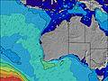 |  |  | 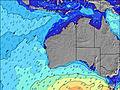 |  | ||||||||||||
Onda Altezza (m) Direzione Periodo (s) | WSW 14 | WSW 15 | WSW 15 | WSW 15 | W 14 | WSW 14 | WSW 14 | WSW 14 | WSW 13 | WSW 13 | WSW 13 | WSW 13 | WSW 13 | WSW 12 | WSW 12 | WSW 12 | WSW 11 | WSW 12 | WSW 14 |
Grafico delle onde | |||||||||||||||||||
5368 | 5916 | 4864 | 4085 | 1977 | 2763 | 2350 | 1777 | 1581 | 1255 | 1120 | 995 | 880 | 787 | 623 | 532 | 522 | 527 | 752 | |
Vento (km/h) | |||||||||||||||||||
Stato del vento onshore cross-onshore cross-shore cross-offshore offshore piatto | on | on | on | on | cross-on | cross-on | cross-on | cross-on | cross-on | cross | glassy | cross-off | off | off | glassy | cross-on | cross-on | cross-on | cross |
Alta Marea | 2:35AM0.38m | 10:07AM0.44m | 2:52AM0.44m | 9:17AM0.40m | |||||||||||||||
Basso Marea | 6:42PM0.21m | 5:22AM0.35m | 6:17PM0.22m | 7:02AM0.38m | 6:04PM0.20m | ||||||||||||||
— | — | — | — | 7:13 | — | — | — | — | — | — | — | 7:13 | — | — | — | — | — | — | |
5:31 | — | — | — | — | — | — | — | 5:31 | — | — | — | — | — | — | — | 5:32 | — | — | |
mm | — | — | — | 1 | 1 | — | — | — | — | — | — | — | — | — | — | — | — | — | — |
Temp. °C | 17 | 16 | 16 | 15 | 16 | 16 | 17 | 17 | 17 | 16 | 15 | 14 | 13 | 13 | 14 | 15 | 15 | 16 | 15 |
Gelo °C | 13 | 12 | 13 | 12 | 12 | 12 | 14 | 14 | 14 | 14 | 14 | 12 | 11 | 11 | 13 | 12 | 12 | 13 | 12 |
Onda 1 Altezza (m) Direzione Periodo (s) | WSW 14 | WSW 15 | WSW 15 | WSW 15 | W 14 | WSW 14 | WSW 14 | WSW 14 | WSW 13 | WSW 13 | WSW 13 | WSW 13 | WSW 13 | WSW 12 | WSW 12 | WSW 12 | WSW 11 | WSW 12 | WSW 14 |
5368 | 5916 | 4864 | 4085 | 1977 | 2763 | 2350 | 1777 | 1581 | 1255 | 1120 | 995 | 880 | 787 | 623 | 532 | 522 | 527 | 752 | |
Onda 2 Altezza (m) Direzione Periodo (s) | — | — | — | — | WSW 15 | — | W 13 | — | — | — | — | — | — | — | — | W 10 | W 10 | W 10 | WSW 15 |
— | — | — | — | 1258 | — | 55 | — | — | — | — | — | — | — | — | 8 | 8 | 8 | 123 | |
Onda 3 Altezza (m) Direzione Periodo (s) | — | — | — | — | — | — | — | — | — | — | — | — | — | — | — | SW 16 | — | — | — |
— | — | — | — | — | — | — | — | — | — | — | — | — | — | — | 10 | — | — | — | |
onde vento Altezza (m) Direzione Periodo (s) | — | — | — | — | — | — | — | — | — | — | — | — | — | — | — | — | — | — | — |
— | — | — | — | — | — | — | — | — | — | — | — | — | — | — | — | — | — | — | |
Il più vicino Offshore or Glassy | |||||||||||||||||||
Distanza (km) | 367 | 364 | 304 | 304 | 304 | 304 | 192 | 155 | 155 | 3 | 0 | 0 | 0 | 0 | 0 | 405 | 155 | 121 | 9 |
Migliori previsioni per le condizioni d'onda in Perth City Coast | |||||||||||||||||||
Migliori previsioni per le condizioni d'onda in Australia | |||||||||||||||||||
Trova Onde Globale | |||||||||||||||||||
- Map Icons:
 Break
Break Live Wave Height (m)
 Live Wind Speed (km/h)
 Surf Rating (10 Max)
 Ocean Swells (m)
- Wind Speed (km/h)
Widget Free Surf-Forecast.com per il tuo sito
La relazione di surf / widget meteo è disponibile qui sotto per incorporare su siti esterni a titolo gratuito e fornisce una sintesi delle nostre Floreat groyne previsione surf. Basta prendere il frammento di codice html da noi fornito e copiarlo nel proprio sito. È possibile scegliere la lingua preferita e unità metriche / imperiali per il feed delle previsioni surf per soddisfare le esigenze degli utenti del vostro sito .... Clicca qui per ottenere il codice.
 Nearest