
Previsioni:

Previsione a breve terminePioggia abbondante (Totale 24mm), più pesante durante venerdì notte. Warm (Max 20°C Sabato mattina, Min 15°C Venerdì notte). Principalmente raffiche di vento. | ||||||||||||||||||
Ven 17 | Sabato 18 | Domenica 19 | ||||||||||||||||
7 PM | 10 PM | 1 AM | 4 AM | 7 AM | 10 AM | 1 PM | 4 PM | 7 PM | 10 PM | 1 AM | 4 AM | 7 AM | 10 AM | 1 PM | 4 PM | 7 PM | 10 PM | |
Mappa dell'altezza del moto ondoso |  | 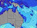 | 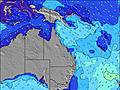 | 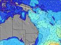 |  | 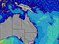 | 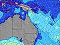 | |||||||||||
Onda Altezza (m) Direzione Periodo (s) | SE 7 | SE 7 | SE 8 | SE 8 | SE 8 | SE 9 | SE 9 | SE 10 | SE 11 | ESE 11 | SE 10 | SE 10 | SE 10 | ESE 10 | ESE 10 | ESE 10 | ESE 10 | ESE 10 |
Grafico delle onde | ||||||||||||||||||
478 | 698 | 789 | 783 | 711 | 730 | 798 | 1312 | 1661 | 1757 | 3464 | 2091 | 2294 | 2522 | 2312 | 2339 | 2473 | 2177 | |
Vento (km/h) | ||||||||||||||||||
Stato del vento onshore cross-onshore cross-shore cross-offshore offshore piatto | cross | cross | cross | cross | cross-off | cross | cross | cross | cross-off | cross-off | cross-off | cross | cross | cross-on | cross-on | cross-on | cross-on | cross-on |
Alta Marea | 10:36PM1.80m | 10:59AM1.37m | 11:19PM1.64m | 11:51AM1.36m | ||||||||||||||
Basso Marea | 4:05PM0.20m | 5:07AM0.27m | 4:56PM0.31m | 5:49AM0.32m | 5:50PM0.44m | |||||||||||||
— | — | — | 6:33 | — | — | — | — | — | — | — | 6:33 | — | — | — | — | — | — | |
— | — | — | — | — | — | — | 5:12 | — | — | — | — | — | — | — | 5:13 | — | — | |
mm | 2 | 2 | 1 | 1 | — | — | — | — | — | — | 1 | 2 | 2 | 2 | 2 | 2 | 2 | 2 |
Temp. °C | 17 | 16 | 16 | 16 | 15 | 17 | 20 | 19 | 17 | 17 | 17 | 17 | 18 | 19 | 19 | 18 | 19 | 18 |
Gelo °C | 11 | 10 | 10 | 10 | 9 | 11 | 13 | 13 | 10 | 11 | 11 | 10 | 11 | 13 | 13 | 12 | 13 | 13 |
Onda 1 Altezza (m) Direzione Periodo (s) | — | NE 8 | — | — | NE 9 | E 21 | E 20 | SE 10 | SE 11 | ESE 11 | SE 11 | E 18 | ESE 17 | SE 18 | — | — | — | — |
— | 3 | — | — | 3 | 9 | 8 | 1312 | 1661 | 1757 | 1836 | 6 | 30 | 13 | — | — | — | — | |
Onda 2 Altezza (m) Direzione Periodo (s) | — | — | — | — | E 21 | — | E 20 | E 20 | E 19 | — | E 18 | — | — | — | — | — | — | — |
— | — | — | — | 9 | — | 8 | 8 | 7 | — | 7 | — | — | — | — | — | — | — | |
Onda 3 Altezza (m) Direzione Periodo (s) | — | — | — | — | — | — | — | — | — | — | — | — | — | — | — | — | — | — |
— | — | — | — | — | — | — | — | — | — | — | — | — | — | — | — | — | — | |
onde vento Altezza (m) Direzione Periodo (s) | SE 7 | SE 7 | SE 8 | SE 8 | SE 8 | SE 9 | SE 9 | SW 4 | SW 4 | SW 4 | SE 10 | SE 10 | SE 10 | ESE 10 | ESE 10 | ESE 10 | ESE 10 | ESE 10 |
478 | 698 | 789 | 783 | 711 | 730 | 798 | 4 | 13 | 21 | 3464 | 2091 | 2294 | 2522 | 2312 | 2339 | 2473 | 2177 | |
Il più vicino Offshore or Glassy | ||||||||||||||||||
Distanza (km) | 582 | 539 | 293 | 412 | 412 | 426 | 856 | 868 | 310 | 856 | 856 | 310 | 310 | 803 | 787 | 787 | 582 | 539 |
Migliori previsioni per le condizioni d'onda in Sunshine Coast | ||||||||||||||||||
Migliori previsioni per le condizioni d'onda in Australia | ||||||||||||||||||
Trova Onde Globale | ||||||||||||||||||
- Map Icons:
 Break
Break Live Wave Height (m)
 Live Wind Speed (km/h)
 Surf Rating (10 Max)
 Ocean Swells (m)
- Wind Speed (km/h)
Widget Free Surf-Forecast.com per il tuo sito
La relazione di surf / widget meteo è disponibile qui sotto per incorporare su siti esterni a titolo gratuito e fornisce una sintesi delle nostre The groyne previsione surf. Basta prendere il frammento di codice html da noi fornito e copiarlo nel proprio sito. È possibile scegliere la lingua preferita e unità metriche / imperiali per il feed delle previsioni surf per soddisfare le esigenze degli utenti del vostro sito .... Clicca qui per ottenere il codice.
 Nearest