
Previsioni:

Previsione a breve termineper lo più asciutto. Warm (Max 24°C Venerdì mattina, Min 21°C Venerdì notte). Vento sarà generalmente leggero. | ||||||||||||||||||||||
Venerdì 17 | Sabato 18 | Domenica 19 | ||||||||||||||||||||
7 AM | 10 AM | 1 PM | 4 PM | 7 PM | 10 PM | 1 AM | 4 AM | 7 AM | 10 AM | 1 PM | 4 PM | 7 PM | 10 PM | 1 AM | 4 AM | 7 AM | 10 AM | 1 PM | 4 PM | 7 PM | 10 PM | |
Mappa dell'altezza del moto ondoso |  | 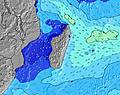 | 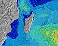 | 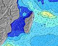 | 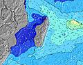 | 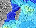 | 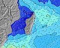 | 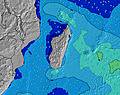 | ||||||||||||||
Onda Altezza (m) Direzione Periodo (s) | S 17 | S 17 | S 16 | S 16 | S 16 | S 15 | S 14 | S 14 | S 14 | S 13 | SSW 13 | SSW 11 | SW 18 | SW 17 | SW 16 | SW 16 | SW 16 | SW 16 | SW 15 | SW 15 | SW 14 | SW 14 |
Grafico delle onde | ||||||||||||||||||||||
153 | 280 | 612 | 590 | 589 | 619 | 501 | 487 | 372 | 334 | 265 | 167 | 158 | 148 | 214 | 254 | 306 | 411 | 365 | 360 | 404 | 447 | |
Vento (km/h) | ||||||||||||||||||||||
Stato del vento onshore cross-onshore cross-shore cross-offshore offshore piatto | glassy | glassy | cross-on | cross-on | cross | cross | cross | cross | cross-off | cross-on | cross-on | cross-on | cross | cross-off | glassy | glassy | glassy | glassy | on | cross-on | glassy | glassy |
Alta Marea | 4:27PM0.67m | 4:05AM0.67m | 5:04PM0.64m | 4:47AM0.62m | 5:40PM0.62m | |||||||||||||||||
Basso Marea | 9:59AM0.09m | 10:13PM0.28m | 10:36AM0.14m | 10:56PM0.29m | 11:11AM0.20m | |||||||||||||||||
6:54 | — | — | — | — | — | — | 6:54 | — | — | — | — | — | — | — | 6:54 | — | — | — | — | — | — | |
— | — | — | 5:53 | — | — | — | — | — | — | — | 5:54 | — | — | — | — | — | — | — | 5:54 | — | — | |
mm | — | — | — | — | — | — | — | — | — | — | — | — | — | — | — | — | — | — | — | — | — | — |
Temp. °C | 23 | 24 | 24 | 24 | 22 | 22 | 22 | 21 | 21 | 23 | 23 | 23 | 22 | 22 | 22 | 21 | 21 | 23 | 23 | 22 | 22 | 22 |
Gelo °C | 26 | 26 | 24 | 23 | 21 | 22 | 22 | 20 | 20 | 23 | 22 | 23 | 22 | 23 | 24 | 22 | 22 | 25 | 24 | 23 | 24 | 24 |
Onda 1 Altezza (m) Direzione Periodo (s) | NNW 4 | S 17 | S 16 | S 16 | S 16 | S 15 | S 14 | S 14 | S 14 | S 13 | SSW 13 | SSW 11 | SSW 11 | SSW 11 | SSW 10 | SSW 10 | SW 16 | SW 16 | SW 15 | SW 15 | SW 14 | SW 14 |
12 | 280 | 612 | 590 | 589 | 619 | 501 | 487 | 372 | 334 | 265 | 167 | 158 | 117 | 139 | 104 | 306 | 411 | 365 | 360 | 404 | 447 | |
Onda 2 Altezza (m) Direzione Periodo (s) | S 10 | S 10 | NNW 4 | NW 4 | NW 4 | NE 7 | SSW 5 | SSW 5 | SSW 5 | SSW 5 | SW 18 | SW 18 | SW 18 | SW 17 | SW 16 | SW 16 | S 10 | SSW 10 | S 10 | S 9 | SSW 15 | SSW 15 |
49 | 78 | 12 | 4 | 3 | 7 | 26 | 19 | 18 | 18 | 50 | 111 | 154 | 148 | 214 | 254 | 71 | 72 | 47 | 43 | 76 | 123 | |
Onda 3 Altezza (m) Direzione Periodo (s) | S 17 | NNW 4 | SSW 11 | NE 7 | NE 7 | NW 4 | NE 7 | NE 7 | NE 7 | WSW 19 | NE 7 | NE 6 | NE 6 | SSW 5 | ESE 8 | ESE 8 | SSW 5 | SSE 12 | SSW 5 | SSW 16 | SSW 5 | SSE 11 |
153 | 13 | 12 | 7 | 7 | 1 | 7 | 7 | 7 | 36 | 2 | 2 | 2 | 9 | 7 | 14 | 8 | 13 | 5 | 51 | 5 | 23 | |
onde vento Altezza (m) Direzione Periodo (s) | — | — | — | SSW 7 | SSW 7 | SW 4 | — | — | — | — | SW 5 | SW 5 | SW 5 | — | — | — | — | — | — | SSW 5 | — | S 5 |
— | — | — | 35 | 43 | 8 | — | — | — | — | 21 | 20 | 12 | — | — | — | — | — | — | 5 | — | 4 | |
Il più vicino Offshore or Glassy | ||||||||||||||||||||||
Distanza (km) | 0 | 0 | 22 | 4 | 4 | 4 | 4 | 4 | 0 | 4 | 20 | 20 | 4 | 0 | 0 | 0 | 0 | 0 | 4 | 4 | 0 | 0 |
Migliori previsioni per le condizioni d'onda in Réunion Island | ||||||||||||||||||||||
Migliori previsioni per le condizioni d'onda in Reunion | ||||||||||||||||||||||
Trova Onde Globale | ||||||||||||||||||||||
- Map Icons:
 Break
Break Live Wave Height (m)
 Live Wind Speed (km/h)
 Surf Rating (10 Max)
 Ocean Swells (m)
- Wind Speed (km/h)
Widget Free Surf-Forecast.com per il tuo sito
La relazione di surf / widget meteo è disponibile qui sotto per incorporare su siti esterni a titolo gratuito e fornisce una sintesi delle nostre Bout de L'Etang previsione surf. Basta prendere il frammento di codice html da noi fornito e copiarlo nel proprio sito. È possibile scegliere la lingua preferita e unità metriche / imperiali per il feed delle previsioni surf per soddisfare le esigenze degli utenti del vostro sito .... Clicca qui per ottenere il codice.
 Nearest