- Forecast
- Maps
- Live
- Weather State
- Spot Information
Burning Palms Previsione surf
/ NSW – Illawarra (42 breaks) / New South Wales (297 breaks) /Previsioni:

Surf a Burning PalmsPrevisione / NSW – Illawarra / Australia
Aggiornamento meteo in hr min s Forecast update imminent
Questi sono altezze d'onde di mare aperto. Onde che si infrangono di solito sono più piccole, specialmente in luoghi riparati.
La temperatura del mare a Burning Palms oggi è
19.8° C
(Che è normale per questo periodo dell'anno)Aggiornamento in hr min s Forecast update imminent
Previsione a breve terminePioggia moderata (Totale 13mm), più pesante Lunedì notte. Very mild (Max 17°C Lunedì notte, Min 13°C martedì notte). Venti in aumento (calma Lunedì notte, venti freschi da SSW per giovedì mattina). | ||||||||||||||||||||||||
Mon 18 | Tuesday 19 | Wednesday 20 | Thursday 21 | |||||||||||||||||||||
7 PM | 10 PM | 1 AM | 4 AM | 7 AM | 10 AM | 1 PM | 4 PM | 7 PM | 10 PM | 1 AM | 4 AM | 7 AM | 10 AM | 1 PM | 4 PM | 7 PM | 10 PM | 1 AM | 4 AM | 7 AM | 10 AM | 1 PM | 4 PM | |
Mappa dell'altezza del moto ondoso |   |    |    |   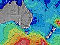 | ||||||||||||||||||||
ENE 9 | ENE 8 | ENE 8 | ENE 9 | ENE 9 | ENE 10 | ENE 10 | ENE 10 | ENE 10 | ENE 10 | ENE 10 | S 9 | S 9 | S 9 | S 10 | S 9 | S 9 | S 9 | S 9 | S 9 | S 9 | S 9 | S 8 | S 8 | |
623 | 681 | 657 | 603 | 856 | 943 | 1280 | 1331 | 1109 | 952 | 870 | 769 | 663 | 1075 | 1137 | 904 | 718 | 700 | 942 | 1473 | 1342 | 1028 | 779 | 597 | |
Vento (km/h) | ||||||||||||||||||||||||
Stato del vento onshore cross-onshore cross-shore cross-offshore offshore piatto | cross-off | glassy | cross | cross | cross-off | cross-off | cross-off | cross | cross | cross | cross-off | cross-off | cross | cross-on | cross-on | cross-on | cross | cross | cross | cross-on | cross | cross-on | cross-on | cross-on |
Alta Marea | 9:32PM1.75m | 10:25AM1.11m | 10:25PM1.71m | 11:25AM1.07m | 11:20PM1.63m | 12:28PM1.04m | ||||||||||||||||||
Basso Marea | 4:25AM-0.02m | 3:51PM0.30m | 5:23AM0.02m | 4:47PM0.36m | 6:23AM0.07m | |||||||||||||||||||
— | — | — | 6:43 | — | — | — | — | — | — | — | 6:43 | — | — | — | — | — | — | — | 6:45 | — | — | — | — | |
— | — | — | — | — | — | — | 5:00 | — | — | — | — | — | — | — | 4:59 | — | — | — | — | — | — | — | 4:59 | |
1 | 2 | 3 | 2 | — | 1 | 2 | 1 | 1 | — | — | — | — | — | — | — | — | — | — | — | — | — | — | — | |
Temp. °C | 18 | 17 | 16 | 17 | 16 | 17 | 17 | 16 | 16 | 16 | 15 | 13 | 13 | 16 | 16 | 16 | 15 | 14 | 14 | 15 | 13 | 15 | 17 | 17 |
18 | 19 | 17 | 17 | 15 | 17 | 16 | 14 | 14 | 14 | 14 | 10 | 10 | 13 | 12 | 12 | 11 | 11 | 9 | 9 | 8 | 9 | 11 | 12 | |
Onda 1 Altezza (m) Direzione Periodo (s) | ENE 9 | ENE 8 | ENE 8 | ENE 9 | ENE 9 | ENE 10 | ENE 10 | ENE 10 | ENE 10 | ENE 10 | S 8 | S 9 | ENE 10 | ENE 10 | ENE 10 | ENE 10 | ENE 10 | ENE 10 | ENE 10 | ENE 10 | ENE 10 | E 10 | E 10 | E 10 |
623 | 681 | 657 | 603 | 856 | 943 | 1280 | 1331 | 1109 | 952 | 671 | 586 | 663 | 573 | 510 | 424 | 370 | 370 | 300 | 300 | 250 | 240 | 240 | 290 | |
Onda 2 Altezza (m) Direzione Periodo (s) | — | — | — | — | — | S 4 | S 5 | — | — | — | ENE 10 | ENE 10 | — | — | — | — | — | — | — | — | — | — | — | S 16 |
— | — | — | — | — | 8 | 17 | — | — | — | 870 | 763 | — | — | — | — | — | — | — | — | — | — | — | 5 | |
Onda 3 Altezza (m) Direzione Periodo (s) | — | — | S 14 | — | — | — | — | — | — | — | — | — | — | — | — | — | — | — | — | — | — | — | — | — |
— | — | 4 | — | — | — | — | — | — | — | — | — | — | — | — | — | — | — | — | — | — | — | — | — | |
onde vento Altezza (m) Direzione Periodo (s) | — | — | — | SSW 4 | SSW 3 | SSW 4 | SSW 5 | S 5 | S 7 | S 8 | S 8 | S 9 | S 9 | S 9 | S 10 | S 9 | S 9 | S 9 | S 9 | S 9 | S 9 | S 9 | S 8 | S 8 |
— | — | — | 2 | 4 | 15 | 27 | 53 | 286 | 499 | 870 | 769 | 641 | 1075 | 1137 | 904 | 718 | 700 | 942 | 1473 | 1342 | 1028 | 779 | 597 | |
Il più vicino Offshore or Glassy | ||||||||||||||||||||||||
Distanza (km) | 0 | 0 | 11 | 11 | 0 | 0 | 0 | 11 | 11 | 11 | 0 | 0 | 6 | 11 | 23 | 18 | 11 | 6 | 23 | 28 | 23 | 23 | 65 | 65 |
Migliori previsioni per le condizioni d'onda in Illawarra | ||||||||||||||||||||||||
Migliori previsioni per le condizioni d'onda in Australia | ||||||||||||||||||||||||
Header Global | ||||||||||||||||||||||||
- Map Icons:
 Break
Break Live Wave Height (m)
 Live Wind Speed (km/h)
 Surf Rating (10 Max)
 Ocean Swells (m)
- Wind Speed (km/h)
Widget Free Surf-Forecast.com per il tuo sito
La relazione di surf / widget meteo è disponibile qui sotto per incorporare su siti esterni a titolo gratuito e fornisce una sintesi delle nostre Burning Palms previsione surf. Basta prendere il frammento di codice html da noi fornito e copiarlo nel proprio sito. È possibile scegliere la lingua preferita e unità metriche / imperiali per il feed delle previsioni surf per soddisfare le esigenze degli utenti del vostro sito .... Clicca qui per ottenere il codice.
 Nearest