
Previsioni:

Previsione a breve termineper lo più asciutto. Warm (Max 21°C Venerdì notte, Min 19°C giovedì mattina). Principalmente venti freschi. | |||||||||||||||||||
Mer 15 | Giovedì 16 | Venerdì 17 | |||||||||||||||||
5 PM | 8 PM | 11 PM | 2 AM | 5 AM | 8 AM | 11 AM | 2 PM | 5 PM | 8 PM | 11 PM | 2 AM | 5 AM | 8 AM | 11 AM | 2 PM | 5 PM | 8 PM | 11 PM | |
Mappa dell'altezza del moto ondoso | 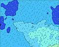 |  | 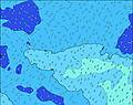 | 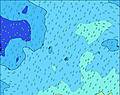 | 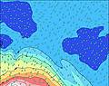 | 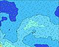 | 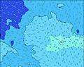 | ||||||||||||
Onda Altezza (m) Direzione Periodo (s) | S 11 | NW 16 | NW 16 | NW 15 | NW 15 | NW 15 | NW 15 | NW 15 | NW 15 | SSE 14 | SSE 14 | S 14 | SSE 14 | NW 15 | NW 15 | NW 15 | NW 15 | NW 15 | S 13 |
Grafico delle onde | |||||||||||||||||||
0 | 40 | 39 | 35 | 35 | 35 | 56 | 34 | 34 | 0 | 0 | 0 | 0 | 35 | 34 | 33 | 33 | 33 | 0 | |
Vento (km/h) | |||||||||||||||||||
Stato del vento onshore cross-onshore cross-shore cross-offshore offshore piatto | off | cross-off | off | off | off | off | off | off | off | off | off | off | cross-off | off | off | off | off | off | off |
Alta Marea | 10:10PM0.57m | 10:27AM0.68m | 11:00PM0.55m | 11:17AM0.61m | |||||||||||||||
Basso Marea | 3:45PM-0.20m | 3:55AM-0.11m | 4:34PM-0.16m | 4:49AM-0.07m | 5:25PM-0.10m | ||||||||||||||
— | — | — | — | 7:16 | — | — | — | — | — | — | — | 7:15 | — | — | — | — | — | — | |
6:13 | — | — | — | — | — | — | — | 6:14 | — | — | — | — | — | — | — | 6:14 | — | — | |
mm | — | — | — | — | — | — | — | — | — | — | — | — | — | — | — | — | — | — | — |
Temp. °C | 20 | 20 | 20 | 20 | 20 | 19 | 20 | 20 | 20 | 20 | 20 | 20 | 19 | 20 | 20 | 19 | 20 | 21 | 21 |
Gelo °C | 14 | 14 | 13 | 14 | 14 | 14 | 15 | 14 | 13 | 14 | 15 | 15 | 13 | 16 | 16 | 15 | 15 | 16 | 16 |
Onda 1 Altezza (m) Direzione Periodo (s) | S 11 | SSW 13 | SSW 13 | SSE 16 | SSE 16 | SSE 16 | SSE 15 | SSE 15 | SSE 14 | SSE 14 | SSE 14 | S 14 | SSE 14 | S 14 | S 14 | S 14 | S 14 | S 14 | S 13 |
949 | 983 | 643 | 3111 | 3299 | 3258 | 3053 | 2648 | 2725 | 2725 | 2895 | 2643 | 2541 | 2814 | 2570 | 2341 | 2125 | 1788 | 1708 | |
Onda 2 Altezza (m) Direzione Periodo (s) | SSE 15 | SSE 17 | NW 16 | SSW 13 | SSW 13 | SSW 13 | SSW 12 | SSW 12 | SSW 12 | SSW 12 | SSW 11 | SSW 11 | SW 10 | SW 19 | SW 16 | SW 16 | SW 17 | SSW 17 | SSW 17 |
539 | 980 | 39 | 522 | 433 | 402 | 278 | 255 | 164 | 218 | 148 | 105 | 142 | 179 | 132 | 133 | 140 | 195 | 197 | |
Onda 3 Altezza (m) Direzione Periodo (s) | SSW 14 | NW 16 | SSW 20 | NW 15 | NW 15 | NW 15 | NW 15 | NW 15 | NW 15 | SW 18 | SW 19 | SW 19 | SSW 19 | NW 15 | NW 15 | NW 15 | NW 15 | NW 15 | WSW 12 |
273 | 40 | 38 | 35 | 35 | 35 | 56 | 34 | 34 | 84 | 95 | 183 | 246 | 35 | 34 | 33 | 33 | 33 | 14 | |
onde vento Altezza (m) Direzione Periodo (s) | — | SSE 12 | SSE 17 | — | — | — | — | — | — | — | — | — | — | — | — | — | — | — | S 13 |
— | 583 | 3202 | — | — | — | — | — | — | — | — | — | — | — | — | — | — | — | 2001 | |
Il più vicino Offshore or Glassy | |||||||||||||||||||
Distanza (km) | 2431 | 2431 | 2431 | 2431 | 2431 | 2431 | 0 | 2431 | 2431 | 2431 | 2431 | 1117 | 2442 | 1117 | 2431 | 4 | 4 | 2786 | 1117 |
Migliori previsioni per le condizioni d'onda in Cook-Islands - Rarotonga | |||||||||||||||||||
Migliori previsioni per le condizioni d'onda in Cook Islands | |||||||||||||||||||
Trova Onde Globale | |||||||||||||||||||
- Map Icons:
 Break
Break Live Wave Height (m)
 Live Wind Speed (km/h)
 Surf Rating (10 Max)
 Ocean Swells (m)
- Wind Speed (km/h)
Widget Free Surf-Forecast.com per il tuo sito
La relazione di surf / widget meteo è disponibile qui sotto per incorporare su siti esterni a titolo gratuito e fornisce una sintesi delle nostre Club Raro previsione surf. Basta prendere il frammento di codice html da noi fornito e copiarlo nel proprio sito. È possibile scegliere la lingua preferita e unità metriche / imperiali per il feed delle previsioni surf per soddisfare le esigenze degli utenti del vostro sito .... Clicca qui per ottenere il codice.
 Nearest