- Forecast
- Maps
- Live
- Weather State
- Spot Information
Previsioni:

Surf a Cook BayPrevisione / Moorea / French Polynesia
Aggiornamento meteo in hr min s Forecast update imminent
Questi sono altezze d'onde di mare aperto. Onde che si infrangono di solito sono più piccole, specialmente in luoghi riparati.
La temperatura del mare a Cook Bay oggi è
28.4° C
(Che è normale per questo periodo dell'anno)Aggiornamento in hr min s Forecast update imminent
Lunedì 02 | Martedì 03 | Mercoledì 04 | ||||||||||||||||||||||
| 11 PM | 2 AM | 5 AM | 8 AM | 11 AM | 2 PM | 5 PM | 8 PM | 11 PM | 2 AM | 5 AM | 8 AM | 11 AM | 2 PM | 5 PM | 8 PM | 11 PM | 2 AM | 5 AM | 8 AM | 11 AM | 2 PM | 5 PM | 8 PM | |
Voto (10 max) | ||||||||||||||||||||||||
Mappa dell'altezza del moto ondoso |  |  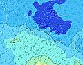  |    |    | ||||||||||||||||||||
| Le onde più grandi (m) & direzione (?) | ||||||||||||||||||||||||
| Periodo(s) (?) | 15 | 15 | 15 | 15 | 15 | 14 | 18 | 18 | 18 | 18 | 18 | 17 | 17 | 16 | 16 | 16 | 16 | 16 | 16 | 15 | 15 | 14 | 14 | 14 |
Grafico (?)delle onde | ||||||||||||||||||||||||
| 266 | 326 | 280 | 188 | 176 | 411 | 404 | 404 | 408 | 659 | 637 | 608 | 587 | 726 | 700 | 683 | 674 | 573 | 499 | 382 | 372 | 367 | 301 | 301 | |
Vento (km/h) | ||||||||||||||||||||||||
| Stato del vento (?) onshore cross-onshore cross-shore cross-offshore offshore piatto | cross- on | cross- on | cross- on | cross- on | cross- on | cross- on | cross- on | cross | cross | cross | cross | cross | cross | cross | cross | cross | cross- off | cross- off | cross | cross- off | cross- off | cross- off | cross- off | cross- off |
Alta Marea / altezza (m) | 12:50AM 0.31 | 1:08PM 0.28 | 1:18AM 0.32 | 1:28PM 0.28 | 1:44AM 0.31 | 1:47PM 0.28 | ||||||||||||||||||
Basso Marea / altezza (m) | 7:13AM -0.00 | 7:10PM 0.01 | 7:36AM 0.01 | 7:34PM 0.01 | 7:57AM 0.03 | 7:56PM 0.01 | ||||||||||||||||||
Lunedì 02 | Martedì 03 | Mercoledì 04 | ||||||||||||||||||||||
| Alba | - | - | - | 5:47 | - | - | - | - | - | - | - | 5:47 | - | - | - | - | - | - | - | 5:48 | - | - | - | - |
| Tramonto | - | - | - | - | - | - | 6:37 | - | - | - | - | - | - | - | 6:37 | - | - | - | - | - | - | - | 6:37 | - |
Piog. (mm) | - | - | - | - | - | - | 1 | 1 | - | 2 | 1 | - | 1 | - | - | - | - | - | - | 1 | - | 1 | - | - |
| Temp. °C | 27 | 27 | 27 | 27 | 27 | 27 | 27 | 27 | 27 | 27 | 27 | 27 | 27 | 28 | 28 | 28 | 28 | 28 | 28 | 28 | 28 | 28 | 28 | 28 |
| Feels °C (?) | 27 | 28 | 28 | 28 | 28 | 28 | 29 | 28 | 26 | 27 | 26 | 26 | 25 | 26 | 27 | 26 | 27 | 27 | 27 | 27 | 27 | 28 | 28 | 27 |
- Map Icons:
 Break
Break Live Wave Height (m)
 Live Wind Speed (km/h)
 Surf Rating (10 Max)
 Ocean Swells (m)
- Wind Speed (km/h)
Widget Free Surf-Forecast.com per il tuo sito
La relazione di surf / widget meteo è disponibile qui sotto per incorporare su siti esterni a titolo gratuito e fornisce una sintesi delle nostre Cook Bay previsione surf. Basta prendere il frammento di codice html da noi fornito e copiarlo nel proprio sito. È possibile scegliere la lingua preferita e unità metriche / imperiali per il feed delle previsioni surf per soddisfare le esigenze degli utenti del vostro sito .... Clicca qui per ottenere il codice.
 Nearest