- Forecast
- Maps
- Live
- Weather State
- Spot Information
Curral Previsione surf
/ Rio Grande Do Norte (34 surf breaks) /Previsioni:

Surf a CurralPrevisione / Rio Grande Do Norte / Brazil
Aggiornamento meteo in hr min s Forecast update imminent
Questi sono altezze d'onde di mare aperto. Onde che si infrangono di solito sono più piccole, specialmente in luoghi riparati.
La temperatura del mare a Curral oggi è
28.1° C
(Che è normale per questo periodo dell'anno)Aggiornamento in hr min s Forecast update imminent
Previsione a breve terminepioggia leggera (Totale 8mm), per lo più che cade Lunedì mattina. Warm (Max 27°C Lunedì mattina, Min 24°C Lunedì notte). Vento sarà generalmente leggero. | ||||||||||||||||||||||||
Sun 17 | Monday 18 | Tuesday 19 | Wednesday 20 | |||||||||||||||||||||
6 PM | 9 PM | 12 AM | 3 AM | 6 AM | 9 AM | 12 PM | 3 PM | 6 PM | 9 PM | 12 AM | 3 AM | 6 AM | 9 AM | 12 PM | 3 PM | 6 PM | 9 PM | 12 AM | 3 AM | 6 AM | 9 AM | 12 PM | 3 PM | |
Mappa dell'altezza del moto ondoso |    |    |    |   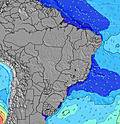 | ||||||||||||||||||||
E 7 | NE 10 | NE 10 | NE 10 | NNE 10 | NE 10 | NE 10 | NE 10 | NE 10 | NE 10 | ESE 7 | ESE 7 | ESE 7 | ESE 7 | NE 10 | NE 10 | ESE 7 | SE 7 | SE 7 | E 7 | ESE 7 | E 7 | E 7 | E 7 | |
103 | 151 | 151 | 151 | 117 | 136 | 92 | 92 | 92 | 92 | 112 | 99 | 111 | 86 | 73 | 74 | 86 | 79 | 75 | 71 | 121 | 91 | 92 | 92 | |
Vento (km/h) | ||||||||||||||||||||||||
Stato del vento onshore cross-onshore cross-shore cross-offshore offshore piatto | cross-on | cross-on | cross-on | cross | cross | cross-on | cross-on | cross-on | cross-on | cross | cross | cross | cross-off | cross | cross | cross | cross | cross | cross | cross | cross | cross | cross-on | cross-on |
Alta Marea | 4:33PM2.28m | 4:49AM2.35m | 5:24PM2.19m | 5:39AM2.29m | 6:18PM2.07m | 6:32AM2.19m | ||||||||||||||||||
Basso Marea | 10:37PM0.12m | 11:08AM-0.04m | 11:25PM0.21m | 12:00PM0.05m | 00:17AM0.33m | 12:58PM0.18m | ||||||||||||||||||
— | — | — | 5:20 | — | — | — | — | — | — | — | 5:20 | — | — | — | — | — | — | — | 5:22 | — | — | — | — | |
— | — | — | — | — | — | — | 5:10 | — | — | — | — | — | — | — | 5:10 | — | — | — | — | — | — | — | 5:10 | |
— | 1 | 1 | 1 | 1 | 2 | 1 | — | — | — | — | — | — | — | — | — | — | — | — | 1 | — | — | — | — | |
Temp. °C | 27 | 26 | 26 | 26 | 25 | 27 | 27 | 27 | 27 | 26 | 26 | 25 | 24 | 26 | 27 | 27 | 26 | 26 | 26 | 25 | 25 | 27 | 27 | 27 |
30 | 29 | 29 | 29 | 27 | 28 | 28 | 27 | 29 | 27 | 28 | 27 | 25 | 27 | 27 | 28 | 27 | 28 | 28 | 26 | 27 | 28 | 27 | 28 | |
Onda 1 Altezza (m) Direzione Periodo (s) | E 7 | E 7 | E 7 | E 7 | E 7 | E 7 | NE 10 | NE 10 | NE 10 | E 6 | E 6 | E 6 | E 5 | ESE 5 | NE 10 | NE 10 | E 7 | E 7 | E 7 | E 7 | E 7 | NNE 9 | NNE 9 | NE 9 |
103 | 93 | 91 | 76 | 78 | 80 | 92 | 92 | 92 | 52 | 50 | 39 | 36 | 35 | 73 | 74 | 52 | 48 | 61 | 61 | 76 | 56 | 56 | 67 | |
Onda 2 Altezza (m) Direzione Periodo (s) | NNE 10 | NE 10 | NE 10 | NE 10 | NNE 10 | NE 10 | NE 11 | NE 11 | NE 11 | NE 10 | NE 10 | NE 10 | NE 10 | NE 10 | SE 16 | S 16 | NE 10 | NE 10 | NE 10 | NE 9 | NE 9 | SE 14 | SE 14 | SE 14 |
81 | 151 | 151 | 151 | 117 | 134 | 20 | 20 | 19 | 92 | 112 | 92 | 92 | 73 | 10 | 5 | 74 | 74 | 73 | 71 | 70 | 8 | 7 | 7 | |
Onda 3 Altezza (m) Direzione Periodo (s) | NE 12 | NNE 12 | SE 12 | SE 12 | NE 11 | NE 11 | SE 12 | E 12 | E 11 | NE 11 | E 11 | — | NE 11 | NE 11 | — | — | SE 16 | SE 15 | SE 15 | SE 15 | SE 15 | S 12 | S 11 | S 11 |
66 | 14 | 6 | 6 | 19 | 5 | 5 | 3 | 3 | 5 | 2 | — | 5 | 5 | — | — | 10 | 9 | 9 | 8 | 8 | 3 | 2 | 2 | |
onde vento Altezza (m) Direzione Periodo (s) | — | — | — | ESE 7 | ESE 7 | ESE 7 | E 6 | E 6 | E 6 | ESE 6 | ESE 7 | ESE 7 | ESE 7 | ESE 7 | ESE 7 | ESE 7 | ESE 7 | SE 7 | SE 7 | — | ESE 7 | E 7 | E 7 | E 7 |
— | — | — | 111 | 114 | 136 | 50 | 64 | 64 | 74 | 96 | 99 | 111 | 86 | 71 | 71 | 86 | 79 | 75 | — | 121 | 91 | 92 | 92 | |
Il più vicino Offshore or Glassy | ||||||||||||||||||||||||
Distanza (km) | 3 | 991 | 83 | 3 | 2 | 492 | 1576 | 392 | 3 | 15 | 2 | 2 | 4 | 525 | 1576 | 1576 | 474 | 15 | 14 | 83 | 4 | 1576 | 1576 | 1576 |
Migliori previsioni per le condizioni d'onda in Rio Grande Do Norte | ||||||||||||||||||||||||
Migliori previsioni per le condizioni d'onda in Brazil | ||||||||||||||||||||||||
Header Global | ||||||||||||||||||||||||
- Map Icons:
 Break
Break Live Wave Height (m)
 Live Wind Speed (km/h)
 Surf Rating (10 Max)
 Ocean Swells (m)
- Wind Speed (km/h)
Widget Free Surf-Forecast.com per il tuo sito
La relazione di surf / widget meteo è disponibile qui sotto per incorporare su siti esterni a titolo gratuito e fornisce una sintesi delle nostre Curral previsione surf. Basta prendere il frammento di codice html da noi fornito e copiarlo nel proprio sito. È possibile scegliere la lingua preferita e unità metriche / imperiali per il feed delle previsioni surf per soddisfare le esigenze degli utenti del vostro sito .... Clicca qui per ottenere il codice.
 Nearest