- Forecast
- Maps
- Live
- Weather State
- Spot Information
Previsioni:

Surf a El CamotalPrevisione / Lima / Peru
Aggiornamento meteo in hr min s Forecast update imminent
Questi sono altezze d'onde di mare aperto. Onde che si infrangono di solito sono più piccole, specialmente in luoghi riparati.
La temperatura del mare a El Camotal oggi è
19.7° C
(Che è 3.3°C più freddo della media per questo periodo dell'anno)Aggiornamento in hr min s Forecast update imminent
Sabato 14 | Domenica 15 | Lunedì 16 | Martedì 17 | |||||||||||||||||||||
| 10 AM | 1 PM | 4 PM | 7 PM | 10 PM | 1 AM | 4 AM | 7 AM | 10 AM | 1 PM | 4 PM | 7 PM | 10 PM | 1 AM | 4 AM | 7 AM | 10 AM | 1 PM | 4 PM | 7 PM | 10 PM | 1 AM | 4 AM | 7 AM | |
Voto (10 max) | ||||||||||||||||||||||||
Mappa dell'altezza del moto ondoso |  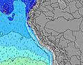 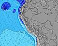 |  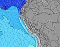 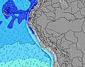 |  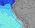 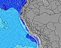 | 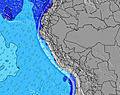 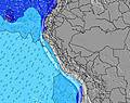 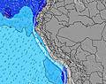 | ||||||||||||||||||||
| Le onde più grandi (m) & direzione (?) | ||||||||||||||||||||||||
| Periodo(s) (?) | 14 | 14 | 14 | 13 | 18 | 18 | 18 | 13 | 14 | 14 | 14 | 14 | 13 | 13 | 16 | 16 | 15 | 15 | 14 | 14 | 14 | 14 | 12 | 14 |
Grafico (?)delle onde | ||||||||||||||||||||||||
| 160 | 115 | 108 | 101 | 68 | 67 | 67 | 67 | 67 | 89 | 91 | 68 | 68 | 84 | 198 | 140 | 128 | 121 | 120 | 118 | 118 | 118 | 118 | 118 | |
Vento (km/h) | ||||||||||||||||||||||||
| Stato del vento (?) onshore cross-onshore cross-shore cross-offshore offshore piatto | cross- off | cross- off | cross- off | cross- off | cross- off | cross- off | cross- off | cross- off | cross- off | cross- off | cross- off | cross- off | cross- off | cross- off | cross- off | cross- off | cross- off | cross- off | cross- off | cross- off | cross- off | cross- off | cross- off | cross- off |
Alta Marea / altezza (m) | 4:55PM 0.97 | 4:17AM 0.61 | 5:24PM 0.99 | 4:54AM 0.65 | 5:51PM 1.01 | 5:30AM 0.69 | ||||||||||||||||||
Basso Marea / altezza (m) | 9:38AM 0.21 | 11:34PM 0.40 | 10:17AM 0.18 | 11:56PM 0.37 | 10:52AM 0.16 | 12:19AM 0.34 | ||||||||||||||||||
Sabato 14 | Domenica 15 | Lunedì 16 | Martedì 17 | |||||||||||||||||||||
| Alba | - | - | - | - | - | - | - | 6:07 | - | - | - | - | - | - | - | 6:07 | - | - | - | - | - | - | - | 6:07 |
| Tramonto | - | - | 6:37 | - | - | - | - | - | - | - | 6:37 | - | - | - | - | - | - | - | 6:36 | - | - | - | - | - |
Piog. (mm) | - | - | - | - | - | - | - | - | - | - | - | - | - | - | - | - | - | - | - | - | - | - | - | - |
| Temp. °C | 23 | 23 | 23 | 23 | 23 | 23 | 23 | 23 | 23 | 23 | 23 | 23 | 22 | 22 | 21 | 22 | 22 | 22 | 23 | 23 | 23 | 22 | 22 | 22 |
| Feels °C (?) | 24 | 24 | 24 | 24 | 23 | 24 | 24 | 24 | 23 | 24 | 24 | 24 | 22 | 23 | 22 | 23 | 23 | 22 | 24 | 23 | 24 | 23 | 23 | 23 |
- Map Icons:
 Break
Break Live Wave Height (m)
 Live Wind Speed (km/h)
 Surf Rating (10 Max)
 Ocean Swells (m)
- Wind Speed (km/h)
Widget Free Surf-Forecast.com per il tuo sito
La relazione di surf / widget meteo è disponibile qui sotto per incorporare su siti esterni a titolo gratuito e fornisce una sintesi delle nostre El Camotal previsione surf. Basta prendere il frammento di codice html da noi fornito e copiarlo nel proprio sito. È possibile scegliere la lingua preferita e unità metriche / imperiali per il feed delle previsioni surf per soddisfare le esigenze degli utenti del vostro sito .... Clicca qui per ottenere il codice.
 Nearest