- Forecast
- Maps
- Live
- Weather State
- Spot Information
Previsioni:


Surf a GouaroPrevisione / New-Caledonia / New Caledonia
Aggiornamento meteo in hr min s Forecast update imminent
Questi sono altezze d'onde di mare aperto. Onde che si infrangono di solito sono più piccole, specialmente in luoghi riparati.
La temperatura del mare a Gouaro oggi è
25.9° C
(Che è 1.1°C più caldo del normale per questo periodo dell'anno)Aggiornamento in hr min s Forecast update imminent
Previsione a breve termineQualche pioggerella, più pesante durante lunedì pomeriggio. Warm (Max 26°C Lunedì pomeriggio, Min 22°C martedì notte). Vento sarà generalmente leggero. | ||||||||||||||||||||||||
Mon 18 | Tuesday 19 | Wednesday 20 | Thu 21 | |||||||||||||||||||||
2 PM | 5 PM | 8 PM | 11 PM | 2 AM | 5 AM | 8 AM | 11 AM | 2 PM | 5 PM | 8 PM | 11 PM | 2 AM | 5 AM | 8 AM | 11 AM | 2 PM | 5 PM | 8 PM | 11 PM | 2 AM | 5 AM | 8 AM | 11 AM | |
Mappa dell'altezza del moto ondoso |  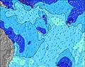 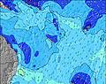 | 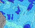 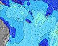 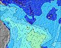 | 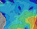 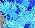 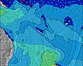 | 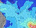 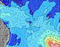 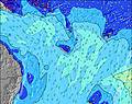 | ||||||||||||||||||||
SE 10 | SE 10 | SE 9 | SE 9 | SSE 8 | SE 9 | SSE 8 | SE 8 | SE 8 | SE 7 | SSE 7 | SSE 7 | SSE 8 | SSE 8 | SSE 8 | SSE 8 | SSE 8 | SSE 8 | SSE 8 | SSE 8 | SSE 8 | SE 7 | SSE 7 | SSW 20 | |
1044 | 1085 | 885 | 654 | 149 | 427 | 133 | 311 | 316 | 325 | 105 | 86 | 95 | 84 | 86 | 59 | 58 | 56 | 41 | 39 | 37 | 27 | 21 | 37 | |
Vento (km/h) | ||||||||||||||||||||||||
Stato del vento onshore cross-onshore cross-shore cross-offshore offshore piatto | cross-on | cross-on | cross | cross | cross | cross | cross-on | cross-on | cross-on | cross-on | cross-off | cross-off | cross | cross | cross | cross | cross | cross-off | cross-off | cross-off | cross-off | cross-off | cross-off | cross-off |
Alta Marea | 7:55PM1.22m | 6:55AM1.24m | 8:55PM1.22m | 7:50AM1.19m | 9:57PM1.21m | 8:51AM1.12m | ||||||||||||||||||
Basso Marea | 1:17AM0.61m | 1:50PM-0.03m | 2:18AM0.65m | 2:47PM0.01m | 3:26AM0.67m | |||||||||||||||||||
— | — | — | — | — | 6:22 | — | — | — | — | — | — | — | 6:22 | — | — | — | — | — | — | — | 6:24 | — | — | |
— | 5:25 | — | — | — | — | — | — | — | 5:24 | — | — | — | — | — | — | — | 5:24 | — | — | — | — | — | 5:24 | |
— | 1 | — | — | — | — | — | — | — | — | — | — | — | — | — | — | — | — | — | — | — | — | — | — | |
Temp. °C | 26 | 26 | 24 | 23 | 23 | 23 | 23 | 25 | 25 | 25 | 24 | 23 | 23 | 22 | 23 | 25 | 26 | 25 | 23 | 23 | 23 | 22 | 23 | 26 |
25 | 26 | 25 | 24 | 24 | 24 | 24 | 25 | 24 | 25 | 25 | 24 | 24 | 23 | 24 | 26 | 27 | 25 | 23 | 24 | 24 | 22 | 23 | 26 | |
Onda 1 Altezza (m) Direzione Periodo (s) | SSE 9 | SSE 9 | SSE 9 | SSE 9 | SSE 8 | SSE 8 | SSE 8 | SSE 8 | SSE 7 | SSE 7 | SSE 7 | SSE 7 | SSE 8 | SSE 8 | SSE 8 | SSE 8 | SSE 8 | SSE 8 | SSE 8 | SSE 8 | SSE 8 | SE 7 | SSE 7 | SSE 7 |
300 | 313 | 300 | 238 | 149 | 140 | 133 | 110 | 104 | 105 | 105 | 86 | 95 | 84 | 86 | 59 | 58 | 56 | 41 | 39 | 37 | 27 | 21 | 21 | |
Onda 2 Altezza (m) Direzione Periodo (s) | S 10 | S 16 | S 15 | S 15 | SE 10 | — | S 18 | S 10 | S 18 | S 16 | S 16 | S 16 | S 16 | S 15 | S 18 | S 18 | SW 17 | SW 16 | SW 16 | SW 15 | S 15 | S 15 | SW 19 | SSW 20 |
8 | 5 | 4 | 4 | 32 | — | 6 | 2 | 6 | 5 | 5 | 5 | 5 | 4 | 6 | 6 | 11 | 11 | 9 | 9 | 4 | 5 | 15 | 37 | |
Onda 3 Altezza (m) Direzione Periodo (s) | S 16 | — | — | S 11 | S 15 | — | — | S 18 | S 10 | S 10 | S 10 | — | S 16 | S 19 | S 14 | S 14 | S 21 | S 21 | S 21 | S 21 | — | S 20 | SE 13 | S 14 |
5 | — | — | 2 | 4 | — | — | 6 | 2 | 2 | 2 | — | 5 | 7 | 4 | 4 | 9 | 9 | 9 | 9 | — | 8 | 7 | 4 | |
onde vento Altezza (m) Direzione Periodo (s) | SE 10 | SE 10 | SE 9 | SE 9 | — | SE 9 | — | SE 8 | SE 8 | SE 7 | — | — | — | — | — | — | — | — | — | — | — | — | — | — |
1044 | 1085 | 885 | 654 | — | 427 | — | 311 | 316 | 325 | — | — | — | — | — | — | — | — | — | — | — | — | — | — | |
Il più vicino Offshore or Glassy | ||||||||||||||||||||||||
Distanza (km) | 5 | 5 | 1301 | 2 | 2 | 2 | 2 | 2 | 2 | 2 | 5 | 5 | 0 | 0 | 2 | 2 | 2 | 2 | 2 | 0 | 0 | 38 | 38 | 115 |
Migliori previsioni per le condizioni d'onda in New Caledonia | ||||||||||||||||||||||||
Migliori previsioni per le condizioni d'onda in New Caledonia | ||||||||||||||||||||||||
Header Global | ||||||||||||||||||||||||
- Map Icons:
 Break
Break Live Wave Height (m)
 Live Wind Speed (km/h)
 Surf Rating (10 Max)
 Ocean Swells (m)
- Wind Speed (km/h)
Widget Free Surf-Forecast.com per il tuo sito
La relazione di surf / widget meteo è disponibile qui sotto per incorporare su siti esterni a titolo gratuito e fornisce una sintesi delle nostre Gouaro previsione surf. Basta prendere il frammento di codice html da noi fornito e copiarlo nel proprio sito. È possibile scegliere la lingua preferita e unità metriche / imperiali per il feed delle previsioni surf per soddisfare le esigenze degli utenti del vostro sito .... Clicca qui per ottenere il codice.
 Nearest