
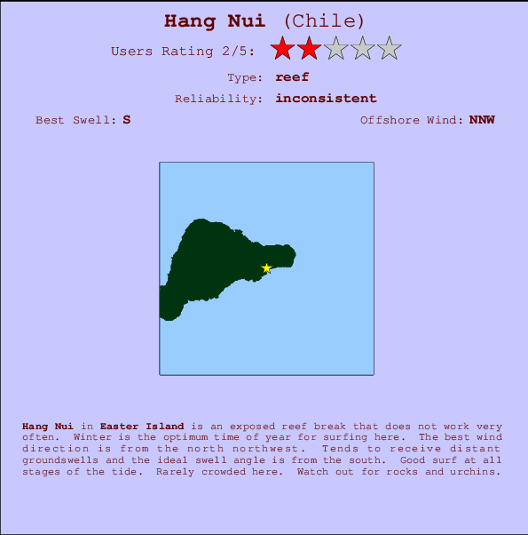
Hang Nui Surf Guide
Hang Nui on the South Coast is an exposed reef break that does not work very often. Winter is the best time of year for surfing here. Offshore winds are from the north northwest. Groundswells more frequent than windswells and the ideal swell direction is from the south. Both left and right reef breaks. Good surf at all stages of the tide. Rarely crowded here. Take care of rocks and urchins.
Hang Nui Spot Info
| Type: | Rating: | Reliability: | Todays Sea Temp*: |
|---|---|---|---|
| inconsistent | 21.1°C*ocean temperature recorded from satellite |
Surfing Hang Nui:
The best conditions reported for surf at Hang Nui occur when a South swell combines with an offshore wind direction from the North-northwest.
Previsioni Energia d'onda (Potenza): 12hrs


Hang Nui Surf:
Thursday, 16 July 2026, 16:37 Local time| Giovedì 16 | Ven | |||
| 3PM | 6PM | 9PM | 0AM | |
| Wave (m) | ||||
| Periodo (s) | 12 | 12 | 12 | 12 |
| Vento (km/h) | ||||
| Stato del vento | cross- off |
cross- off |
cross- off |
cross- off |
- /breaks/Hanga-Nui/forecasts/latest
Hang Nui Surf Guide
Hang Nui on the South Coast is an exposed reef break that does not work very often. Winter is the best time of year for surfing here. Offshore winds are from the north northwest. Groundswells more frequent than windswells and the ideal swell direction is from the south. Both left and right reef breaks. Good surf at all stages of the tide. Rarely crowded here. Take care of rocks and urchins.
Hang Nui Spot Info
Type: Rating: Reliability: Todays Sea Temp*:  Reef
Reef 2
2inconsistent 21.1°C*ocean temperature recorded from satelliteSurfing Hang Nui:
The best conditions reported for surf at Hang Nui occur when a South swell combines with an offshore wind direction from the North-northwest.
Previsioni Energia d'onda (Potenza): 12hrs
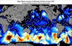
Utilizzare la scheda di navigazione in alto per visualizzare Hang Nui temperatura del mare, Hang Nui fotografie, Hang Nui dettagliate previsioni onde, il vento e le previsioni meteo, Hang Nui webcam, vento corrente da Easter Island stazioni meteo e Hang Nui previsioni marea. Il link Chile mappe maree apre l'immagine grande, che mostra Chile e dei mari circostanti. Queste mappe possono essere animate per mostrare le diverse componenti del moto ondoso, energia delle onde, periodo d'onda, altezza delle onde, insieme con le previsioni del vento e meteo, meteo corrente e osservazioni sullo stato del mare dal Chile onda-boe, le navi passanti e stazioni meteo costiere. Ciascuna delle pagine di previsioni per questo surf break rappresenta uno strumento di wavefinder globale e regionale per individuare le migliori condizioni di surf nella zona intorno Hang Nui.
Hang Nui Surf:
Thursday, 16 July 2026, 16:37 Local timeGiovedì 16 Ven 3PM 6PM 9PM 0AM Wave (m) Periodo (s) 12 12 12 12 Vento (km/h) Stato del vento cross-
offcross-
offcross-
offcross-
off- /breaks/Hanga-Nui/forecasts/latest
- /breaks/Hanga-Nui/forecasts/latest/six_day
Hang Nui Surf Guide
Hang Nui on the South Coast is an exposed reef break that does not work very often. Winter is the best time of year for surfing here. Offshore winds are from the north northwest. Groundswells more frequent than windswells and the ideal swell direction is from the south. Both left and right reef breaks. Good surf at all stages of the tide. Rarely crowded here. Take care of rocks and urchins.
Hang Nui Spot Info
Type: Rating: Reliability: Todays Sea Temp*: Reef2inconsistent 21.1°C*ocean temperature recorded from satelliteSurfing Hang Nui:
The best conditions reported for surf at Hang Nui occur when a South swell combines with an offshore wind direction from the North-northwest.
Previsioni Energia d'onda (Potenza): 12hrs
Utilizzare la scheda di navigazione in alto per visualizzare Hang Nui temperatura del mare, Hang Nui fotografie, Hang Nui dettagliate previsioni onde, il vento e le previsioni meteo, Hang Nui webcam, vento corrente da Easter Island stazioni meteo e Hang Nui previsioni marea. Il link Chile mappe maree apre l'immagine grande, che mostra Chile e dei mari circostanti. Queste mappe possono essere animate per mostrare le diverse componenti del moto ondoso, energia delle onde, periodo d'onda, altezza delle onde, insieme con le previsioni del vento e meteo, meteo corrente e osservazioni sullo stato del mare dal Chile onda-boe, le navi passanti e stazioni meteo costiere. Ciascuna delle pagine di previsioni per questo surf break rappresenta uno strumento di wavefinder globale e regionale per individuare le migliori condizioni di surf nella zona intorno Hang Nui.
Hang Nui Surf:
Thursday, 16 July 2026, 16:37 Local timeGiovedì 16 Ven 3PM 6PM 9PM 0AM Wave (m) Periodo (s) 12 12 12 12 Vento (km/h) Stato del vento cross-
offcross-
offcross-
offcross-
off- /breaks/Hanga-Nui/forecasts/latest
Hang Nui Surf Guide
Hang Nui on the South Coast is an exposed reef break that does not work very often. Winter is the best time of year for surfing here. Offshore winds are from the north northwest. Groundswells more frequent than windswells and the ideal swell direction is from the south. Both left and right reef breaks. Good surf at all stages of the tide. Rarely crowded here. Take care of rocks and urchins.
Hang Nui Spot Info
Type: Rating: Reliability: Todays Sea Temp*: Reef2inconsistent 21.1°C*ocean temperature recorded from satelliteSurfing Hang Nui:
The best conditions reported for surf at Hang Nui occur when a South swell combines with an offshore wind direction from the North-northwest.
Previsioni Energia d'onda (Potenza): 12hrs
Utilizzare la scheda di navigazione in alto per visualizzare Hang Nui temperatura del mare, Hang Nui fotografie, Hang Nui dettagliate previsioni onde, il vento e le previsioni meteo, Hang Nui webcam, vento corrente da Easter Island stazioni meteo e Hang Nui previsioni marea. Il link Chile mappe maree apre l'immagine grande, che mostra Chile e dei mari circostanti. Queste mappe possono essere animate per mostrare le diverse componenti del moto ondoso, energia delle onde, periodo d'onda, altezza delle onde, insieme con le previsioni del vento e meteo, meteo corrente e osservazioni sullo stato del mare dal Chile onda-boe, le navi passanti e stazioni meteo costiere. Ciascuna delle pagine di previsioni per questo surf break rappresenta uno strumento di wavefinder globale e regionale per individuare le migliori condizioni di surf nella zona intorno Hang Nui.
Hang Nui Surf:
Thursday, 16 July 2026, 16:37 Local timeGiovedì 16 Ven 3PM 6PM 9PM 0AM Wave (m) Periodo (s) 12 12 12 12 Vento (km/h) Stato del vento cross-
offcross-
offcross-
offcross-
offTide Times:
Per Hanga Piko, Easter Island, %{dist} %{km} da %{location}.
PROSSIMA È ALLE (ora locale) rimanente alta marea bassa marea Hang Nui Tide Times and Tide Chart
Live Weather:
At Easter Island, 16 km from Hang Nui.
wind obs. (40 kph from 120 degs) was rejected
(km/h)
no reportAir temperature
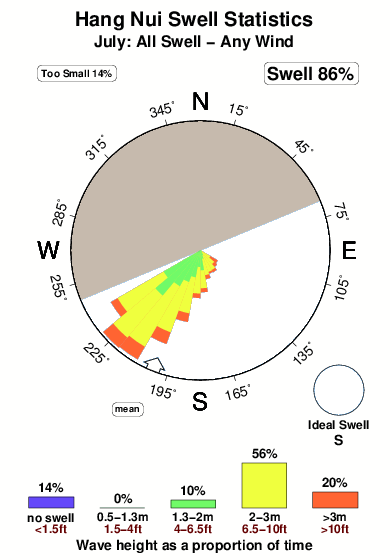
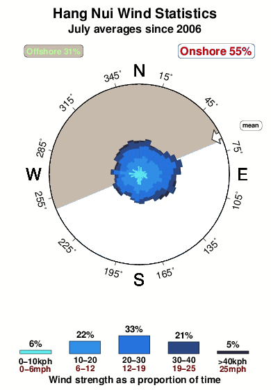
14.5°COverall Hang Nui Surf Consistency and Wind Distribution in Luglio
foto dall' album
Contorni: Strade e fiumi: seleziona un surf break dal menu 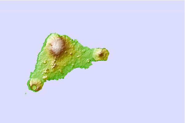
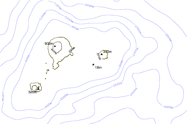
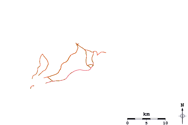
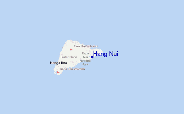
Utilizzare questa mappa sollievo per navigare Easter Island surf breaks e stazioni di marea che si trovano nella zona diHang Nui
Onda boe più vicina a Hang Nui:
- Closest Onda boa1623 mi
- Second closest Onda boa3548 mi
- Third closest Onda boa3553 mi
- Fourth closest Onda boa3567 mi
- Fifth closest Onda boa3633 mi
Stazioni di marea più vicina alla Hang Nui:
- Closest marea stazioneHanga Piko, Easter Island4 mi
- Second closest marea stazioneEaster Island11 mi
- Third closest marea stazioneMangareva Island1628 mi
- Fourth closest marea stazioneRikitea, Gambier Islands1629 mi
- Fifth closest marea stazioneMururoa Atoll1888 mi
Airports
- The nearest passenger airport to Hang Nui is Mataveri International (Easter Island) Airport (IPC) in Chile, which is 15 km (9 miles) away (directly).
- The second closest airport to Hang Nui is (Carnarvon) Airport (CVQ) in Australia, 505 km (314 miles) away.
- /breaks/Hanga-Nui/forecasts/latest


 Nearest