- Forecast
- Maps
- Live
- Weather State
- Spot Information
Previsioni:

Surf a KeaauPrevisione / HAW – Oahu / USA
Aggiornamento meteo in hr min s Forecast update imminent
Questi sono altezze d'onde di mare aperto. Onde che si infrangono di solito sono più piccole, specialmente in luoghi riparati.
La temperatura del mare a Keaau oggi è
25.4° C
(Che è normale per questo periodo dell'anno)Aggiornamento in hr min s Forecast update imminent
Previsione a breve termineper lo più asciutto. Warm (Max 27°C Domenica mattina, Min 24°C Domenica mattina). Vento sarà generalmente leggero. | ||||||||||||||||||||||||
Sun 17 | Monday 18 | Tuesday 19 | Wed 20 | |||||||||||||||||||||
5 PM | 8 PM | 11 PM | 2 AM | 5 AM | 8 AM | 11 AM | 2 PM | 5 PM | 8 PM | 11 PM | 2 AM | 5 AM | 8 AM | 11 AM | 2 PM | 5 PM | 8 PM | 11 PM | 2 AM | 5 AM | 8 AM | 11 AM | 2 PM | |
Mappa dell'altezza del moto ondoso |    |    |    |   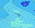 | ||||||||||||||||||||
NE 8 | SW 21 | NE 8 | NE 8 | NE 7 | NE 8 | NE 8 | NE 7 | NE 7 | NE 7 | NE 6 | NE 6 | NE 6 | NE 6 | NE 6 | NNW 12 | NNW 11 | NNW 11 | NNW 11 | NNW 10 | NE 8 | NNW 10 | NNW 10 | NNW 10 | |
63 | 224 | 63 | 67 | 79 | 82 | 82 | 77 | 69 | 54 | 49 | 47 | 39 | 32 | 32 | 90 | 75 | 76 | 76 | 97 | 92 | 67 | 69 | 95 | |
Vento (km/h) | ||||||||||||||||||||||||
Stato del vento onshore cross-onshore cross-shore cross-offshore offshore piatto | glassy | glassy | off | off | cross-off | off | off | off | off | off | off | off | off | off | off | off | off | off | off | off | off | off | off | off |
Alta Marea | 5:28PM0.71m | 5:10AM0.08m | 6:19PM0.70m | 6:15AM0.06m | 7:12PM0.66m | 7:36AM0.06m | ||||||||||||||||||
Basso Marea | 1:01AM-0.00m | 10:26AM-0.12m | 2:06AM-0.01m | 11:13AM-0.08m | 3:08AM-0.02m | 12:07PM-0.02m | ||||||||||||||||||
— | — | — | — | 5:52 | — | — | — | — | — | — | — | 5:52 | — | — | — | — | — | — | — | 5:52 | — | — | — | |
7:05 | — | — | — | — | — | — | — | 7:05 | — | — | — | — | — | — | — | 7:05 | — | — | — | — | — | — | 7:06 | |
2 | — | — | — | — | — | — | — | — | — | — | — | — | — | — | — | — | — | — | — | — | — | — | — | |
Temp. °C | 27 | 27 | 25 | 25 | 24 | 25 | 26 | 27 | 26 | 24 | 24 | 24 | 24 | 24 | 26 | 27 | 26 | 25 | 24 | 24 | 24 | 24 | 25 | 26 |
30 | 30 | 26 | 26 | 25 | 27 | 28 | 28 | 26 | 24 | 25 | 25 | 25 | 25 | 27 | 26 | 25 | 26 | 24 | 24 | 24 | 23 | 25 | 25 | |
Onda 1 Altezza (m) Direzione Periodo (s) | SSW 15 | SSW 15 | SSW 15 | NE 8 | NE 7 | NE 8 | NE 8 | NE 7 | NE 7 | NE 7 | NE 6 | NE 6 | NE 6 | SSW 14 | SSW 14 | SSW 14 | SSW 14 | SSW 15 | SSW 15 | SSW 15 | SSW 15 | SSW 14 | SSW 14 | SSW 14 |
249 | 246 | 242 | 67 | 79 | 82 | 82 | 77 | 69 | 54 | 49 | 47 | 39 | 173 | 175 | 178 | 239 | 249 | 242 | 252 | 169 | 183 | 163 | 158 | |
Onda 2 Altezza (m) Direzione Periodo (s) | NE 8 | NE 8 | NE 8 | SSW 14 | SSW 14 | SSW 14 | SSW 14 | SSW 14 | SSW 14 | SSW 14 | SSW 14 | SSW 14 | SSW 14 | NE 6 | NE 6 | NNW 12 | NNW 11 | NNW 11 | NNW 11 | NNW 10 | NNW 10 | NNW 10 | NNW 10 | NNW 10 |
63 | 63 | 63 | 239 | 233 | 233 | 233 | 229 | 168 | 163 | 161 | 161 | 163 | 32 | 32 | 90 | 75 | 76 | 76 | 97 | 92 | 67 | 69 | 95 | |
Onda 3 Altezza (m) Direzione Periodo (s) | NNW 10 | SW 21 | NNW 9 | NNW 9 | SSE 7 | SSE 7 | SSW 19 | SSW 19 | SSW 19 | SSE 7 | NW 12 | SSW 17 | SSW 17 | SSW 18 | SSW 18 | SSW 18 | SSE 9 | SE 7 | SSE 6 | SSE 9 | SSE 9 | NNW 12 | SSE 9 | SSW 18 |
55 | 224 | 35 | 33 | 16 | 19 | 251 | 251 | 212 | 19 | 35 | 92 | 97 | 273 | 207 | 176 | 32 | 11 | 7 | 17 | 17 | 28 | 16 | 63 | |
onde vento Altezza (m) Direzione Periodo (s) | — | — | — | — | — | — | — | — | — | — | — | — | — | — | — | NE 6 | NE 6 | ENE 6 | ENE 6 | NE 6 | NE 8 | ENE 8 | ENE 7 | ENE 7 |
— | — | — | — | — | — | — | — | — | — | — | — | — | — | — | 40 | 51 | 44 | 49 | 59 | 91 | 106 | 140 | 172 | |
Il più vicino Offshore or Glassy | ||||||||||||||||||||||||
Distanza (km) | 0 | 0 | 0 | 0 | 0 | 0 | 0 | 0 | 0 | 0 | 0 | 1 | 2 | 2 | 2 | 0 | 0 | 0 | 0 | 0 | 0 | 0 | 0 | 0 |
Migliori previsioni per le condizioni d'onda in Oahu | ||||||||||||||||||||||||
Migliori previsioni per le condizioni d'onda in United States | ||||||||||||||||||||||||
Header Global | ||||||||||||||||||||||||
- Map Icons:
 Break
Break Live Wave Height (m)
 Live Wind Speed (km/h)
 Surf Rating (10 Max)
 Ocean Swells (m)
- Wind Speed (km/h)
Widget Free Surf-Forecast.com per il tuo sito
La relazione di surf / widget meteo è disponibile qui sotto per incorporare su siti esterni a titolo gratuito e fornisce una sintesi delle nostre Keaau previsione surf. Basta prendere il frammento di codice html da noi fornito e copiarlo nel proprio sito. È possibile scegliere la lingua preferita e unità metriche / imperiali per il feed delle previsioni surf per soddisfare le esigenze degli utenti del vostro sito .... Clicca qui per ottenere il codice.
 Nearest