- Forecast
- Maps
- Live
- Weather State
- Spot Information
Previsioni:


Surf a Khao Lak / Nang ThongPrevisione / Andaman Sea / Thailand
Aggiornamento meteo in hr min s Forecast update imminent
Questi sono altezze d'onde di mare aperto. Onde che si infrangono di solito sono più piccole, specialmente in luoghi riparati.
La temperatura del mare a Khao Lak / Nang Thong oggi è
29.1° C
(Che è leggermente più caldo del solito)Aggiornamento in hr min s Forecast update imminent
Giovedì 06 | Venerdì 07 | Sabato 08 | Domenica 09 | |||||||||||||||||||||
| 10 AM | 1 PM | 4 PM | 7 PM | 10 PM | 1 AM | 4 AM | 7 AM | 10 AM | 1 PM | 4 PM | 7 PM | 10 PM | 1 AM | 4 AM | 7 AM | 10 AM | 1 PM | 4 PM | 7 PM | 10 PM | 1 AM | 4 AM | 7 AM | |
Voto (10 max) | ||||||||||||||||||||||||
Mappa dell'altezza del moto ondoso |    |   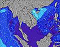 | 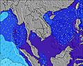 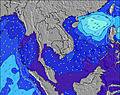 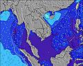 | 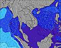 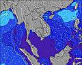 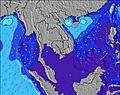 | ||||||||||||||||||||
| Le onde più grandi (m) & direzione (?) | ||||||||||||||||||||||||
| Periodo(s) (?) | 6 | 6 | 17 | 7 | 7 | 7 | 7 | 7 | 7 | 7 | 7 | 7 | 7 | 7 | 7 | 7 | 7 | 7 | 7 | 7 | 7 | 7 | 7 | 7 |
Grafico (?)delle onde | ||||||||||||||||||||||||
| 140 | 140 | 188 | 154 | 158 | 158 | 170 | 204 | 247 | 266 | 259 | 266 | 302 | 310 | 222 | 155 | 124 | 108 | 81 | 90 | 83 | 81 | 81 | 78 | |
Vento (km/h) | ||||||||||||||||||||||||
| Stato del vento (?) onshore cross-onshore cross-shore cross-offshore offshore piatto | on | on | on | on | on | on | on | on | on | on | on | on | on | on | on | on | on | on | on | cross- on | on | glass | glass | glass |
Alta Marea / altezza (m) | 10:35PM 2.81 | 10:57AM 2.40 | 11:15PM 2.74 | 11:40AM 2.25 | 11:56PM 2.58 | |||||||||||||||||||
Basso Marea / altezza (m) | 4:26PM -0.05 | 5:02AM -0.08 | 5:05PM 0.04 | 5:45AM -0.00 | 5:45PM 0.19 | 6:29AM 0.15 | ||||||||||||||||||
Giovedì 06 | Venerdì 07 | Sabato 08 | Domenica 09 | |||||||||||||||||||||
| Alba | - | - | - | - | - | - | - | 6:16 | - | - | - | - | - | - | - | 6:16 | - | - | - | - | - | - | - | 6:16 |
| Tramonto | - | - | 6:04 | - | - | - | - | - | - | - | 6:04 | - | - | - | - | - | - | - | 6:02 | - | - | - | - | - |
Piog. (mm) | 2 | 3 | 4 | 2 | 3 | 4 | 6 | 7 | 7 | 7 | 6 | 6 | 4 | 2 | 3 | 3 | 2 | 1 | - | 1 | - | - | - | 1 |
| Temp. °C | 27 | 27 | 26 | 26 | 26 | 26 | 26 | 26 | 26 | 26 | 26 | 26 | 26 | 26 | 26 | 26 | 27 | 28 | 28 | 27 | 26 | 26 | 26 | 26 |
| Feels °C (?) | 29 | 29 | 28 | 28 | 29 | 28 | 27 | 28 | 28 | 27 | 27 | 28 | 28 | 28 | 29 | 30 | 30 | 30 | 31 | 30 | 29 | 30 | 30 | 30 |
- Map Icons:
 Break
Break Live Wave Height (m)
 Live Wind Speed (km/h)
 Surf Rating (10 Max)
 Ocean Swells (m)
- Wind Speed (km/h)
Widget Free Surf-Forecast.com per il tuo sito
La relazione di surf / widget meteo è disponibile qui sotto per incorporare su siti esterni a titolo gratuito e fornisce una sintesi delle nostre Khao Lak / Nang Thong previsione surf. Basta prendere il frammento di codice html da noi fornito e copiarlo nel proprio sito. È possibile scegliere la lingua preferita e unità metriche / imperiali per il feed delle previsioni surf per soddisfare le esigenze degli utenti del vostro sito .... Clicca qui per ottenere il codice.
 Nearest