- Forecast
- Maps
- Live
- Weather State
- Spot Information
Le Mail Previsione surf
/ Mediterranean – Languedoc-Roussillon (17 surf breaks) /Previsioni:

Surf a Le MailPrevisione / Mediterranean – Languedoc-Roussillon / France
Aggiornamento meteo in hr min s Forecast update imminent
Questi sono altezze d'onde di mare aperto. Onde che si infrangono di solito sono più piccole, specialmente in luoghi riparati.
La temperatura del mare a Le Mail oggi è
17.5° C
(Che è leggermente più caldo del solito)Aggiornamento in hr min s Forecast update imminent
Previsione a breve termineper lo più asciutto. Warm (Max 27°C mercoledì pomeriggio, Min 13°C Lunedì mattina). Venti decrescenti (venti freschi da SSW Lunedì pomeriggio, calma per martedì mattina). | ||||||||||||||||||||||||
Monday 18 | Tuesday 19 | Wednesday 20 | Thu 21 | |||||||||||||||||||||
5 AM | 8 AM | 11 AM | 2 PM | 5 PM | 8 PM | 11 PM | 2 AM | 5 AM | 8 AM | 11 AM | 2 PM | 5 PM | 8 PM | 11 PM | 2 AM | 5 AM | 8 AM | 11 AM | 2 PM | 5 PM | 8 PM | 11 PM | 2 AM | |
Mappa dell'altezza del moto ondoso |    |    |    |  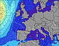 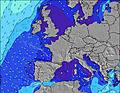 | ||||||||||||||||||||
S 4 | S 4 | — | — | S 3 | SSW 4 | S 4 | S 4 | S 4 | S 4 | S 3 | — | — | — | SSW 3 | S 3 | S 3 | NNW 2 | S 5 | — | — | SSW 3 | SSW 4 | S 4 | |
3 | 1 | 0 | 0 | 4 | 15 | 17 | 5 | 3 | 1 | 1 | 0 | 0 | 0 | 1 | 1 | 1 | 0 | 1 | 0 | 0 | 3 | 9 | 2 | |
Vento (km/h) | ||||||||||||||||||||||||
Stato del vento onshore cross-onshore cross-shore cross-offshore offshore piatto | cross | cross-off | cross-off | on | on | on | cross | cross-off | cross-off | off | glassy | cross-on | on | on | cross-on | cross-off | cross-off | cross-off | cross | cross-on | cross-on | cross-on | off | cross-off |
Alta Marea | 9:58AM0.17m | 11:09PM0.28m | 10:44AM0.16m | 00:03AM0.28m | 11:33AM0.14m | 1:02AM0.27m | ||||||||||||||||||
Basso Marea | 4:45AM0.06m | 4:05PM0.00m | 5:46AM0.07m | 4:48PM0.01m | 6:53AM0.08m | 5:34PM0.02m | ||||||||||||||||||
6:18 | — | — | — | — | — | — | — | 6:18 | — | — | — | — | — | — | — | 6:16 | — | — | — | — | — | — | 6:16 | |
— | — | — | — | — | 9:05 | — | — | — | — | — | — | — | 9:06 | — | — | — | — | — | — | — | 9:07 | — | 9:07 | |
— | — | — | — | — | — | — | — | — | — | — | — | — | — | — | — | — | — | — | — | — | — | — | — | |
Temp. °C | 14 | 13 | 17 | 18 | 17 | 17 | 19 | 17 | 17 | 17 | 17 | 17 | 18 | 18 | 19 | 20 | 20 | 19 | 21 | 25 | 27 | 26 | 23 | 21 |
10 | 10 | 15 | 15 | 12 | 12 | 16 | 14 | 14 | 15 | 15 | 15 | 15 | 14 | 16 | 18 | 18 | 16 | 18 | 23 | 24 | 23 | 20 | 20 | |
Onda 1 Altezza (m) Direzione Periodo (s) | S 4 | S 4 | — | — | — | — | — | S 4 | S 4 | S 4 | S 3 | — | — | — | S 3 | S 3 | S 3 | — | — | — | — | — | S 3 | S 4 |
3 | 1 | — | — | — | — | — | 5 | 3 | 1 | 1 | — | — | — | 1 | 1 | 1 | — | — | — | — | — | 4 | 2 | |
Onda 2 Altezza (m) Direzione Periodo (s) | — | — | — | — | — | — | — | — | — | — | — | — | — | — | — | — | — | — | S 5 | — | — | — | — | — |
— | — | — | — | — | — | — | — | — | — | — | — | — | — | — | — | — | — | 1 | — | — | — | — | — | |
Onda 3 Altezza (m) Direzione Periodo (s) | — | — | — | — | — | — | — | — | — | — | — | — | — | — | — | — | S 5 | — | — | — | — | — | — | — |
— | — | — | — | — | — | — | — | — | — | — | — | — | — | — | — | 1 | — | — | — | — | — | — | — | |
onde vento Altezza (m) Direzione Periodo (s) | — | — | — | — | S 3 | SSW 4 | S 4 | — | — | — | — | — | — | — | SSW 3 | — | NNW 2 | NNW 2 | — | — | — | SSW 3 | SSW 4 | — |
— | — | — | — | 4 | 15 | 17 | — | — | — | — | — | — | — | 1 | — | 1 | 1 | — | — | — | 3 | 9 | — | |
Il più vicino Offshore or Glassy | ||||||||||||||||||||||||
Distanza (km) | 407 | 177 | 405 | 440 | 424 | 284 | 303 | 57 | 303 | 397 | 400 | 499 | 272 | 483 | 397 | 397 | 397 | 397 | 397 | 398 | 398 | 397 | 197 | 397 |
Migliori previsioni per le condizioni d'onda in Languedoc-Roussillon | ||||||||||||||||||||||||
Migliori previsioni per le condizioni d'onda in France | ||||||||||||||||||||||||
Header Global | ||||||||||||||||||||||||
- Map Icons:
 Break
Break Live Wave Height (m)
 Live Wind Speed (km/h)
 Surf Rating (10 Max)
 Ocean Swells (m)
- Wind Speed (km/h)
Widget Free Surf-Forecast.com per il tuo sito
La relazione di surf / widget meteo è disponibile qui sotto per incorporare su siti esterni a titolo gratuito e fornisce una sintesi delle nostre Le Mail previsione surf. Basta prendere il frammento di codice html da noi fornito e copiarlo nel proprio sito. È possibile scegliere la lingua preferita e unità metriche / imperiali per il feed delle previsioni surf per soddisfare le esigenze degli utenti del vostro sito .... Clicca qui per ottenere il codice.
 Nearest