- Forecast
- Maps
- Live
- Weather State
- Spot Information
Previsioni:


Surf a Long SandsPrevisione / Maine / USA
Aggiornamento meteo in hr min s Forecast update imminent
Questi sono altezze d'onde di mare aperto. Onde che si infrangono di solito sono più piccole, specialmente in luoghi riparati.
La temperatura del mare a Long Sands oggi è
8.2° C
(Che è leggermente più freddo del normale)Aggiornamento in hr min s Forecast update imminent
Previsione a breve termineper lo più asciutto. Warm (Max 33°C martedì pomeriggio, Min 12°C Lunedì notte). Venti in aumento (calma Lunedì notte, venti freschi da ONO per mercoledì pomeriggio). | ||||||||||||||||||||||||
Sun 17 | Monday 18 | Tuesday 19 | Wed 20 | |||||||||||||||||||||
5 PM | 8 PM | 11 PM | 2 AM | 5 AM | 8 AM | 11 AM | 2 PM | 5 PM | 8 PM | 11 PM | 2 AM | 5 AM | 8 AM | 11 AM | 2 PM | 5 PM | 8 PM | 11 PM | 2 AM | 5 AM | 8 AM | 11 AM | 2 PM | |
Mappa dell'altezza del moto ondoso | 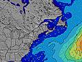 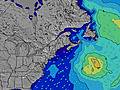 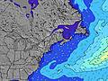 | 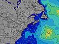 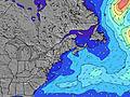 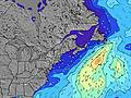 | 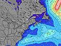 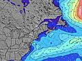 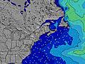 | 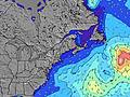 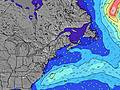 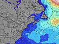 | ||||||||||||||||||||
SE 8 | SE 8 | SE 8 | SE 8 | SE 8 | SE 8 | SE 8 | SE 8 | SE 8 | SE 8 | SSE 4 | SE 5 | SSE 5 | SE 9 | SE 9 | SE 9 | SSE 5 | S 6 | SSE 7 | SSE 7 | SSE 7 | S 5 | S 5 | SE 9 | |
53 | 51 | 31 | 50 | 30 | 29 | 28 | 20 | 20 | 20 | 25 | 22 | 19 | 28 | 28 | 26 | 28 | 213 | 145 | 114 | 69 | 28 | 27 | 29 | |
Vento (km/h) | ||||||||||||||||||||||||
Stato del vento onshore cross-onshore cross-shore cross-offshore offshore piatto | cross-off | off | cross-off | cross-on | cross | cross-on | on | on | on | on | glassy | cross-on | cross | cross | cross | cross-off | cross-off | cross-off | cross-off | cross-off | cross | cross-off | cross-off | cross-off |
Alta Marea | 00:15AM3.36m | 1:01PM2.87m | 1:08AM3.35m | 1:55PM2.83m | 2:02AM3.27m | |||||||||||||||||||
Basso Marea | 6:06PM-0.06m | 6:51AM-0.49m | 6:59PM-0.04m | 7:44AM-0.46m | 7:53PM0.02m | 8:39AM-0.38m | ||||||||||||||||||
— | — | — | — | 5:16 | — | — | — | — | — | — | — | 5:15 | — | — | — | — | — | — | — | 5:13 | — | — | — | |
— | 8:00 | — | — | — | — | — | — | — | 8:01 | — | — | — | — | — | — | — | 8:02 | — | — | — | — | — | 8:04 | |
— | — | — | — | — | — | — | — | — | — | — | — | — | — | — | — | — | — | — | — | — | — | — | — | |
Temp. °C | 26 | 24 | 19 | 16 | 14 | 13 | 13 | 13 | 13 | 12 | 16 | 18 | 20 | 23 | 30 | 33 | 32 | 28 | 24 | 23 | 22 | 24 | 30 | 31 |
25 | 22 | 17 | 14 | 11 | 9 | 9 | 8 | 8 | 10 | 16 | 18 | 20 | 23 | 29 | 30 | 29 | 27 | 23 | 21 | 21 | 23 | 28 | 28 | |
Onda 1 Altezza (m) Direzione Periodo (s) | SE 8 | SE 8 | SE 8 | SE 8 | SE 8 | SE 8 | SE 8 | SE 8 | SE 8 | SE 8 | SSE 4 | SE 5 | SSE 5 | SSE 5 | SE 9 | SE 9 | SSE 5 | SSE 6 | SSE 7 | SSE 7 | SSE 7 | S 5 | SE 8 | S 5 |
53 | 51 | 31 | 50 | 30 | 29 | 28 | 20 | 20 | 20 | 25 | 22 | 19 | 17 | 28 | 26 | 28 | 100 | 145 | 114 | 69 | 28 | 24 | 17 | |
Onda 2 Altezza (m) Direzione Periodo (s) | E 8 | — | SSE 5 | E 15 | SSE 5 | E 15 | E 3 | NE 4 | ENE 4 | E 13 | SE 8 | SE 8 | SE 8 | SE 9 | E 13 | E 13 | SE 9 | E 16 | E 16 | E 16 | SE 9 | SE 8 | E 15 | SE 9 |
6 | — | 5 | 4 | 5 | 4 | 6 | 4 | 1 | 4 | 20 | 9 | 10 | 28 | 3 | 3 | 26 | 5 | 5 | 5 | 22 | 21 | 5 | 29 | |
Onda 3 Altezza (m) Direzione Periodo (s) | — | E 15 | E 15 | E 15 | E 15 | — | E 15 | E 14 | E 14 | E 18 | E 13 | SE 9 | SE 9 | E 13 | — | E 16 | E 13 | — | — | — | E 16 | E 16 | E 12 | E 12 |
— | 4 | 4 | 4 | 4 | — | 4 | 4 | 4 | 6 | 3 | 14 | 14 | 3 | — | 5 | 3 | — | — | — | 5 | 5 | 3 | 3 | |
onde vento Altezza (m) Direzione Periodo (s) | — | NW 2 | — | NE 3 | ENE 3 | E 3 | E 4 | SE 4 | SE 4 | SE 4 | — | SSE 4 | — | WSW 3 | S 4 | S 4 | WSW 3 | S 6 | WSW 4 | WSW 4 | SW 4 | WSW 4 | S 5 | WSW 3 |
— | 1 | — | 2 | 2 | 3 | 6 | 4 | 9 | 15 | — | 20 | — | 2 | 10 | 12 | 1 | 213 | 8 | 13 | 3 | 2 | 27 | 5 | |
Il più vicino Offshore or Glassy | ||||||||||||||||||||||||
Distanza (km) | 11 | 11 | 188 | 188 | 199 | 348 | 474 | 213 | 474 | 474 | 11 | 23 | 11 | 11 | 417 | 412 | 11 | 23 | 23 | 427 | 11 | 410 | 421 | 11 |
Migliori previsioni per le condizioni d'onda in Maine | ||||||||||||||||||||||||
Migliori previsioni per le condizioni d'onda in United States | ||||||||||||||||||||||||
Header Global | ||||||||||||||||||||||||
- Map Icons:
 Break
Break Live Wave Height (m)
 Live Wind Speed (km/h)
 Surf Rating (10 Max)
 Ocean Swells (m)
- Wind Speed (km/h)
Widget Free Surf-Forecast.com per il tuo sito
La relazione di surf / widget meteo è disponibile qui sotto per incorporare su siti esterni a titolo gratuito e fornisce una sintesi delle nostre Long Sands previsione surf. Basta prendere il frammento di codice html da noi fornito e copiarlo nel proprio sito. È possibile scegliere la lingua preferita e unità metriche / imperiali per il feed delle previsioni surf per soddisfare le esigenze degli utenti del vostro sito .... Clicca qui per ottenere il codice.
 Nearest