
Previsioni:

Previsione a breve terminePioggia moderata (Totale 14mm), più pesante Venerdì pomeriggio. Very mild (Max 18°C Venerdì pomeriggio, Min 13°C Domenica mattina). Venti in aumento (calma Venerdì mattina, raffiche di vento da ONO per venerdì notte). | ||||||||||||||||||||||||
Venerdì 17 | Sabato 18 | Domenica 19 | ||||||||||||||||||||||
2 AM | 5 AM | 8 AM | 11 AM | 2 PM | 5 PM | 8 PM | 11 PM | 2 AM | 5 AM | 8 AM | 11 AM | 2 PM | 5 PM | 8 PM | 11 PM | 2 AM | 5 AM | 8 AM | 11 AM | 2 PM | 5 PM | 8 PM | 11 PM | |
Mappa dell'altezza del moto ondoso |  | 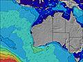 |  |  | 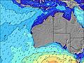 |  |  | 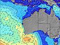 |  | |||||||||||||||
Onda Altezza (m) Direzione Periodo (s) | W 13 | W 13 | WSW 13 | WSW 13 | WSW 12 | WSW 12 | WNW 12 | W 14 | WNW 14 | W 13 | W 10 | W 11 | W 12 | W 16 | W 16 | W 15 | W 15 | W 14 | W 14 | WSW 14 | WSW 14 | WSW 13 | WSW 13 | WSW 13 |
Grafico delle onde | ||||||||||||||||||||||||
1530 | 1370 | 901 | 874 | 727 | 608 | 1477 | 674 | 2982 | 3724 | 2813 | 3899 | 3344 | 6609 | 6223 | 5421 | 4235 | 3570 | 2811 | 2343 | 1873 | 1616 | 1316 | 1175 | |
Vento (km/h) | ||||||||||||||||||||||||
Stato del vento onshore cross-onshore cross-shore cross-offshore offshore piatto | cross | cross | glassy | cross-off | cross-on | cross-on | cross-on | on | on | on | on | cross-on | cross-on | cross-on | cross-on | cross-on | cross-on | cross-on | on | cross-on | cross-on | cross-on | cross-off | off |
Alta Marea | 11:05AM0.62m | 11:07AM0.52m | 2:57AM0.37m | 10:20AM0.44m | ||||||||||||||||||||
Basso Marea | 7:34PM0.16m | 6:56PM0.21m | 5:25AM0.35m | 6:32PM0.22m | ||||||||||||||||||||
— | 7:16 | — | — | — | — | — | — | — | 7:16 | — | — | — | — | — | — | — | 7:16 | — | — | — | — | — | — | |
— | — | — | — | — | 5:30 | — | — | — | — | — | — | — | 5:30 | — | — | — | — | — | — | — | 5:30 | — | — | |
mm | — | — | — | — | 1 | 3 | 2 | 1 | 1 | 3 | 1 | — | — | — | — | — | — | — | — | — | — | 1 | 1 | — |
Temp. °C | 16 | 16 | 16 | 16 | 18 | 16 | 18 | 18 | 17 | 17 | 16 | 15 | 15 | 16 | 16 | 16 | 15 | 15 | 16 | 16 | 16 | 15 | 14 | 14 |
Gelo °C | 14 | 15 | 16 | 14 | 15 | 12 | 13 | 12 | 9 | 9 | 8 | 6 | 8 | 10 | 11 | 11 | 11 | 11 | 13 | 13 | 12 | 12 | 13 | 12 |
Onda 1 Altezza (m) Direzione Periodo (s) | W 13 | W 13 | WSW 13 | WSW 13 | WSW 12 | WSW 12 | — | W 14 | — | — | — | — | W 17 | W 16 | W 16 | W 15 | W 15 | W 14 | W 14 | WSW 14 | WSW 14 | WSW 13 | WSW 13 | WSW 13 |
1530 | 1370 | 901 | 874 | 727 | 608 | — | 674 | — | — | — | — | 1669 | 6609 | 6223 | 5421 | 4235 | 3570 | 2811 | 2343 | 1873 | 1616 | 1316 | 1175 | |
Onda 2 Altezza (m) Direzione Periodo (s) | WNW 12 | WNW 12 | WNW 8 | WNW 8 | WNW 7 | NW 11 | — | — | — | — | — | — | — | — | — | — | — | — | — | — | — | — | — | — |
14 | 14 | 55 | 48 | 30 | 5 | — | — | — | — | — | — | — | — | — | — | — | — | — | — | — | — | — | — | |
Onda 3 Altezza (m) Direzione Periodo (s) | — | — | NNW 7 | NNW 7 | NW 12 | — | — | — | — | — | — | — | — | — | — | — | — | — | — | — | — | — | — | — |
— | — | 32 | 30 | 5 | — | — | — | — | — | — | — | — | — | — | — | — | — | — | — | — | — | — | — | |
onde vento Altezza (m) Direzione Periodo (s) | — | — | — | — | NNW 7 | NW 7 | WNW 12 | WNW 7 | WNW 14 | W 13 | W 10 | W 11 | W 12 | — | — | — | — | — | — | — | — | — | — | — |
— | — | — | — | 29 | 106 | 1477 | 342 | 2982 | 3724 | 2813 | 3899 | 3344 | — | — | — | — | — | — | — | — | — | — | — | |
Il più vicino Offshore or Glassy | ||||||||||||||||||||||||
Distanza (km) | 75 | 7 | 0 | 0 | 194 | 194 | 249 | 295 | 295 | 311 | 985 | 1630 | 562 | 311 | 362 | 311 | 311 | 311 | 70 | 70 | 67 | 70 | 0 | 0 |
Migliori previsioni per le condizioni d'onda in Perth City Coast | ||||||||||||||||||||||||
Migliori previsioni per le condizioni d'onda in Australia | ||||||||||||||||||||||||
Trova Onde Globale | ||||||||||||||||||||||||
- Map Icons:
 Break
Break Live Wave Height (m)
 Live Wind Speed (km/h)
 Surf Rating (10 Max)
 Ocean Swells (m)
- Wind Speed (km/h)
Widget Free Surf-Forecast.com per il tuo sito
La relazione di surf / widget meteo è disponibile qui sotto per incorporare su siti esterni a titolo gratuito e fornisce una sintesi delle nostre Melros previsione surf. Basta prendere il frammento di codice html da noi fornito e copiarlo nel proprio sito. È possibile scegliere la lingua preferita e unità metriche / imperiali per il feed delle previsioni surf per soddisfare le esigenze degli utenti del vostro sito .... Clicca qui per ottenere il codice.
 Nearest