- Forecast
- Maps
- Live
- Weather State
- Spot Information
Norderney Previsione surf
/ Nordsee (13 surf breaks) /Previsioni:

Surf a NorderneyPrevisione / Nordsee / Germany
Previsione a breve termine: per lo più asciutto. Very mild (Max 14°C Lunedì notte, Min 12°C martedì mattina). Venti in aumento (calma martedì notte, venti freschi da NW per mercoledì notte). | Giorni 3 -6 Sintesi meteo per lo più asciutto. Very mild (Max 14°C giovedì notte, Min 11°C Domenica mattina). Venti decrescenti (venti freschi da NW giovedì notte, venti deboli da N per domenica pomeriggio). | |||||||||||||||||||||
Martedì 14 | Mercoledì 15 | Giovedì 16 | Venerdì 17 | Sabato 18 | Domenica 19 | Lun 20 | ||||||||||||||||
| Notte | Mattina | Pomeriggio | Notte | Mattina | Pomeriggio | Notte | Mattina | Pomeriggio | Notte | Mattina | Pomeriggio | Notte | Mattina | Pomeriggio | Notte | Mattina | Pomeriggio | Notte | Mattina | Pomeriggio | ||
Voto (10 max) | ||||||||||||||||||||||
Mappa dell'altezza del moto ondoso | 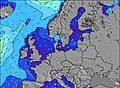 | 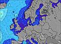 | 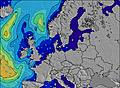 | 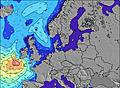 | 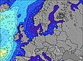 | 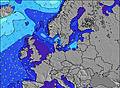 | 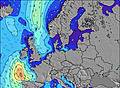 | 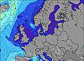 | ||||||||||||||
| Le onde più grandi (m) & direzione (?) | ||||||||||||||||||||||
| Periodo(s) (?) | 6 | 7 | 7 | 7 | 6 | 7 | 7 | 7 | 8 | 7 | 7 | 7 | 8 | 7 | 7 | 6 | 6 | 6 | 5 | 5 | 6 | |
Grafico (?)delle onde | ||||||||||||||||||||||
| 37 | 163 | 139 | 64 | 75 | 88 | 217 | 249 | 256 | 249 | 208 | 203 | 169 | 53 | 25 | 16 | 7 | 6 | 3 | 3 | 7 | ||
Vento (km/h) | ||||||||||||||||||||||
| Stato del vento (?) onshore cross-onshore cross-shore cross-offshore offshore piatto | cross- on | cross- on | on | glass | on | cross- on | cross- on | cross- on | cross- on | cross- on | cross- on | on | on | cross- on | on | on | on | on | glass | cross- off | cross- off | |
Alta Marea / altezza (m) | 4:57AM 2.62 | 5:38PM 2.37 | 6:00AM 2.52 | 6:48PM 2.24 | 7:11AM 2.48 | 8:10PM 2.23 | 8:31AM 2.53 | 9:29PM 2.34 | 9:47AM 2.67 | 10:32PM 2.51 | 10:48AM 2.82 | 11:23PM 2.66 | 11:37AM 2.92 | |||||||||
Basso Marea / altezza (m) | 10:43PM 0.47 | 11:23AM 0.34 | 11:43PM 0.65 | 12:31PM 0.47 | 12:53AM 0.76 | 1:47PM 0.51 | 2:12AM 0.76 | 3:23PM 0.39 | 3:50AM 0.58 | 4:30PM 0.18 | 4:50AM 0.33 | 5:20PM 0.02 | 5:37AM 0.14 | 6:02PM -0.04 | ||||||||
Martedì 14 | Mercoledì 15 | Giovedì 16 | Venerdì 17 | Sabato 18 | Domenica 19 | Lun 20 | ||||||||||||||||
| Alba | - | 7:54 | - | - | 7:56 | - | - | 7:58 | - | - | 8:00 | - | - | 8:03 | - | - | 8:03 | - | - | 8:06 | - | |
| Tramonto | - | - | 6:37 | - | - | 6:35 | - | - | 6:32 | - | - | 6:30 | - | - | 6:29 | - | - | 6:25 | - | - | 6:23 | |
Piog. (mm) | - | - | - | - | - | - | - | - | - | - | - | - | - | - | - | - | - | - | - | - | - | |
| Temp. °C | 14 | 13 | 14 | 14 | 13 | 12 | 14 | 13 | 14 | 14 | 12 | 12 | 12 | 12 | 12 | 12 | 12 | 11 | 10 | 8 | 11 | |
| Feels °C (?) | 11 | 7 | 10 | 13 | 10 | 7 | 8 | 6 | 8 | 8 | 5 | 6 | 6 | 7 | 8 | 7 | 8 | 8 | 7 | 5 | 6 | |
- Map Icons:
 Break
Break Live Wave Height (m)
 Live Wind Speed (km/h)
 Surf Rating (10 Max)
 Ocean Swells (m)
- Wind Speed (km/h)
 Recenti Eyeball Surf Report per Nordsee

Actual: 56 min ago
Widget Free Surf-Forecast.com per il tuo sito
La relazione di surf / widget meteo è disponibile qui sotto per incorporare su siti esterni a titolo gratuito e fornisce una sintesi delle nostre Norderney previsione surf. Basta prendere il frammento di codice html da noi fornito e copiarlo nel proprio sito. È possibile scegliere la lingua preferita e unità metriche / imperiali per il feed delle previsioni surf per soddisfare le esigenze degli utenti del vostro sito .... Clicca qui per ottenere il codice.
Informazioni su Norderney Surf forecast
La tabella della previsione di surf qui sopra per Norderney fornisce informazioni essenziali per determinare se le condizioni di surf saranno buone nei prossimi 12 giorni. Una guida generale al surf per Norderney è disponibile selezionando l'opzione della guida locale al surf nel menu grigio. La nostra previsione di surf per Norderney è unica in quanto include l'energia delle onde (potenza) che definisce la reale sensazione di surf piuttosto che solo l'altezza o la periodicità. Se si fa surf regolarmente nello stesso punto (Norderney), prendi nota mentalmente dell'energia delle onde indicata nella tabella della previsione di surf ogni volta che esci in mare. Molto presto inizierai a selezionare le giornate di surf in base alla sola energia delle onde combinata con la nostra previsione delle condizioni favorevoli del vento a largo. La nostra classificazione basata sul numero di stelle ti sarà di aiuto e, naturalmente, nella nostra previsione di surf saranno presenti anche le normali previsioni sull'altezza delle onde e sulla periodicità, nonché una suddivisione completa dei componenti del moto ondoso utilizzando l'opzione per utenti avanzati (per visualizzarla, clicca sul piccolo personaggio di Einstein sotto i tempi di marea).
Ulteriori informazioni relative alle domande più frequenti sulla nostra previsione di surf per Norderney sono disponibili nella scheda Aiuto nel menu in alto e anche spostando il mouse sui punti interrogativi all'interno della tabella delle previsioni di surf stessa. Si prega di tenere sempre presente che la previsione si riferisce alle acque aperte vicino alla riva e che i fattori locali presenti in ogni località di surf influenzano l'altezza di rottura effettiva dell'onda, come il profilo della spiaggia/scogliera, la profondità dell'acqua al largo e al riparo.
Norderney is 14 km (9 miles) from Norden. If you plan a holiday in Nordsee (North Sea), look for hotels and other accommodation in Norden. Norden has rooms for a wide range of budgets as well as car hire and transport links.
 Nearest