- Forecast
- Maps
- Live
- Weather State
- Spot Information
Previsioni:

Surf a Parea LeftPrevisione / Huahine / French Polynesia
Aggiornamento meteo in hr min s Forecast update imminent
Questi sono altezze d'onde di mare aperto. Onde che si infrangono di solito sono più piccole, specialmente in luoghi riparati.
La temperatura del mare a Parea Left oggi è
28.9° C
(Che è normale per questo periodo dell'anno)Aggiornamento in hr min s Forecast update imminent
Giovedì 12 | Venerdì 13 | Sabato 14 | Dom 15 | |||||||||||||||||||||
| 5 AM | 8 AM | 11 AM | 2 PM | 5 PM | 8 PM | 11 PM | 2 AM | 5 AM | 8 AM | 11 AM | 2 PM | 5 PM | 8 PM | 11 PM | 2 AM | 5 AM | 8 AM | 11 AM | 2 PM | 5 PM | 8 PM | 11 PM | 2 AM | |
Voto (10 max) | ||||||||||||||||||||||||
Mappa dell'altezza del moto ondoso |    |    |    |  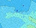 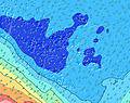 | ||||||||||||||||||||
| Le onde più grandi (m) & direzione (?) | ||||||||||||||||||||||||
| Periodo(s) (?) | 14 | 14 | 15 | 15 | 14 | 14 | 14 | 14 | 14 | 14 | 15 | 15 | 18 | 18 | 17 | 16 | 16 | 16 | 16 | 16 | 16 | 15 | 14 | 14 |
Grafico (?)delle onde | ||||||||||||||||||||||||
| 232 | 232 | 393 | 372 | 325 | 312 | 290 | 290 | 243 | 264 | 272 | 199 | 697 | 961 | 1244 | 1271 | 1428 | 1730 | 1687 | 1842 | 1818 | 1680 | 1439 | 1419 | |
Vento (km/h) | ||||||||||||||||||||||||
| Stato del vento (?) onshore cross-onshore cross-shore cross-offshore offshore piatto | cross | cross | cross | cross | cross- on | cross- on | cross- on | cross- on | cross- on | cross- on | cross | cross- on | cross- on | cross- on | cross- on | cross- on | cross- on | cross | cross | cross | cross | cross | cross | cross- on |
Alta Marea / altezza (m) | 12:33PM 0.16 | 11:40PM 0.15 | 12:05PM 0.17 | 11:35PM 0.18 | 11:59AM 0.19 | 11:44PM 0.21 | ||||||||||||||||||
Basso Marea / altezza (m) | 6:06AM 0.04 | 6:13PM 0.06 | 5:59AM 0.02 | 6:01PM 0.05 | 6:01AM 0.01 | 5:57PM 0.04 | ||||||||||||||||||
Giovedì 12 | Venerdì 13 | Sabato 14 | Dom 15 | |||||||||||||||||||||
| Alba | - | 6:05 | - | - | - | - | - | - | - | 6:05 | - | - | - | - | - | - | - | 6:05 | - | - | - | - | - | - |
| Tramonto | - | - | - | - | 6:20 | - | - | - | - | - | - | - | 6:20 | - | - | - | - | - | - | - | 6:19 | - | - | - |
Piog. (mm) | - | - | 1 | - | - | - | - | - | - | - | - | - | - | - | - | - | - | - | 1 | - | - | - | - | - |
| Temp. °C | 27 | 27 | 27 | 27 | 28 | 28 | 27 | 27 | 27 | 27 | 27 | 27 | 27 | 27 | 27 | 27 | 27 | 27 | 27 | 27 | 27 | 27 | 27 | 27 |
| Feels °C (?) | 29 | 29 | 28 | 28 | 30 | 30 | 28 | 29 | 28 | 29 | 29 | 29 | 29 | 29 | 29 | 29 | 29 | 29 | 29 | 29 | 29 | 29 | 28 | 28 |
- Map Icons:
 Break
Break Live Wave Height (m)
 Live Wind Speed (km/h)
 Surf Rating (10 Max)
 Ocean Swells (m)
- Wind Speed (km/h)
Widget Free Surf-Forecast.com per il tuo sito
La relazione di surf / widget meteo è disponibile qui sotto per incorporare su siti esterni a titolo gratuito e fornisce una sintesi delle nostre Parea Left previsione surf. Basta prendere il frammento di codice html da noi fornito e copiarlo nel proprio sito. È possibile scegliere la lingua preferita e unità metriche / imperiali per il feed delle previsioni surf per soddisfare le esigenze degli utenti del vostro sito .... Clicca qui per ottenere il codice.
 Nearest