
Previsioni:

Previsione a breve termineper lo più asciutto. Warm (Max 24°C giovedì mattina, Min 21°C Sabato notte). Vento sarà generalmente leggero. | |||||||||||||||||||||||
Giovedì 16 | Venerdì 17 | Sabato 18 | |||||||||||||||||||||
4 AM | 7 AM | 10 AM | 1 PM | 4 PM | 7 PM | 10 PM | 1 AM | 4 AM | 7 AM | 10 AM | 1 PM | 4 PM | 7 PM | 10 PM | 1 AM | 4 AM | 7 AM | 10 AM | 1 PM | 4 PM | 7 PM | 10 PM | |
Mappa dell'altezza del moto ondoso | 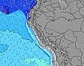 |  | 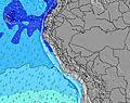 | 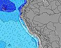 | 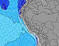 | 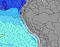 | 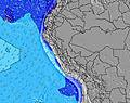 | 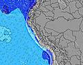 | 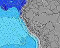 | ||||||||||||||
Onda Altezza (m) Direzione Periodo (s) | SSW 13 | SSW 13 | SSW 13 | SSW 13 | SSW 13 | SSW 12 | SSW 13 | SSW 13 | SSW 13 | SSW 13 | SSW 13 | SSW 13 | SSW 12 | SSW 12 | SSW 12 | SSW 12 | SSW 12 | SSW 13 | SSW 12 | SSW 12 | SSW 12 | SSW 12 | SSW 12 |
Grafico delle onde | |||||||||||||||||||||||
824 | 793 | 793 | 878 | 669 | 384 | 679 | 781 | 781 | 679 | 633 | 614 | 412 | 493 | 485 | 467 | 490 | 522 | 246 | 379 | 226 | 211 | 260 | |
Vento (km/h) | |||||||||||||||||||||||
Stato del vento onshore cross-onshore cross-shore cross-offshore offshore piatto | cross-off | cross-off | cross-off | cross | cross | cross-off | cross-off | cross-off | cross-off | cross-off | cross-off | cross-on | cross | cross | cross-off | cross-off | cross-off | cross-off | cross-off | cross | cross | cross-off | cross |
Alta Marea | 5:32AM1.73m | 5:28PM1.47m | 6:17AM1.73m | 6:19PM1.43m | 7:00AM1.67m | 7:10PM1.38m | |||||||||||||||||
Basso Marea | 11:44AM0.31m | 11:45PM0.01m | 12:32PM0.30m | 00:30AM0.11m | 1:19PM0.32m | ||||||||||||||||||
6:35 | — | — | — | — | — | — | — | 6:35 | — | — | — | — | — | — | — | 6:35 | — | — | — | — | — | — | |
— | — | — | — | 6:24 | — | — | — | — | — | — | — | 6:24 | — | — | — | — | — | — | — | 6:24 | — | — | |
mm | — | — | — | — | — | — | — | — | — | — | — | — | — | — | — | — | — | — | — | — | — | — | — |
Temp. °C | 23 | 22 | 24 | 24 | 23 | 23 | 22 | 22 | 22 | 22 | 23 | 23 | 23 | 23 | 22 | 22 | 22 | 22 | 23 | 24 | 23 | 22 | 22 |
Gelo °C | 24 | 22 | 24 | 23 | 21 | 21 | 21 | 22 | 23 | 23 | 24 | 22 | 21 | 21 | 20 | 21 | 22 | 22 | 22 | 23 | 21 | 21 | 22 |
Onda 1 Altezza (m) Direzione Periodo (s) | SSW 13 | SSW 13 | SSW 13 | SSW 13 | SSW 13 | SSW 12 | SSW 13 | SSW 13 | SSW 13 | SSW 13 | SSW 13 | SSW 13 | SSW 12 | SSW 12 | SSW 12 | SSW 12 | SSW 12 | SSW 13 | SSW 12 | SSW 12 | SSW 12 | SSW 12 | SSW 12 |
824 | 793 | 793 | 878 | 669 | 384 | 679 | 781 | 781 | 679 | 633 | 614 | 412 | 493 | 485 | 467 | 490 | 522 | 246 | 379 | 226 | 211 | 260 | |
Onda 2 Altezza (m) Direzione Periodo (s) | NW 11 | NW 11 | NW 11 | NW 11 | NW 11 | SSW 14 | NW 11 | S 5 | NW 11 | S 5 | S 5 | S 16 | S 14 | S 15 | S 15 | SW 19 | SW 18 | SW 18 | S 13 | SSW 16 | S 13 | S 12 | S 13 |
5 | 5 | 5 | 5 | 5 | 265 | 5 | 31 | 4 | 25 | 19 | 119 | 253 | 157 | 157 | 54 | 50 | 53 | 176 | 104 | 123 | 148 | 168 | |
Onda 3 Altezza (m) Direzione Periodo (s) | NW 11 | NW 11 | NW 11 | NW 11 | SW 22 | NW 11 | SW 21 | NW 11 | NW 11 | S 16 | S 16 | SSW 20 | SSW 20 | SW 19 | SW 19 | SW 15 | SSW 15 | NW 10 | SW 15 | SSW 13 | SW 16 | SSW 16 | SW 18 |
5 | 5 | 5 | 5 | 18 | 5 | 18 | 4 | 4 | 81 | 81 | 38 | 38 | 57 | 54 | 8 | 21 | 4 | 112 | 35 | 130 | 51 | 49 | |
onde vento Altezza (m) Direzione Periodo (s) | — | — | S 5 | SW 2 | S 4 | S 5 | S 5 | — | S 5 | — | — | S 5 | SSW 4 | S 4 | S 5 | S 5 | S 5 | S 6 | S 6 | S 6 | SSW 6 | S 6 | S 6 |
— | — | 2 | 1 | 30 | 34 | 35 | — | 25 | — | — | 19 | 21 | 31 | 37 | 34 | 36 | 38 | 39 | 40 | 56 | 56 | 58 | |
Il più vicino Offshore or Glassy | |||||||||||||||||||||||
Distanza (km) | 0 | 0 | 193 | 835 | 835 | 766 | 532 | 79 | 0 | 0 | 0 | 835 | 766 | 403 | 278 | 94 | 94 | 94 | 333 | 812 | 835 | 532 | 197 |
Migliori previsioni per le condizioni d'onda in Piura | |||||||||||||||||||||||
Migliori previsioni per le condizioni d'onda in Peru | |||||||||||||||||||||||
Trova Onde Globale | |||||||||||||||||||||||
- Map Icons:
 Break
Break Live Wave Height (m)
 Live Wind Speed (km/h)
 Surf Rating (10 Max)
 Ocean Swells (m)
- Wind Speed (km/h)
Widget Free Surf-Forecast.com per il tuo sito
La relazione di surf / widget meteo è disponibile qui sotto per incorporare su siti esterni a titolo gratuito e fornisce una sintesi delle nostre Bayobar - Punta Tur previsione surf. Basta prendere il frammento di codice html da noi fornito e copiarlo nel proprio sito. È possibile scegliere la lingua preferita e unità metriche / imperiali per il feed delle previsioni surf per soddisfare le esigenze degli utenti del vostro sito .... Clicca qui per ottenere il codice.
 Nearest