

- Forecast
- Maps
- Live
- Weather State
- Spot Information
Shingles Surf Forecast
/ West Coast South Island (17 surf breaks) /
Surf Forecasts
Beach
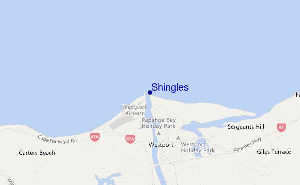
Shingles surf Forecast / West Coast South Island / New Zealand
48hr Weather and Surf, issued 11 pm Friday 26 Apr 2024 NZST
Forecast update in hr min s Update imminent
Shingles surf forecast is for near shore open water. Breaking waves will often be smaller at less exposed spots.
Today's Shingles sea temperature is 15.4°C (Statistics for 26 Apr 1981-2005 - mean: 15.5 °C max: 17.1 °C min: 13.9 °C)
- Map Icons:
 Break
Break Live Wave Height (m)
 Live Wind Speed (km/h)
 Surf Rating (10 Max)
 Ocean Swells (m)
- Wind Speed (km/h)
Shingles surf forecast is for near shore open water. Breaking waves will often be smaller at less exposed spots.
Today's Shingles sea temperature is 15.4°C (Statistics for 26 Apr 1981-2005 - mean: 15.5 °C max: 17.1 °C min: 13.9 °C)
How big are the waves at Shingles today?
The current surf forecast for Shingles at 4AM is: 3.5m 14s primary swell from a West direction (forecast issued at 11:00pm April 26). The wind direction is predicted to be offshore and the swell rating is 11.
| Time (NZST) & Date | Wave Height | Wave Period |
|---|---|---|
| Morning (27 Apr) | 10ft (3.0m) | 14s |
| Afternoon (27 Apr) | 8ft (2.5m) | 14s |
| Evening (27 Apr) | 7ft (2.1m) | 14s |
Table - waves today at Shingles. (Swell directed towards the surf break)
Updates in hr min s Update imminent
Saturday 27 | Sunday 28 | Monday 29 | Tuesday 30 | Wednesday 01 | Thursday 02 | Friday 03 | Saturday 04 | |||||||||||||||||||||||||||||||||||||||||||||||||||||
| 9 PM | 0 AM | 3 AM | 6 AM | 9 AM | 12 PM | 3 PM | 6 PM | 9 PM | 0 AM | 3 AM | 6 AM | 9 AM | 12 PM | 3 PM | 6 PM | 9 PM | 0 AM | 3 AM | 6 AM | 9 AM | 12 PM | 3 PM | 6 PM | 9 PM | 0 AM | 3 AM | 6 AM | 9 AM | 12 PM | 3 PM | 6 PM | 9 PM | 0 AM | 3 AM | 6 AM | 9 AM | 12 PM | 3 PM | 6 PM | 9 PM | 0 AM | 3 AM | 6 AM | 9 AM | 12 PM | 3 PM | 6 PM | 9 PM | 0 AM | 3 AM | 6 AM | 9 AM | 12 PM | 3 PM | 6 PM | 9 PM | 0 AM | 3 AM | 6 AM | |
Rating (10 max) | ||||||||||||||||||||||||||||||||||||||||||||||||||||||||||||
Swell Height Map |  |    |    |    |  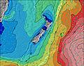 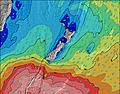 |  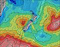 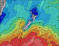 |  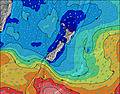 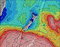 |  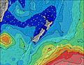 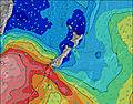 | 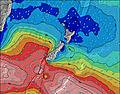 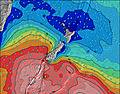 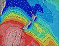 | |||||||||||||||||||||||||||||||||||||||||||||||||||
| Wave Height (m) & direction (?) | ||||||||||||||||||||||||||||||||||||||||||||||||||||||||||||
| Period(s) (?) | 14 | 14 | 14 | 14 | 14 | 14 | 14 | 14 | 14 | 14 | 14 | 14 | 13 | 13 | 13 | 12 | 12 | 12 | 11 | 11 | 11 | 11 | 11 | 11 | 12 | 13 | 13 | 14 | 14 | 14 | 14 | 13 | 13 | 13 | 13 | 13 | 13 | 13 | 13 | 13 | 13 | 14 | 14 | 14 | 14 | 14 | 14 | 13 | 13 | 13 | 9 | 9 | 9 | 10 | 9 | 14 | 14 | 14 | 15 | 15 |
Wave (?)Graph | ||||||||||||||||||||||||||||||||||||||||||||||||||||||||||||
| Energy (?) | 5739 | 5808 | 5491 | 4638 | 3806 | 3110 | 2606 | 2012 | 1657 | 1449 | 1139 | 972 | 823 | 799 | 669 | 639 | 505 | 422 | 401 | 387 | 325 | 325 | 280 | 290 | 301 | 367 | 408 | 439 | 427 | 427 | 421 | 408 | 451 | 475 | 608 | 690 | 623 | 828 | 917 | 1009 | 1777 | 2027 | 2099 | 2140 | 1928 | 1740 | 1400 | 1229 | 1210 | 468 | 390 | 451 | 418 | 435 | 337 | 389 | 899 | 911 | 811 | 833 |
Wind (km/h) | ||||||||||||||||||||||||||||||||||||||||||||||||||||||||||||
| Wind State (?) onshore cross-onshore cross-shore cross-offshore offshore glassy | cross- off | off | off | off | off | off | cross- off | off | glass | cross | cross | cross- off | cross | glass | on | glass | cross- off | cross | cross | cross | cross- off | on | on | glass | cross | cross | cross- on | glass | glass | cross- off | cross- off | cross- off | cross- off | cross | cross- off | cross- off | cross- off | cross- off | cross- off | off | cross- off | cross- off | cross- off | cross- off | cross- off | glass | glass | glass | glass | cross | cross | cross- off | cross- off | glass | glass | glass | cross- off | cross- off | cross | cross- off |
High Tide / height (m) | 12:10AM 2.99 | 12:31PM 2.93 | 12:48AM 2.90 | 1:14PM 2.81 | 1:33AM 2.78 | 2:06PM 2.67 | 2:27AM 2.66 | 3:11PM 2.56 | 3:35AM 2.57 | 4:24PM 2.51 | 4:51AM 2.58 | 5:35PM 2.55 | 6:02AM 2.68 | 6:41PM 2.67 | ||||||||||||||||||||||||||||||||||||||||||||||
Low Tide / height (m) | 6:04PM 0.55 | 6:18AM 0.58 | 6:42PM 0.63 | 6:59AM 0.67 | 7:25PM 0.73 | 7:48AM 0.77 | 8:17PM 0.83 | 8:49AM 0.85 | 9:21PM 0.91 | 10:03AM 0.86 | 10:34PM 0.90 | 11:18AM 0.77 | 11:48PM 0.80 | 12:26PM 0.60 | 12:53AM 0.63 | |||||||||||||||||||||||||||||||||||||||||||||
Saturday 27 | Sunday 28 | Monday 29 | Tuesday 30 | Wednesday 01 | Thursday 02 | Friday 03 | Saturday 04 | |||||||||||||||||||||||||||||||||||||||||||||||||||||
| Sunrise | - | - | - | - | 7:16 | - | - | - | - | - | - | - | 7:18 | - | - | - | - | - | - | - | 7:20 | - | - | - | - | - | - | - | 7:20 | - | - | - | - | - | - | - | 7:22 | - | - | - | - | - | - | - | 7:22 | - | - | - | - | - | - | - | 7:24 | - | - | - | - | - | - | - |
| Sunset | - | - | - | - | - | - | 5:43 | - | - | - | - | - | - | - | 5:42 | - | - | - | - | - | - | - | 5:40 | - | - | - | - | - | - | - | 5:38 | - | - | - | - | - | - | - | 5:37 | - | - | - | - | - | - | - | 5:37 | - | - | - | - | - | - | - | 5:36 | - | - | - | - | - |
Rain (mm) | 1 | 1 | - | - | - | - | - | - | - | - | - | - | - | - | - | - | - | - | - | - | - | - | - | - | - | - | - | - | - | - | - | - | - | - | - | - | - | - | 1 | - | - | - | - | - | - | - | - | - | - | - | - | - | - | - | - | - | - | - | - | - |
| Temp. °C | 10 | 10 | 10 | 10 | 10 | 12 | 13 | 12 | 11 | 11 | 12 | 12 | 12 | 14 | 14 | 13 | 13 | 12 | 11 | 11 | 12 | 15 | 15 | 14 | 14 | 14 | 13 | 13 | 14 | 15 | 16 | 13 | 12 | 11 | 12 | 12 | 12 | 14 | 13 | 11 | 9 | 7 | 7 | 6 | 7 | 11 | 11 | 10 | 10 | 9 | 8 | 8 | 9 | 13 | 14 | 12 | 11 | 11 | 9 | 9 |
| Feels °C (?) | 5 | 5 | 6 | 6 | 8 | 9 | 9 | 10 | 9 | 8 | 10 | 10 | 10 | 12 | 12 | 12 | 12 | 10 | 9 | 9 | 10 | 13 | 13 | 13 | 13 | 12 | 12 | 12 | 14 | 13 | 13 | 11 | 10 | 9 | 10 | 7 | 6 | 8 | 9 | 8 | 6 | 4 | 4 | 3 | 4 | 9 | 9 | 9 | 8 | 6 | 5 | 5 | 6 | 11 | 12 | 10 | 8 | 8 | 6 | 6 |
FREE! Surf-Forecast.com widget for your website
The surf report / weather widget below is available to embed on third party websites free of charge and provides a summary of our Shingles surf forecast. Simply grab the html code snippet that we provide and paste it into your own site. You can choose your preferred language and metric/imperial units for the surf forecast feed to suit users of your site. Click here to get the code.


 Nearest