- Forecast
- Maps
- Live
- Weather State
- Spot Information
Previsioni:

Surf a Tanjung A'anPrevisione / Lombok – South / Indonesia
Aggiornamento meteo in hr min s Forecast update imminent
Questi sono altezze d'onde di mare aperto. Onde che si infrangono di solito sono più piccole, specialmente in luoghi riparati.
La temperatura del mare a Tanjung A'an oggi è
28.7° C
(Che è normale per questo periodo dell'anno)Aggiornamento in hr min s Forecast update imminent
Previsione a breve terminePioggia moderata (Totale 15mm), più pesante Domenica mattina. Warm (Max 28°C Domenica mattina, Min 25°C martedì notte). Vento sarà generalmente leggero. | ||||||||||||||||||||||||
Sun 17 | Monday 18 | Tuesday 19 | Wed 20 | |||||||||||||||||||||
11 AM | 2 PM | 5 PM | 8 PM | 11 PM | 2 AM | 5 AM | 8 AM | 11 AM | 2 PM | 5 PM | 8 PM | 11 PM | 2 AM | 5 AM | 8 AM | 11 AM | 2 PM | 5 PM | 8 PM | 11 PM | 2 AM | 5 AM | 8 AM | |
Mappa dell'altezza del moto ondoso |    |    |    |   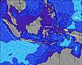 | ||||||||||||||||||||
SSW 13 | SSW 13 | SSW 14 | SSW 14 | SSW 15 | SSW 15 | SSW 14 | SSW 14 | SSW 14 | SSW 14 | SSW 14 | SSW 14 | SSW 13 | SSW 13 | SSW 13 | SSW 13 | SSW 13 | SSW 13 | SSW 12 | SSW 12 | SSW 12 | SSW 12 | SSW 12 | SSW 12 | |
820 | 745 | 1257 | 1393 | 1413 | 1559 | 1517 | 1496 | 1644 | 1644 | 1598 | 1353 | 905 | 1155 | 793 | 878 | 878 | 757 | 618 | 666 | 655 | 579 | 579 | 579 | |
Vento (km/h) | ||||||||||||||||||||||||
Stato del vento onshore cross-onshore cross-shore cross-offshore offshore piatto | on | on | on | on | on | on | cross-on | cross-on | cross-on | on | on | cross-on | cross-on | cross-on | cross-on | cross-on | cross-on | cross-on | cross-on | cross-off | cross-off | off | glassy | cross-off |
Alta Marea | 10:41PM2.26m | 10:26AM3.05m | 11:22PM2.24m | 11:08AM3.05m | 00:04AM2.19m | |||||||||||||||||||
Basso Marea | 4:29PM-0.09m | 4:11AM0.58m | 5:11PM-0.15m | 4:51AM0.57m | 5:53PM-0.10m | 5:34AM0.60m | ||||||||||||||||||
— | — | — | — | — | — | 6:20 | — | — | — | — | — | — | — | 6:20 | — | — | — | — | — | — | — | 6:20 | — | |
— | — | 6:01 | — | — | — | — | — | — | — | 6:00 | — | — | — | — | — | — | — | 6:00 | — | — | — | — | 6:00 | |
2 | — | — | 1 | 2 | 1 | 1 | 1 | 2 | 1 | — | — | — | 1 | 1 | — | — | 1 | 2 | 1 | — | — | — | — | |
Temp. °C | 28 | 28 | 28 | 27 | 26 | 26 | 26 | 27 | 27 | 27 | 27 | 27 | 27 | 26 | 26 | 27 | 28 | 28 | 27 | 27 | 26 | 25 | 26 | 26 |
32 | 30 | 31 | 31 | 30 | 29 | 29 | 29 | 29 | 29 | 29 | 30 | 31 | 30 | 29 | 31 | 31 | 31 | 30 | 31 | 30 | 29 | 31 | 30 | |
Onda 1 Altezza (m) Direzione Periodo (s) | SSW 13 | SSW 13 | SSW 14 | SSW 14 | SSW 15 | SSW 15 | SSW 14 | SSW 14 | SSW 14 | SSW 14 | SSW 14 | SSW 14 | SSW 13 | SSW 13 | SSW 13 | SSW 13 | SSW 13 | SSW 13 | SSW 12 | SSW 12 | SSW 12 | SSW 12 | SSW 12 | SSW 12 |
820 | 745 | 1257 | 1393 | 1413 | 1559 | 1517 | 1496 | 1644 | 1644 | 1598 | 1353 | 905 | 1155 | 793 | 878 | 878 | 757 | 618 | 666 | 655 | 579 | 579 | 579 | |
Onda 2 Altezza (m) Direzione Periodo (s) | SSW 16 | SSW 16 | SSW 18 | SSW 18 | S 5 | S 5 | S 5 | S 5 | SW 24 | WSW 22 | SW 21 | SW 21 | SSW 8 | SW 21 | SSW 8 | SW 19 | SW 19 | SW 19 | SW 18 | SW 18 | SW 18 | SW 18 | SW 18 | SW 18 |
147 | 463 | 326 | 246 | 21 | 26 | 34 | 34 | 22 | 45 | 72 | 72 | 107 | 67 | 94 | 236 | 184 | 133 | 161 | 375 | 442 | 442 | 447 | 442 | |
Onda 3 Altezza (m) Direzione Periodo (s) | SSW 19 | SE 5 | — | — | — | SW 24 | SW 24 | SW 24 | — | — | — | — | SW 21 | SW 21 | SW 20 | W 9 | W 9 | W 9 | SE 5 | SW 21 | SSW 21 | SE 5 | SE 5 | SE 7 |
117 | 5 | — | — | — | 22 | 22 | 22 | — | — | — | — | 72 | 69 | 186 | 2 | 2 | 2 | 3 | 18 | 44 | 4 | 7 | 11 | |
onde vento Altezza (m) Direzione Periodo (s) | S 4 | S 4 | SE 5 | S 5 | — | — | — | — | — | — | — | — | — | SE 4 | — | — | — | — | — | — | — | — | — | — |
6 | 6 | 10 | 21 | — | — | — | — | — | — | — | — | — | 7 | — | — | — | — | — | — | — | — | — | — | |
Il più vicino Offshore or Glassy | ||||||||||||||||||||||||
Distanza (km) | 14 | 100 | 32 | 19 | 19 | 14 | 14 | 14 | 15 | 45 | 19 | 14 | 14 | 14 | 14 | 14 | 14 | 14 | 14 | 0 | 0 | 0 | 0 | 0 |
Migliori previsioni per le condizioni d'onda in South Coast of Lombok | ||||||||||||||||||||||||
Migliori previsioni per le condizioni d'onda in Indonesia | ||||||||||||||||||||||||
Header Global | ||||||||||||||||||||||||
- Map Icons:
 Break
Break Live Wave Height (m)
 Live Wind Speed (km/h)
 Surf Rating (10 Max)
 Ocean Swells (m)
- Wind Speed (km/h)
Widget Free Surf-Forecast.com per il tuo sito
La relazione di surf / widget meteo è disponibile qui sotto per incorporare su siti esterni a titolo gratuito e fornisce una sintesi delle nostre Tanjung A'an previsione surf. Basta prendere il frammento di codice html da noi fornito e copiarlo nel proprio sito. È possibile scegliere la lingua preferita e unità metriche / imperiali per il feed delle previsioni surf per soddisfare le esigenze degli utenti del vostro sito .... Clicca qui per ottenere il codice.
 Nearest