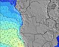
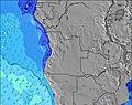
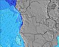
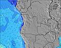
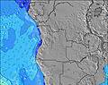
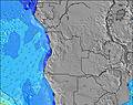
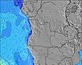
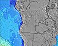
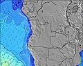
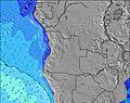
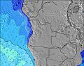
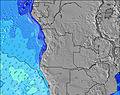
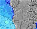
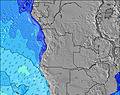
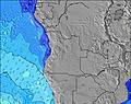
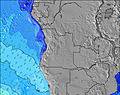
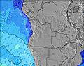
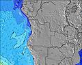
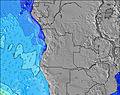
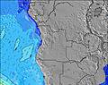
Angola Mappa metereologica

Altri tipi di mappe statiche | Mappa animata
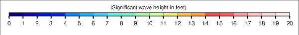
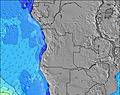
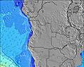
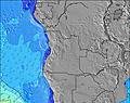
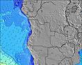
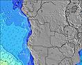
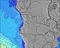
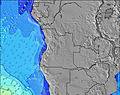
Altri periodi di questa Altezza significativa delle onde mappa
|
|
|
|
|
|
|
|
|
|
|
|
|
|
|
|
|
|
|
|
|
|
|
|
|
|
|
|
|
|
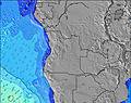
Altri tipi di mappe statiche | Mappa animata
|
|
|
|
|
|
|
|
|
|
|
|
|
|
|
|
|
|
|
|
|
|
|
|
|
|
|
|
|
|
|
|
|
|
|
|
 Nearest