
Previsioni:

Previsione a breve terminePioggia moderata (Totale 13mm), più pesante Domenica mattina. Warm (Max 28°C Sabato pomeriggio, Min 27°C Sabato mattina). Principalmente venti freschi. | |||||||||||||||||||||||
Sabato 1 | Domenica 2 | Lunedì 3 | |||||||||||||||||||||
5 AM | 8 AM | 11 AM | 2 PM | 5 PM | 8 PM | 11 PM | 2 AM | 5 AM | 8 AM | 11 AM | 2 PM | 5 PM | 8 PM | 11 PM | 2 AM | 5 AM | 8 AM | 11 AM | 2 PM | 5 PM | 8 PM | 11 PM | |
Mappa dell'altezza del moto ondoso |  |  | 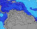 |  | 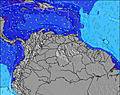 | 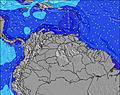 |  | 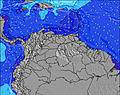 | 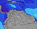 | ||||||||||||||
Onda Altezza (m) Direzione Periodo (s) | NE 8 | NE 8 | ENE 8 | ENE 8 | ENE 8 | NE 8 | NE 8 | ENE 8 | ENE 8 | ENE 8 | ENE 8 | ENE 8 | ENE 7 | ENE 7 | ENE 7 | ENE 7 | ENE 7 | E 7 | E 7 | E 7 | E 7 | E 7 | E 7 |
Grafico delle onde | |||||||||||||||||||||||
105 | 102 | 90 | 90 | 90 | 70 | 70 | 86 | 45 | 37 | 130 | 123 | 125 | 147 | 164 | 186 | 181 | 150 | 155 | 155 | 155 | 131 | 150 | |
Vento (km/h) | |||||||||||||||||||||||
Stato del vento onshore cross-onshore cross-shore cross-offshore offshore piatto | cross-off | cross-off | cross-off | cross-off | cross-off | cross-off | cross-off | cross-off | cross-off | cross-off | cross-off | cross-off | cross-off | cross-off | cross-off | cross-off | cross-off | cross-off | cross-off | cross-off | cross-off | cross-off | cross-off |
Alta Marea | 4:48AM0.89m | 5:33PM0.81m | 5:26AM0.85m | 6:02PM0.83m | 6:07AM0.80m | 6:35PM0.84m | |||||||||||||||||
Basso Marea | 11:16AM0.18m | 11:23PM0.31m | 11:45AM0.22m | 00:05AM0.30m | 12:14PM0.26m | ||||||||||||||||||
5:50 | — | — | — | — | — | — | — | 5:50 | — | — | — | — | — | — | — | 5:50 | — | — | — | — | — | — | |
— | — | — | — | 6:27 | — | — | — | — | — | — | — | 6:27 | — | — | — | — | — | — | — | 6:27 | — | — | |
mm | — | — | — | — | — | 1 | 1 | — | — | — | — | — | — | — | — | 1 | 2 | 2 | 2 | 1 | 1 | — | — |
Temp. °C | 27 | 27 | 27 | 28 | 28 | 28 | 27 | 27 | 27 | 27 | 27 | 27 | 28 | 27 | 27 | 27 | 27 | 27 | 27 | 28 | 28 | 28 | 27 |
Gelo °C | 27 | 28 | 27 | 29 | 29 | 29 | 27 | 27 | 28 | 27 | 27 | 27 | 29 | 26 | 26 | 26 | 26 | 26 | 27 | 29 | 28 | 28 | 26 |
Onda 1 Altezza (m) Direzione Periodo (s) | NE 8 | NE 8 | ENE 8 | ENE 8 | ENE 8 | NE 8 | NE 8 | SE 7 | ENE 8 | ENE 8 | — | ESE 7 | — | — | — | — | — | — | — | — | — | — | — |
105 | 102 | 90 | 90 | 90 | 70 | 70 | 26 | 45 | 37 | — | 21 | — | — | — | — | — | — | — | — | — | — | — | |
Onda 2 Altezza (m) Direzione Periodo (s) | ESE 8 | ESE 8 | ESE 8 | — | — | SE 7 | SE 7 | ESE 7 | — | — | — | — | — | — | — | — | — | — | — | — | — | — | — |
6 | 6 | 6 | — | — | 29 | 43 | 47 | — | — | — | — | — | — | — | — | — | — | — | — | — | — | — | |
Onda 3 Altezza (m) Direzione Periodo (s) | — | — | — | — | — | — | — | — | — | — | — | — | — | — | — | — | — | — | — | — | — | — | — |
— | — | — | — | — | — | — | — | — | — | — | — | — | — | — | — | — | — | — | — | — | — | — | |
onde vento Altezza (m) Direzione Periodo (s) | SE 6 | SE 6 | SE 6 | SE 6 | SE 7 | ENE 3 | — | ENE 8 | E 4 | E 5 | ENE 8 | ENE 8 | ENE 7 | ENE 7 | ENE 7 | ENE 7 | ENE 7 | E 7 | E 7 | E 7 | E 7 | E 7 | E 7 |
34 | 34 | 37 | 38 | 46 | 4 | — | 86 | 19 | 36 | 130 | 123 | 125 | 147 | 164 | 186 | 181 | 150 | 155 | 155 | 155 | 131 | 150 | |
Il più vicino Offshore or Glassy | |||||||||||||||||||||||
Distanza (km) | 3 | 3 | 3 | 3 | 3 | 255 | 255 | 584 | 584 | 584 | 673 | 3 | 673 | 143 | 584 | 62 | 584 | 584 | 673 | 673 | 644 | 584 | 584 |
Migliori previsioni per le condizioni d'onda in Tobago | |||||||||||||||||||||||
Migliori previsioni per le condizioni d'onda in Trinidad and Tobago | |||||||||||||||||||||||
Trova Onde Globale | |||||||||||||||||||||||
- Map Icons:
 Break
Break Live Wave Height (m)
 Live Wind Speed (km/h)
 Surf Rating (10 Max)
 Ocean Swells (m)
- Wind Speed (km/h)
Widget Free Surf-Forecast.com per il tuo sito
La relazione di surf / widget meteo è disponibile qui sotto per incorporare su siti esterni a titolo gratuito e fornisce una sintesi delle nostre Airports previsione surf. Basta prendere il frammento di codice html da noi fornito e copiarlo nel proprio sito. È possibile scegliere la lingua preferita e unità metriche / imperiali per il feed delle previsioni surf per soddisfare le esigenze degli utenti del vostro sito .... Clicca qui per ottenere il codice.
 Nearest