
Previsioni:

Previsione a breve terminePioggia moderata (Totale 17mm), più pesante Lunedì notte. Warm (Max 31°C martedì mattina, Min 28°C Lunedì notte). Venti in aumento (venti deboli da NNE Lunedì notte, raffiche di vento da N per giovedì mattina). | ||||||||||||||||||||
Lun 3 | Martedì 4 | Mercoledì 5 | ||||||||||||||||||
12 PM | 3 PM | 6 PM | 9 PM | 12 AM | 3 AM | 6 AM | 9 AM | 12 PM | 3 PM | 6 PM | 9 PM | 12 AM | 3 AM | 6 AM | 9 AM | 12 PM | 3 PM | 6 PM | 9 PM | |
Mappa dell'altezza del moto ondoso |  |  |  | 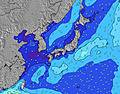 |  |  | 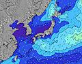 |  | ||||||||||||
Onda Altezza (m) Direzione Periodo (s) | W 7 | W 7 | WNW 7 | NNE 3 | N 4 | N 4 | ESE 17 | E 17 | E 17 | E 17 | E 17 | ESE 17 | E 17 | E 17 | E 17 | E 17 | E 17 | E 17 | E 18 | E 18 |
Grafico delle onde | ||||||||||||||||||||
4 | 4 | 5 | 3 | 6 | 8 | 0 | 0 | 0 | 1749 | 1954 | 0 | 0 | 0 | 2461 | 2827 | 3092 | 3514 | 4970 | 6942 | |
Vento (km/h) | ||||||||||||||||||||
Stato del vento onshore cross-onshore cross-shore cross-offshore offshore piatto | cross-on | cross-on | cross-on | cross-on | cross-on | cross | cross | cross | cross | cross-off | cross-off | cross-off | cross-off | cross-off | cross | cross | cross | cross | cross | cross |
Alta Marea | 9:38AM2.01m | 10:13PM2.03m | 10:23AM1.90m | 10:45PM2.00m | 11:18AM1.77m | |||||||||||||||
Basso Marea | 3:54PM0.51m | 4:27AM0.69m | 4:27PM0.68m | 5:16AM0.68m | 5:06PM0.88m | |||||||||||||||
— | — | — | — | — | 5:54 | — | — | — | — | — | — | — | 5:56 | — | — | — | — | — | — | |
— | — | 7:15 | — | — | — | — | — | — | — | 7:14 | — | — | — | — | — | — | — | 7:14 | — | |
mm | — | — | — | — | — | 3 | 1 | 2 | — | 1 | 1 | — | — | 3 | — | — | 1 | 1 | 2 | — |
Temp. °C | 30 | 30 | 30 | 29 | 29 | 28 | 28 | 29 | 31 | 30 | 29 | 29 | 28 | 28 | 28 | 29 | 31 | 30 | 29 | 29 |
Gelo °C | 33 | 32 | 32 | 32 | 33 | 32 | 32 | 32 | 34 | 32 | 32 | 33 | 32 | 31 | 30 | 32 | 33 | 31 | 30 | 31 |
Onda 1 Altezza (m) Direzione Periodo (s) | ESE 16 | ESE 16 | ESE 16 | ESE 16 | ESE 16 | ESE 16 | ESE 17 | E 17 | E 17 | E 17 | E 17 | ESE 17 | E 17 | E 17 | E 17 | E 17 | E 17 | E 17 | E 18 | E 18 |
620 | 636 | 768 | 671 | 793 | 940 | 1203 | 1389 | 1573 | 1749 | 1954 | 2238 | 2441 | 2385 | 2461 | 2827 | 3092 | 3514 | 4970 | 6942 | |
Onda 2 Altezza (m) Direzione Periodo (s) | S 7 | SSE 7 | SSE 7 | S 7 | S 7 | S 8 | S 7 | SSE 7 | SSE 8 | SSE 8 | SSE 8 | — | SE 8 | SSE 8 | — | SE 8 | SE 7 | S 7 | S 7 | — |
4 | 5 | 5 | 4 | 4 | 5 | 9 | 10 | 12 | 21 | 24 | — | 14 | 33 | — | 28 | 27 | 17 | 8 | — | |
Onda 3 Altezza (m) Direzione Periodo (s) | W 7 | SW 7 | SE 14 | SW 7 | SW 7 | SW 7 | SE 14 | — | — | — | — | — | — | — | — | — | SSW 7 | — | SSW 7 | — |
4 | 2 | 8 | 2 | 2 | 2 | 8 | — | — | — | — | — | — | — | — | — | 11 | — | 5 | — | |
onde vento Altezza (m) Direzione Periodo (s) | — | W 7 | WNW 7 | NNE 3 | N 4 | N 4 | — | SE 8 | — | — | SE 8 | SE 8 | — | SE 8 | SE 8 | — | SE 8 | NNE 4 | NE 5 | NNE 5 |
— | 4 | 5 | 3 | 6 | 8 | — | 21 | — | — | 31 | 20 | — | 15 | 28 | — | 28 | 35 | 69 | 45 | |
Il più vicino Offshore or Glassy | ||||||||||||||||||||
Distanza (km) | 17 | 17 | 24 | 53 | 17 | 17 | 17 | 49 | 49 | 15 | 14 | 17 | 17 | 17 | 15 | 49 | 778 | 778 | 598 | 598 |
Migliori previsioni per le condizioni d'onda in Okinawa | ||||||||||||||||||||
Migliori previsioni per le condizioni d'onda in Japan | ||||||||||||||||||||
Trova Onde Globale | ||||||||||||||||||||
- Map Icons:
 Break
Break Live Wave Height (m)
 Live Wind Speed (km/h)
 Surf Rating (10 Max)
 Ocean Swells (m)
- Wind Speed (km/h)
Widget Free Surf-Forecast.com per il tuo sito
La relazione di surf / widget meteo è disponibile qui sotto per incorporare su siti esterni a titolo gratuito e fornisce una sintesi delle nostre Aja previsione surf. Basta prendere il frammento di codice html da noi fornito e copiarlo nel proprio sito. È possibile scegliere la lingua preferita e unità metriche / imperiali per il feed delle previsioni surf per soddisfare le esigenze degli utenti del vostro sito .... Clicca qui per ottenere il codice.
 Nearest