
Previsioni:

Previsione a breve termineper lo più asciutto. Warm (Max 32°C Venerdì mattina, Min 25°C giovedì notte). Principalmente raffiche di vento. | ||||||||||||||||||||
Gio 30 | Venerdì 31 | Sabato 1 | ||||||||||||||||||
1 PM | 4 PM | 7 PM | 10 PM | 1 AM | 4 AM | 7 AM | 10 AM | 1 PM | 4 PM | 7 PM | 10 PM | 1 AM | 4 AM | 7 AM | 10 AM | 1 PM | 4 PM | 7 PM | 10 PM | |
Mappa dell'altezza del moto ondoso | 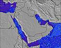 | 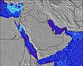 | 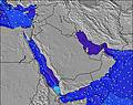 | 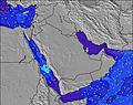 | 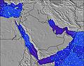 | 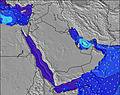 | 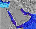 | 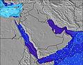 | ||||||||||||
Onda Altezza (m) Direzione Periodo (s) | S 10 | S 10 | S 10 | S 10 | S 10 | S 10 | SSW 10 | S 10 | S 10 | S 10 | S 10 | S 11 | SSW 11 | SSW 11 | S 11 | S 11 | S 11 | S 11 | S 11 | S 11 |
Grafico delle onde | ||||||||||||||||||||
755 | 830 | 813 | 830 | 928 | 928 | 1295 | 947 | 1076 | 1308 | 1345 | 1313 | 1939 | 1779 | 1185 | 1354 | 1521 | 1694 | 1800 | 1612 | |
Vento (km/h) | ||||||||||||||||||||
Stato del vento onshore cross-onshore cross-shore cross-offshore offshore piatto | cross | cross | cross | cross-off | cross-off | cross-off | cross-off | cross | cross | cross | cross | cross-off | cross-off | cross-off | cross-off | cross | cross | cross | cross | cross-off |
Alta Marea | 10:42AM2.39m | 9:40PM2.01m | 11:05AM2.42m | 10:21PM2.01m | 11:26AM2.43m | |||||||||||||||
Basso Marea | 4:34PM1.25m | 4:12AM0.38m | 5:04PM1.13m | 4:41AM0.47m | 5:35PM1.00m | |||||||||||||||
— | — | — | — | — | 5:33 | — | — | — | — | — | — | — | 5:33 | — | — | — | — | — | — | |
— | 6:42 | — | — | — | — | — | — | — | 6:42 | — | — | — | — | — | — | — | 6:40 | — | — | |
mm | — | — | — | — | — | — | — | — | — | — | — | — | — | — | — | — | — | — | — | — |
Temp. °C | 33 | 30 | 26 | 25 | 25 | 26 | 26 | 31 | 32 | 29 | 26 | 25 | 25 | 25 | 26 | 30 | 31 | 29 | 26 | 25 |
Gelo °C | 31 | 27 | 26 | 24 | 24 | 25 | 24 | 30 | 30 | 27 | 25 | 24 | 24 | 24 | 25 | 29 | 28 | 26 | 24 | 24 |
Onda 1 Altezza (m) Direzione Periodo (s) | SE 11 | SE 11 | SE 11 | SE 11 | SE 11 | SE 11 | S 10 | SE 11 | S 16 | SSE 12 | SE 11 | S 20 | S 11 | S 11 | S 19 | S 18 | S 18 | S 18 | S 18 | S 18 |
30 | 18 | 18 | 18 | 19 | 19 | 928 | 18 | 21 | 13 | 5 | 30 | 1329 | 1289 | 28 | 57 | 56 | 56 | 25 | 26 | |
Onda 2 Altezza (m) Direzione Periodo (s) | S 20 | S 19 | S 18 | S 18 | S 18 | SSW 16 | SE 11 | S 17 | S 21 | S 16 | S 20 | SSE 11 | S 20 | S 20 | S 18 | SE 11 | S 20 | S 20 | S 20 | S 20 |
30 | 30 | 27 | 26 | 25 | 26 | 18 | 22 | 9 | 21 | 31 | 12 | 30 | 30 | 6 | 4 | 8 | 8 | 8 | 8 | |
Onda 3 Altezza (m) Direzione Periodo (s) | SW 18 | S 15 | S 18 | SW 17 | SW 16 | S 18 | S 18 | S 16 | S 16 | S 21 | S 16 | SE 18 | SE 18 | S 18 | — | — | — | — | — | — |
12 | 4 | 6 | 12 | 10 | 25 | 24 | 5 | 5 | 9 | 5 | 12 | 12 | 6 | — | — | — | — | — | — | |
onde vento Altezza (m) Direzione Periodo (s) | S 10 | S 10 | S 10 | S 10 | S 10 | S 10 | SSW 10 | S 10 | S 10 | S 10 | S 10 | S 11 | SSW 11 | SSW 11 | S 11 | S 11 | S 11 | S 11 | S 11 | S 11 |
755 | 830 | 813 | 830 | 928 | 928 | 1295 | 947 | 1076 | 1308 | 1345 | 1313 | 1939 | 1779 | 1185 | 1354 | 1521 | 1694 | 1800 | 1612 | |
Il più vicino Offshore or Glassy | ||||||||||||||||||||
Distanza (km) | 515 | 515 | 515 | 504 | 515 | 2450 | 504 | 515 | 515 | 2912 | 515 | 504 | 2415 | 2410 | 515 | 515 | 515 | 515 | 2471 | 448 |
Migliori previsioni per le condizioni d'onda in Mainland Coast of Oman | ||||||||||||||||||||
Migliori previsioni per le condizioni d'onda in Oman | ||||||||||||||||||||
Trova Onde Globale | ||||||||||||||||||||
- Map Icons:
 Break
Break Live Wave Height (m)
 Live Wind Speed (km/h)
 Surf Rating (10 Max)
 Ocean Swells (m)
- Wind Speed (km/h)
Widget Free Surf-Forecast.com per il tuo sito
La relazione di surf / widget meteo è disponibile qui sotto per incorporare su siti esterni a titolo gratuito e fornisce una sintesi delle nostre Al Jafn previsione surf. Basta prendere il frammento di codice html da noi fornito e copiarlo nel proprio sito. È possibile scegliere la lingua preferita e unità metriche / imperiali per il feed delle previsioni surf per soddisfare le esigenze degli utenti del vostro sito .... Clicca qui per ottenere il codice.
 Nearest