
Previsioni:

Previsione a breve termineper lo più asciutto. Warm (Max 25°C Sabato pomeriggio, Min 16°C giovedì notte). Vento sarà generalmente leggero. | ||||||||||||||||||||||||
Mer 15 | Giovedì 16 | Venerdì 17 | 18 | |||||||||||||||||||||
5 PM | 8 PM | 11 PM | 2 AM | 5 AM | 8 AM | 11 AM | 2 PM | 5 PM | 8 PM | 11 PM | 2 AM | 5 AM | 8 AM | 11 AM | 2 PM | 5 PM | 8 PM | 11 PM | 2 AM | 5 AM | 8 AM | 11 AM | 2 PM | |
Mappa dell'altezza del moto ondoso |  |  |  |  |  |  |  |  | 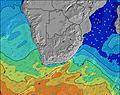 | |||||||||||||||
Onda Altezza (m) Direzione Periodo (s) | E 10 | E 11 | E 11 | E 11 | E 11 | E 10 | E 10 | E 10 | E 10 | E 10 | E 10 | E 10 | E 10 | E 10 | E 10 | E 10 | E 10 | E 10 | E 10 | E 10 | SSW 12 | E 10 | E 10 | E 10 |
Grafico delle onde | ||||||||||||||||||||||||
840 | 907 | 828 | 730 | 716 | 621 | 524 | 452 | 386 | 379 | 327 | 327 | 279 | 279 | 279 | 284 | 234 | 234 | 233 | 241 | 207 | 192 | 196 | 194 | |
Vento (km/h) | ||||||||||||||||||||||||
Stato del vento onshore cross-onshore cross-shore cross-offshore offshore piatto | cross-on | cross-off | cross-off | cross-off | cross-off | cross-off | glassy | on | on | off | off | off | off | cross-off | cross-on | cross-on | cross-on | cross-off | cross-off | off | cross-off | cross-off | cross-off | cross |
Alta Marea | 4:41PM1.79m | 4:55AM1.76m | 5:22PM1.82m | 5:33AM1.72m | 6:01PM1.80m | 6:09AM1.64m | ||||||||||||||||||
Basso Marea | 10:47PM0.11m | 11:04AM0.01m | 11:28PM0.13m | 11:41AM0.03m | 00:07AM0.20m | 12:16PM0.10m | ||||||||||||||||||
— | — | — | — | 6:50 | — | — | — | — | — | — | — | 6:50 | — | — | — | — | — | — | — | 6:50 | — | — | — | |
5:13 | — | — | — | — | — | — | — | 5:14 | — | — | — | — | — | — | — | 5:14 | — | — | — | — | — | — | 5:15 | |
mm | — | — | — | — | — | — | — | — | — | — | — | — | — | — | — | — | — | — | — | — | — | — | — | — |
Temp. °C | 20 | 19 | 19 | 17 | 17 | 17 | 20 | 21 | 19 | 18 | 17 | 16 | 16 | 16 | 20 | 21 | 19 | 17 | 17 | 16 | 16 | 17 | 23 | 25 |
Gelo °C | 20 | 19 | 18 | 16 | 16 | 16 | 20 | 19 | 18 | 18 | 16 | 15 | 16 | 15 | 19 | 20 | 19 | 17 | 17 | 15 | 14 | 14 | 20 | 23 |
Onda 1 Altezza (m) Direzione Periodo (s) | E 10 | E 11 | E 11 | E 11 | E 11 | E 10 | E 10 | E 10 | E 10 | E 10 | E 10 | E 10 | E 10 | E 10 | E 10 | E 10 | E 10 | E 10 | E 10 | E 10 | E 10 | E 10 | E 10 | E 10 |
840 | 907 | 828 | 730 | 716 | 621 | 524 | 452 | 386 | 379 | 327 | 327 | 279 | 279 | 279 | 284 | 234 | 234 | 233 | 233 | 192 | 192 | 196 | 194 | |
Onda 2 Altezza (m) Direzione Periodo (s) | SSW 9 | SSW 9 | SSE 10 | S 10 | S 4 | SSE 9 | S 8 | SSW 8 | SSW 9 | SSW 8 | SSW 8 | SSW 14 | SSW 13 | SSW 13 | SSW 12 | SSW 12 | SSW 12 | SSW 14 | SSW 13 | SSW 12 | SSW 12 | SSW 11 | SSW 10 | S 14 |
17 | 17 | 22 | 28 | 9 | 16 | 41 | 118 | 158 | 96 | 51 | 223 | 156 | 151 | 103 | 99 | 79 | 118 | 158 | 241 | 207 | 173 | 125 | 175 | |
Onda 3 Altezza (m) Direzione Periodo (s) | SSE 11 | SSE 11 | SSW 9 | — | S 9 | SW 12 | SSE 9 | SSW 12 | SW 16 | SSW 16 | SW 15 | SSE 10 | SSE 10 | S 10 | S 10 | S 10 | SSW 15 | S 9 | — | — | S 16 | S 15 | S 15 | SSW 10 |
12 | 11 | 8 | — | 15 | 6 | 16 | 15 | 11 | 24 | 104 | 10 | 10 | 2 | 2 | 2 | 21 | 2 | — | — | 20 | 69 | 106 | 75 | |
onde vento Altezza (m) Direzione Periodo (s) | — | SSW 4 | SSW 3 | SSW 4 | SSW 4 | SSW 5 | — | — | — | — | — | — | — | — | — | — | — | — | — | — | — | NNE 3 | NE 3 | NE 4 |
— | 11 | 7 | 10 | 16 | 19 | — | — | — | — | — | — | — | — | — | — | — | — | — | — | — | 2 | 2 | 11 | |
Il più vicino Offshore or Glassy | ||||||||||||||||||||||||
Distanza (km) | 20 | 0 | 0 | 0 | 0 | 0 | 0 | 25 | 27 | 0 | 0 | 0 | 0 | 0 | 20 | 26 | 20 | 0 | 0 | 0 | 0 | 0 | 0 | 25 |
Migliori previsioni per le condizioni d'onda in Durban/KwaZulu-Natal South Coast | ||||||||||||||||||||||||
Migliori previsioni per le condizioni d'onda in South Africa | ||||||||||||||||||||||||
Trova Onde Globale | ||||||||||||||||||||||||
- Map Icons:
 Break
Break Live Wave Height (m)
 Live Wind Speed (km/h)
 Surf Rating (10 Max)
 Ocean Swells (m)
- Wind Speed (km/h)
Widget Free Surf-Forecast.com per il tuo sito
La relazione di surf / widget meteo è disponibile qui sotto per incorporare su siti esterni a titolo gratuito e fornisce una sintesi delle nostre Amanzimtoti previsione surf. Basta prendere il frammento di codice html da noi fornito e copiarlo nel proprio sito. È possibile scegliere la lingua preferita e unità metriche / imperiali per il feed delle previsioni surf per soddisfare le esigenze degli utenti del vostro sito .... Clicca qui per ottenere il codice.
 Nearest