
Previsioni:

Previsione a breve termineper lo più asciutto. Warm (Max 23°C mercoledì mattina, Min 15°C Lunedì notte). Vento sarà generalmente leggero. | |||||||||||||||||||||
Lun 27 | Martedì 28 | Mercoledì 29 | |||||||||||||||||||
11 AM | 2 PM | 5 PM | 8 PM | 11 PM | 2 AM | 5 AM | 8 AM | 11 AM | 2 PM | 5 PM | 8 PM | 11 PM | 2 AM | 5 AM | 8 AM | 11 AM | 2 PM | 5 PM | 8 PM | 11 PM | |
Mappa dell'altezza del moto ondoso |  |  | 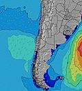 | 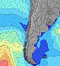 |  |  | 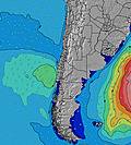 | 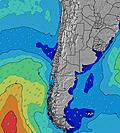 | |||||||||||||
Onda Altezza (m) Direzione Periodo (s) | WSW 13 | WSW 13 | SW 16 | WSW 16 | WSW 15 | WSW 15 | SW 15 | SW 15 | SW 14 | SW 13 | SW 14 | SW 13 | SW 13 | SW 13 | SW 13 | WSW 13 | SW 13 | SW 11 | SW 12 | WSW 12 | WSW 12 |
Grafico delle onde | |||||||||||||||||||||
357 | 357 | 376 | 778 | 791 | 851 | 435 | 424 | 1031 | 947 | 1292 | 1200 | 1147 | 1112 | 951 | 444 | 382 | 447 | 587 | 536 | 472 | |
Vento (km/h) | |||||||||||||||||||||
Stato del vento onshore cross-onshore cross-shore cross-offshore offshore piatto | on | cross-on | cross-on | cross | cross | cross-on | glassy | cross-off | cross-on | cross-on | cross-on | cross | cross | cross | cross | cross-off | cross-on | cross-on | cross-on | cross | glassy |
Alta Marea | 8:31AM1.30m | 8:50PM0.96m | 9:03AM1.33m | 9:32PM1.00m | 9:33AM1.35m | 10:11PM1.02m | |||||||||||||||
Basso Marea | 3:09PM0.41m | 2:29AM0.41m | 3:42PM0.34m | 3:06AM0.42m | 4:14PM0.28m | ||||||||||||||||
— | — | — | — | — | — | 7:18 | — | — | — | — | — | — | — | 7:18 | — | — | — | — | — | — | |
— | — | 6:16 | — | — | — | — | — | — | — | 6:16 | — | — | — | — | — | — | — | 6:17 | — | — | |
mm | — | — | — | — | — | — | — | — | — | — | — | — | — | — | — | — | — | — | — | — | — |
Temp. °C | 17 | 18 | 17 | 15 | 16 | 16 | 16 | 16 | 19 | 19 | 18 | 17 | 18 | 19 | 19 | 19 | 23 | 22 | 20 | 18 | 19 |
Gelo °C | 17 | 17 | 16 | 15 | 15 | 16 | 16 | 15 | 18 | 17 | 17 | 16 | 17 | 17 | 17 | 18 | 22 | 21 | 19 | 17 | 19 |
Onda 1 Altezza (m) Direzione Periodo (s) | WSW 13 | WSW 13 | WSW 13 | WSW 16 | WSW 15 | WSW 15 | SW 15 | WSW 12 | SW 14 | SW 13 | SW 14 | SW 13 | SW 13 | SW 13 | SW 13 | SW 11 | SW 11 | SW 11 | SW 12 | WSW 12 | WSW 12 |
357 | 357 | 261 | 778 | 791 | 851 | 435 | 378 | 1031 | 947 | 1292 | 1200 | 1147 | 1112 | 951 | 334 | 334 | 447 | 587 | 536 | 472 | |
Onda 2 Altezza (m) Direzione Periodo (s) | SW 16 | SW 16 | SW 16 | WNW 15 | WNW 15 | WNW 14 | WSW 12 | SW 15 | WNW 14 | WSW 15 | WNW 14 | — | — | NW 15 | — | WSW 13 | SW 13 | WSW 13 | NW 14 | — | — |
278 | 274 | 376 | 21 | 21 | 21 | 230 | 424 | 21 | 272 | 20 | — | — | 8 | — | 444 | 382 | 222 | 8 | — | — | |
Onda 3 Altezza (m) Direzione Periodo (s) | W 15 | SSW 10 | SW 6 | SSW 10 | — | — | SW 5 | WNW 14 | — | WNW 14 | — | — | — | — | — | — | NW 14 | NW 14 | — | — | — |
38 | 9 | 8 | 9 | — | — | 14 | 21 | — | 20 | — | — | — | — | — | — | 8 | 8 | — | — | — | |
onde vento Altezza (m) Direzione Periodo (s) | — | — | — | — | — | — | — | — | — | — | — | — | — | — | — | — | — | — | — | — | — |
— | — | — | — | — | — | — | — | — | — | — | — | — | — | — | — | — | — | — | — | — | |
Il più vicino Offshore or Glassy | |||||||||||||||||||||
Distanza (km) | 28 | 154 | 154 | 1 | 202 | 75 | 0 | 0 | 75 | 154 | 380 | 297 | 9 | 9 | 9 | 0 | 202 | 154 | 297 | 202 | 0 |
Migliori previsioni per le condizioni d'onda in Antofagasta | |||||||||||||||||||||
Migliori previsioni per le condizioni d'onda in Chile | |||||||||||||||||||||
Trova Onde Globale | |||||||||||||||||||||
- Map Icons:
 Break
Break Live Wave Height (m)
 Live Wind Speed (km/h)
 Surf Rating (10 Max)
 Ocean Swells (m)
- Wind Speed (km/h)
Widget Free Surf-Forecast.com per il tuo sito
La relazione di surf / widget meteo è disponibile qui sotto per incorporare su siti esterni a titolo gratuito e fornisce una sintesi delle nostre Andromeda previsione surf. Basta prendere il frammento di codice html da noi fornito e copiarlo nel proprio sito. È possibile scegliere la lingua preferita e unità metriche / imperiali per il feed delle previsioni surf per soddisfare le esigenze degli utenti del vostro sito .... Clicca qui per ottenere il codice.
 Nearest