
Previsioni:

Previsione a breve terminePioggia abbondante (Totale 37mm), più pesante durante venerdì notte. Warm (Max 20°C Venerdì mattina, Min 13°C mercoledì mattina). Vento sarà generalmente leggero. | ||||||||||||||||||||||||
Mercoledì 15 | Giovedì 16 | Venerdì 17 | 18 | |||||||||||||||||||||
5 AM | 8 AM | 11 AM | 2 PM | 5 PM | 8 PM | 11 PM | 2 AM | 5 AM | 8 AM | 11 AM | 2 PM | 5 PM | 8 PM | 11 PM | 2 AM | 5 AM | 8 AM | 11 AM | 2 PM | 5 PM | 8 PM | 11 PM | 2 AM | |
Mappa dell'altezza del moto ondoso | 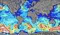 | 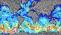 | 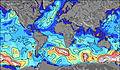 | 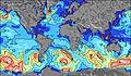 |  |  |  |  | 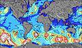 | 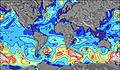 | ||||||||||||||
Onda Altezza (m) Direzione Periodo (s) | WNW 5 | WNW 3 | WNW 4 | WNW 4 | NW 4 | WNW 4 | WNW 4 | WNW 5 | WNW 5 | WNW 4 | WNW 4 | NW 4 | WNW 4 | NW 3 | NW 3 | — | — | — | — | — | ESE 3 | ESE 3 | SE 3 | SE 3 |
Grafico delle onde | ||||||||||||||||||||||||
9 | 5 | 6 | 12 | 19 | 23 | 23 | 24 | 19 | 11 | 7 | 4 | 3 | 3 | 2 | 0 | 0 | 0 | 0 | 0 | 0 | 0 | 0 | 0 | |
Vento (km/h) | ||||||||||||||||||||||||
Stato del vento onshore cross-onshore cross-shore cross-offshore offshore piatto | cross | cross-on | cross | cross | cross | cross | cross | cross | cross | cross | cross-on | cross | cross-on | glassy | glassy | on | cross | cross-off | off | glassy | off | off | off | off |
Alta Marea | ||||||||||||||||||||||||
Basso Marea | ||||||||||||||||||||||||
6:05 | — | — | — | — | — | — | — | 6:05 | — | — | — | — | — | — | — | 6:07 | — | — | — | — | — | — | 6:07 | |
— | — | — | — | — | 9:34 | — | — | — | — | — | — | — | 9:34 | — | — | — | — | — | — | — | 9:32 | — | 9:31 | |
mm | — | — | — | — | — | — | — | — | — | — | — | — | — | — | — | — | — | — | — | 2 | 1 | — | — | 25 |
Temp. °C | 15 | 13 | 13 | 14 | 14 | 15 | 15 | 16 | 14 | 14 | 15 | 15 | 16 | 16 | 15 | 16 | 17 | 17 | 20 | 18 | 18 | 19 | 17 | 17 |
Gelo °C | 15 | 12 | 11 | 11 | 11 | 12 | 12 | 13 | 12 | 12 | 13 | 13 | 14 | 15 | 15 | 14 | 16 | 16 | 20 | 20 | 17 | 19 | 15 | 16 |
Onda 1 Altezza (m) Direzione Periodo (s) | — | — | — | — | — | — | — | — | — | — | WNW 4 | — | — | — | — | — | — | — | — | — | — | — | — | — |
— | — | — | — | — | — | — | — | — | — | 7 | — | — | — | — | — | — | — | — | — | — | — | — | — | |
Onda 2 Altezza (m) Direzione Periodo (s) | — | — | — | — | — | — | — | — | — | — | — | — | — | — | — | — | — | — | — | — | — | — | — | — |
— | — | — | — | — | — | — | — | — | — | — | — | — | — | — | — | — | — | — | — | — | — | — | — | |
Onda 3 Altezza (m) Direzione Periodo (s) | — | — | — | — | — | — | — | — | — | — | — | — | — | — | — | — | — | — | — | — | — | — | — | — |
— | — | — | — | — | — | — | — | — | — | — | — | — | — | — | — | — | — | — | — | — | — | — | — | |
onde vento Altezza (m) Direzione Periodo (s) | WNW 5 | WNW 3 | WNW 4 | WNW 4 | NW 4 | WNW 4 | WNW 4 | WNW 5 | WNW 5 | WNW 4 | — | NW 4 | WNW 4 | NW 3 | NW 3 | — | — | — | — | — | ESE 3 | ESE 3 | SE 3 | SE 3 |
9 | 5 | 6 | 12 | 19 | 23 | 23 | 24 | 19 | 11 | — | 4 | 3 | 3 | 2 | — | — | — | — | — | 1 | 2 | 2 | 4 | |
Il più vicino Offshore or Glassy | ||||||||||||||||||||||||
Distanza (km) | 1209 | 1209 | 1298 | 1245 | 1263 | 1272 | 1272 | 1290 | 1272 | 1958 | 1958 | 2384 | 1691 | 833 | 1245 | 1290 | 1290 | 1697 | 2732 | 1691 | 1710 | 2940 | 1776 | 1697 |
Migliori previsioni per le condizioni d'onda in Lake Superior | ||||||||||||||||||||||||
Migliori previsioni per le condizioni d'onda in United States | ||||||||||||||||||||||||
Trova Onde Globale | ||||||||||||||||||||||||
- Map Icons:
 Break
Break Live Wave Height (m)
 Live Wind Speed (km/h)
 Surf Rating (10 Max)
 Ocean Swells (m)
- Wind Speed (km/h)
Widget Free Surf-Forecast.com per il tuo sito
La relazione di surf / widget meteo è disponibile qui sotto per incorporare su siti esterni a titolo gratuito e fornisce una sintesi delle nostre Au Sable Point previsione surf. Basta prendere il frammento di codice html da noi fornito e copiarlo nel proprio sito. È possibile scegliere la lingua preferita e unità metriche / imperiali per il feed delle previsioni surf per soddisfare le esigenze degli utenti del vostro sito .... Clicca qui per ottenere il codice.
 Nearest