
Previsioni:

Aggiornamento in hr min s Forecast update imminent
Previsione a breve terminepioggia leggera (Totale 2mm), per lo più che cade martedì notte. Warm (Max 32°C Domenica mattina, Min 24°C martedì notte). Vento sarà generalmente leggero. | ||||||||||||||||||||||||
Dom 28 | Lunedì 29 | Martedì 30 | Mer 1 | |||||||||||||||||||||
3 PM | 6 PM | 9 PM | 12 AM | 3 AM | 6 AM | 9 AM | 12 PM | 3 PM | 6 PM | 9 PM | 12 AM | 3 AM | 6 AM | 9 AM | 12 PM | 3 PM | 6 PM | 9 PM | 12 AM | 3 AM | 6 AM | 9 AM | 12 PM | |
Mappa dell'altezza del moto ondoso |  |  |  |  |  |  |  |  | 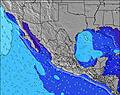 | |||||||||||||||
Onda Altezza (m) Direzione Periodo (s) | SSW 17 | SSW 17 | SSW 16 | SSW 16 | SSW 16 | SSW 16 | SSW 15 | SSW 15 | SSW 15 | SSW 14 | SSW 14 | SSW 14 | SSW 14 | SSW 18 | SSW 18 | SSW 14 | SSW 18 | SSW 17 | SSW 17 | SSW 16 | SW 16 | SSW 16 | SSW 16 | SSW 16 |
Grafico delle onde | ||||||||||||||||||||||||
601 | 432 | 298 | 387 | 506 | 499 | 493 | 461 | 405 | 330 | 325 | 330 | 323 | 399 | 399 | 319 | 390 | 522 | 481 | 559 | 376 | 458 | 643 | 808 | |
Vento (km/h) | ||||||||||||||||||||||||
Stato del vento onshore cross-onshore cross-shore cross-offshore offshore piatto | cross-on | on | glassy | glassy | off | off | glassy | cross-on | cross-on | cross | cross-off | cross-off | cross-off | off | glassy | cross-on | cross-on | cross-on | off | off | off | off | off | glassy |
Alta Marea | 7:59PM1.02m | 10:19AM0.85m | 8:28PM1.03m | 10:45AM0.83m | 8:56PM1.03m | 11:12AM0.82m | ||||||||||||||||||
Basso Marea | 2:26PM0.66m | 3:21AM0.09m | 2:48PM0.65m | 3:48AM0.09m | 3:11PM0.64m | 4:14AM0.11m | ||||||||||||||||||
— | — | — | — | — | 6:24 | — | — | — | — | — | — | — | 6:24 | — | — | — | — | — | — | — | 6:24 | — | — | |
— | 7:39 | — | — | — | — | — | — | — | 7:39 | — | — | — | — | — | — | — | 7:39 | — | — | — | — | — | 7:40 | |
mm | — | — | — | — | — | — | — | — | — | — | — | — | — | — | — | — | — | — | 1 | — | — | 1 | — | — |
Temp. °C | 32 | 31 | 29 | 28 | 26 | 26 | 29 | 32 | 32 | 30 | 28 | 27 | 26 | 26 | 29 | 31 | 32 | 30 | 26 | 25 | 26 | 24 | 25 | 29 |
Gelo °C | 34 | 35 | 34 | 33 | 30 | 30 | 34 | 35 | 34 | 31 | 30 | 29 | 29 | 29 | 33 | 34 | 35 | 33 | 30 | 28 | 29 | 26 | 28 | 32 |
Onda 1 Altezza (m) Direzione Periodo (s) | SSW 17 | SSW 17 | SSW 14 | SSW 16 | SSW 16 | SSW 16 | SSW 15 | SSW 15 | SSW 15 | SSW 14 | SSW 14 | SSW 14 | SSW 14 | SSW 14 | SSW 14 | SSW 14 | SSW 18 | SSW 17 | SSW 17 | SSW 16 | SW 16 | SSW 16 | SSW 16 | SSW 16 |
601 | 432 | 232 | 387 | 506 | 499 | 493 | 461 | 405 | 330 | 325 | 325 | 321 | 357 | 352 | 307 | 390 | 522 | 481 | 559 | 376 | 458 | 643 | 808 | |
Onda 2 Altezza (m) Direzione Periodo (s) | SSE 11 | SSW 13 | SSW 16 | SSE 10 | SSE 10 | SSE 10 | SSE 10 | SSE 10 | SSW 20 | SSE 10 | SSW 19 | SW 18 | SW 18 | SSW 18 | SSW 18 | SW 18 | SSW 13 | SSW 13 | SSW 13 | SSW 13 | SSW 13 | SSW 13 | SSE 10 | SSE 10 |
66 | 225 | 298 | 86 | 59 | 59 | 60 | 62 | 253 | 60 | 246 | 330 | 323 | 399 | 399 | 319 | 229 | 149 | 151 | 151 | 151 | 151 | 52 | 51 | |
Onda 3 Altezza (m) Direzione Periodo (s) | SSW 13 | SSE 11 | SSE 11 | SSW 13 | SW 21 | SW 20 | SW 20 | SSW 20 | SSE 10 | SSW 20 | SSE 10 | SSE 10 | SSE 10 | SSE 10 | SSE 10 | SSE 10 | SSE 10 | SSE 10 | SSE 10 | SSE 10 | SSW 19 | SSE 10 | SSW 19 | WNW 7 |
99 | 91 | 65 | 99 | 116 | 102 | 186 | 253 | 60 | 253 | 59 | 59 | 59 | 58 | 58 | 58 | 58 | 58 | 57 | 57 | 210 | 54 | 74 | 4 | |
onde vento Altezza (m) Direzione Periodo (s) | — | — | — | — | — | — | — | — | WNW 6 | WNW 3 | NW 3 | WNW 3 | WNW 9 | NW 10 | NW 4 | WNW 4 | WNW 10 | WNW 3 | WNW 3 | — | — | — | — | — |
— | — | — | — | — | — | — | — | 3 | 3 | 5 | 5 | 32 | 16 | 6 | 5 | 38 | 4 | 4 | — | — | — | — | — | |
Il più vicino Offshore or Glassy | ||||||||||||||||||||||||
Distanza (km) | 186 | 164 | 0 | 0 | 0 | 0 | 0 | 184 | 184 | 158 | 0 | 0 | 0 | 0 | 0 | 70 | 184 | 49 | 0 | 0 | 0 | 0 | 0 | 0 |
Migliori previsioni per le condizioni d'onda in Jalisco | ||||||||||||||||||||||||
Migliori previsioni per le condizioni d'onda in Mexico | ||||||||||||||||||||||||
Trova Onde Globale | ||||||||||||||||||||||||
- Map Icons:
 Break
Break Live Wave Height (m)
 Live Wind Speed (km/h)
 Surf Rating (10 Max)
 Ocean Swells (m)
- Wind Speed (km/h)
Widget Free Surf-Forecast.com per il tuo sito
La relazione di surf / widget meteo è disponibile qui sotto per incorporare su siti esterni a titolo gratuito e fornisce una sintesi delle nostre Barre de Navidad previsione surf. Basta prendere il frammento di codice html da noi fornito e copiarlo nel proprio sito. È possibile scegliere la lingua preferita e unità metriche / imperiali per il feed delle previsioni surf per soddisfare le esigenze degli utenti del vostro sito .... Clicca qui per ottenere il codice.
 Nearest