
Previsioni:

Previsione a breve termineper lo più asciutto. Warm (Max 22°C Sabato pomeriggio, Min 16°C Venerdì mattina). Vento sarà generalmente leggero. | ||||||||||||||||||||||||
Venerdì 17 | Sabato 18 | Domenica 19 | ||||||||||||||||||||||
2 AM | 5 AM | 8 AM | 11 AM | 2 PM | 5 PM | 8 PM | 11 PM | 2 AM | 5 AM | 8 AM | 11 AM | 2 PM | 5 PM | 8 PM | 11 PM | 2 AM | 5 AM | 8 AM | 11 AM | 2 PM | 5 PM | 8 PM | 11 PM | |
Mappa dell'altezza del moto ondoso |  | 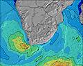 |  |  |  |  |  |  |  | |||||||||||||||
Onda Altezza (m) Direzione Periodo (s) | E 10 | E 10 | E 10 | E 10 | E 10 | E 10 | E 10 | E 10 | E 10 | E 10 | E 10 | E 10 | E 10 | S 13 | S 13 | S 12 | S 12 | S 12 | SSE 14 | SSE 14 | SSE 13 | SSE 13 | SSE 12 | SSE 12 |
Grafico delle onde | ||||||||||||||||||||||||
327 | 279 | 279 | 279 | 234 | 234 | 234 | 194 | 192 | 192 | 192 | 156 | 156 | 170 | 260 | 347 | 393 | 380 | 722 | 1034 | 983 | 980 | 826 | 759 | |
Vento (km/h) | ||||||||||||||||||||||||
Stato del vento onshore cross-onshore cross-shore cross-offshore offshore piatto | cross-off | cross-off | off | cross-on | cross-on | cross | cross-off | cross-off | off | off | cross-off | cross | cross-on | cross-on | cross-off | cross-off | cross-off | cross-off | cross-off | glassy | on | on | glassy | cross-off |
Alta Marea | 5:34AM1.89m | 6:01PM1.96m | 6:11AM1.82m | 6:38PM1.88m | 6:48AM1.71m | 7:14PM1.78m | ||||||||||||||||||
Basso Marea | 11:31PM0.27m | 11:44AM0.18m | 00:10AM0.32m | 12:21PM0.26m | 00:48AM0.41m | 12:56PM0.37m | ||||||||||||||||||
— | 6:48 | — | — | — | — | — | — | — | 6:48 | — | — | — | — | — | — | — | 6:48 | — | — | — | — | — | — | |
— | — | — | — | — | 5:14 | — | — | — | — | — | — | — | 5:15 | — | — | — | — | — | — | — | 5:15 | — | — | |
mm | — | — | — | — | — | — | — | — | — | — | — | — | — | — | — | — | — | — | — | — | — | — | — | — |
Temp. °C | 17 | 16 | 16 | 20 | 20 | 19 | 18 | 17 | 17 | 17 | 16 | 20 | 22 | 20 | 19 | 19 | 18 | 17 | 17 | 20 | 20 | 20 | 19 | 18 |
Gelo °C | 16 | 16 | 15 | 19 | 19 | 18 | 18 | 17 | 17 | 17 | 15 | 18 | 20 | 20 | 19 | 19 | 16 | 15 | 15 | 19 | 19 | 21 | 20 | 19 |
Onda 1 Altezza (m) Direzione Periodo (s) | E 10 | E 10 | E 10 | E 10 | E 10 | E 10 | E 10 | E 10 | E 10 | E 10 | E 10 | E 10 | E 10 | E 10 | S 13 | S 12 | S 12 | S 12 | SSE 14 | SSE 14 | SSE 13 | SSE 13 | SSE 12 | SSE 12 |
327 | 279 | 279 | 279 | 234 | 234 | 234 | 194 | 192 | 192 | 192 | 156 | 156 | 156 | 260 | 347 | 393 | 380 | 722 | 1034 | 983 | 980 | 826 | 759 | |
Onda 2 Altezza (m) Direzione Periodo (s) | SSW 7 | S 13 | SSW 13 | SSW 12 | SSW 12 | SW 12 | SSW 8 | S 14 | SSW 13 | SSW 12 | SSW 11 | SSW 10 | S 10 | S 13 | E 10 | E 10 | E 10 | SSE 13 | S 11 | E 10 | E 10 | S 11 | SSW 11 | S 11 |
15 | 89 | 57 | 52 | 49 | 6 | 23 | 101 | 127 | 179 | 158 | 110 | 92 | 170 | 121 | 121 | 118 | 342 | 231 | 92 | 92 | 119 | 158 | 143 | |
Onda 3 Altezza (m) Direzione Periodo (s) | SSW 14 | SSE 10 | SSE 10 | S 10 | S 10 | S 10 | SSW 15 | — | — | S 16 | S 15 | S 15 | S 14 | S 9 | S 8 | SSE 14 | SSE 14 | E 10 | E 10 | S 11 | S 11 | E 10 | E 10 | E 10 |
19 | 10 | 10 | 2 | 2 | 2 | 22 | — | — | 20 | 40 | 69 | 136 | 56 | 51 | 80 | 210 | 90 | 90 | 38 | 61 | 94 | 71 | 71 | |
onde vento Altezza (m) Direzione Periodo (s) | — | — | — | — | — | SSW 9 | — | — | — | — | — | — | — | — | — | — | — | — | — | — | — | — | — | — |
— | — | — | — | — | 26 | — | — | — | — | — | — | — | — | — | — | — | — | — | — | — | — | — | — | |
Il più vicino Offshore or Glassy | ||||||||||||||||||||||||
Distanza (km) | 0 | 0 | 0 | 1 | 1 | 1 | 0 | 0 | 0 | 0 | 0 | 1 | 5 | 5 | 0 | 0 | 0 | 0 | 0 | 0 | 5 | 5 | 0 | 0 |
Migliori previsioni per le condizioni d'onda in Durban/KwaZulu-Natal South Coast | ||||||||||||||||||||||||
Migliori previsioni per le condizioni d'onda in South Africa | ||||||||||||||||||||||||
Trova Onde Globale | ||||||||||||||||||||||||
- Map Icons:
 Break
Break Live Wave Height (m)
 Live Wind Speed (km/h)
 Surf Rating (10 Max)
 Ocean Swells (m)
- Wind Speed (km/h)
Widget Free Surf-Forecast.com per il tuo sito
La relazione di surf / widget meteo è disponibile qui sotto per incorporare su siti esterni a titolo gratuito e fornisce una sintesi delle nostre Bay of Plenty previsione surf. Basta prendere il frammento di codice html da noi fornito e copiarlo nel proprio sito. È possibile scegliere la lingua preferita e unità metriche / imperiali per il feed delle previsioni surf per soddisfare le esigenze degli utenti del vostro sito .... Clicca qui per ottenere il codice.
 Nearest