
Previsioni:

Previsione a breve terminepioggia leggera (Totale 2mm), per lo più che cade giovedì pomeriggio. Warm (Max 28°C giovedì pomeriggio, Min 27°C Venerdì notte). Vento sarà generalmente leggero. | ||||||||||||||||||||
Gio 16 | Venerdì 17 | Sabato 18 | ||||||||||||||||||
1 PM | 4 PM | 7 PM | 10 PM | 1 AM | 4 AM | 7 AM | 10 AM | 1 PM | 4 PM | 7 PM | 10 PM | 1 AM | 4 AM | 7 AM | 10 AM | 1 PM | 4 PM | 7 PM | 10 PM | |
Mappa dell'altezza del moto ondoso | 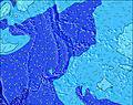 | 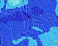 | 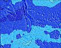 | 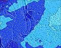 | 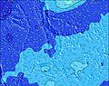 |  | 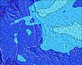 | 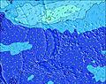 | ||||||||||||
Onda Altezza (m) Direzione Periodo (s) | E 9 | E 9 | E 9 | E 9 | E 9 | E 9 | E 9 | E 9 | E 9 | E 9 | E 9 | E 9 | E 9 | E 9 | E 9 | E 9 | E 9 | E 9 | E 9 | E 9 |
Grafico delle onde | ||||||||||||||||||||
43 | 43 | 43 | 44 | 44 | 61 | 43 | 44 | 43 | 43 | 43 | 43 | 43 | 42 | 42 | 42 | 42 | 42 | 42 | 41 | |
Vento (km/h) | ||||||||||||||||||||
Stato del vento onshore cross-onshore cross-shore cross-offshore offshore piatto | off | off | off | off | off | off | off | off | off | off | off | off | off | off | off | off | off | off | off | off |
Alta Marea | 10:42PM0.76m | 8:03AM0.72m | 11:11PM0.75m | 9:12AM0.66m | ||||||||||||||||
Basso Marea | 3:45AM0.60m | 3:41PM0.08m | 4:47AM0.54m | 4:23PM0.18m | ||||||||||||||||
— | — | — | — | — | 5:54 | — | — | — | — | — | — | — | 5:54 | — | — | — | — | — | — | |
— | 6:51 | — | — | — | — | — | — | — | 6:50 | — | — | — | — | — | — | — | 6:50 | — | — | |
mm | 2 | — | 1 | — | — | — | — | — | — | — | — | — | — | — | — | — | — | — | — | — |
Temp. °C | 28 | 28 | 28 | 28 | 28 | 28 | 28 | 28 | 28 | 28 | 28 | 28 | 28 | 27 | 27 | 27 | 28 | 28 | 28 | 28 |
Gelo °C | 29 | 29 | 30 | 31 | 29 | 29 | 29 | 30 | 29 | 29 | 30 | 31 | 31 | 29 | 29 | 29 | 30 | 31 | 31 | 32 |
Onda 1 Altezza (m) Direzione Periodo (s) | E 9 | E 9 | E 9 | E 9 | E 9 | E 9 | E 9 | E 9 | E 9 | E 9 | WSW 7 | WSW 7 | WSW 7 | WSW 7 | WSW 7 | WSW 7 | WSW 7 | WSW 7 | WSW 7 | WSW 7 |
43 | 43 | 43 | 44 | 44 | 61 | 43 | 44 | 43 | 43 | 111 | 91 | 88 | 73 | 73 | 59 | 59 | 59 | 59 | 57 | |
Onda 2 Altezza (m) Direzione Periodo (s) | SE 8 | SE 9 | SE 9 | SE 8 | SE 8 | SE 8 | SE 8 | SE 8 | SE 8 | SE 8 | E 9 | E 9 | E 9 | E 9 | E 9 | E 9 | E 9 | E 9 | E 9 | E 9 |
18 | 19 | 19 | 18 | 18 | 17 | 17 | 17 | 17 | 10 | 43 | 43 | 43 | 42 | 42 | 42 | 42 | 42 | 42 | 41 | |
Onda 3 Altezza (m) Direzione Periodo (s) | NNE 8 | NNE 8 | NE 8 | NNE 8 | NE 8 | S 8 | S 8 | S 8 | S 8 | S 8 | SE 8 | SE 8 | SSE 8 | SSE 8 | NNW 6 | NNW 6 | NW 6 | NW 6 | NW 6 | NW 6 |
6 | 6 | 2 | 6 | 2 | 5 | 5 | 5 | 5 | 5 | 10 | 10 | 6 | 6 | 8 | 8 | 10 | 10 | 9 | 9 | |
onde vento Altezza (m) Direzione Periodo (s) | WSW 8 | WSW 8 | WSW 8 | WSW 8 | WSW 8 | WSW 7 | WSW 7 | WSW 7 | WSW 7 | WSW 7 | — | S 4 | S 8 | S 8 | S 8 | SSW 8 | S 7 | S 7 | — | S 7 |
191 | 204 | 191 | 186 | 161 | 157 | 181 | 177 | 148 | 124 | — | 3 | 19 | 18 | 18 | 19 | 17 | 16 | — | 9 | |
Il più vicino Offshore or Glassy | ||||||||||||||||||||
Distanza (km) | 4 | 1495 | 4 | 0 | 4 | 244 | 1495 | 4 | 2259 | 4 | 4 | 4 | 4 | 4 | 0 | 0 | 0 | 0 | 0 | 0 |
Migliori previsioni per le condizioni d'onda in Saipan | ||||||||||||||||||||
Migliori previsioni per le condizioni d'onda in Northern Mariana Islands | ||||||||||||||||||||
Trova Onde Globale | ||||||||||||||||||||
- Map Icons:
 Break
Break Live Wave Height (m)
 Live Wind Speed (km/h)
 Surf Rating (10 Max)
 Ocean Swells (m)
- Wind Speed (km/h)
Widget Free Surf-Forecast.com per il tuo sito
La relazione di surf / widget meteo è disponibile qui sotto per incorporare su siti esterni a titolo gratuito e fornisce una sintesi delle nostre Bird Island previsione surf. Basta prendere il frammento di codice html da noi fornito e copiarlo nel proprio sito. È possibile scegliere la lingua preferita e unità metriche / imperiali per il feed delle previsioni surf per soddisfare le esigenze degli utenti del vostro sito .... Clicca qui per ottenere il codice.
 Nearest