

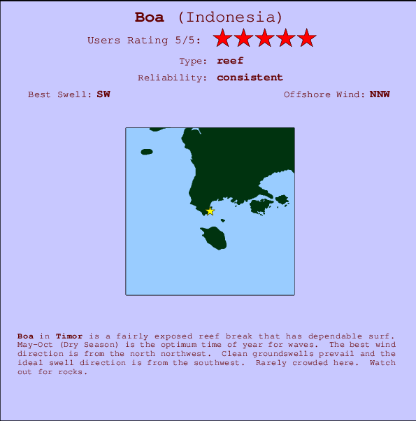
Boa Surf Guide
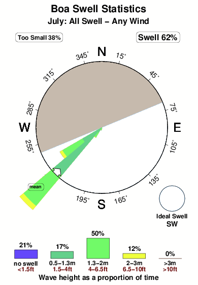
Boa in Timor is a fairly exposed reef break that usually has waves. May-Oct (Dry Season) is the favoured time of year for waves. Offshore winds blow from the north northwest. Groundswells are more common than windswells and the ideal swell angle is from the southwest. A reef breaks right. It very rarely gets crowded here. Watch out for rocks.
Boa Spot Info
| Type: | Rating: | Reliability: | Todays Sea Temp*: |
|---|---|---|---|
| consistent | 27.2°C*ocean temperature recorded from satellite |
Surfing Boa:
The best conditions reported for surf at Boa occur when a Southwest swell combines with an offshore wind direction from the North-northwest.

Previsioni Energia d'onda (Potenza): 12hrs


Boa Surf:
Sunday, 19 July 2026, 19:05 Local time| Domenica 19 | Lun | |||
| 5PM | 8PM | 11PM | 2AM | |
| Wave (m) | ||||
| Periodo (s) | 14 | 13 | 13 | 13 |
| Vento (km/h) | ||||
| Stato del vento | cross- on |
cross- on |
cross- on |
cross- on |
- /breaks/Boa/forecasts/latest
Boa Surf Guide
Boa in Timor is a fairly exposed reef break that usually has waves. May-Oct (Dry Season) is the favoured time of year for waves. Offshore winds blow from the north northwest. Groundswells are more common than windswells and the ideal swell angle is from the southwest. A reef breaks right. It very rarely gets crowded here. Watch out for rocks.
Boa Spot Info
Type: Rating: Reliability: Todays Sea Temp*:  Reef
Reef 5
5consistent 27.2°C*ocean temperature recorded from satelliteSurfing Boa:
The best conditions reported for surf at Boa occur when a Southwest swell combines with an offshore wind direction from the North-northwest.
Previsioni Energia d'onda (Potenza): 12hrs
Utilizzare la scheda di navigazione in alto per visualizzare Boa temperatura del mare, Boa fotografie, Boa dettagliate previsioni onde, il vento e le previsioni meteo, Boa webcam, vento corrente da Timor stazioni meteo e Boa previsioni marea. Il link Indonesia mappe maree apre l'immagine grande, che mostra Indonesia e dei mari circostanti. Queste mappe possono essere animate per mostrare le diverse componenti del moto ondoso, energia delle onde, periodo d'onda, altezza delle onde, insieme con le previsioni del vento e meteo, meteo corrente e osservazioni sullo stato del mare dal Indonesia onda-boe, le navi passanti e stazioni meteo costiere. Ciascuna delle pagine di previsioni per questo surf break rappresenta uno strumento di wavefinder globale e regionale per individuare le migliori condizioni di surf nella zona intorno Boa.
Boa Surf:
Sunday, 19 July 2026, 19:05 Local timeDomenica 19 Lun 5PM 8PM 11PM 2AM Wave (m) Periodo (s) 14 13 13 13 Vento (km/h) Stato del vento cross-
oncross-
oncross-
oncross-
on- /breaks/Boa/forecasts/latest
- /breaks/Boa/forecasts/latest/six_day
Boa Surf Guide
Boa in Timor is a fairly exposed reef break that usually has waves. May-Oct (Dry Season) is the favoured time of year for waves. Offshore winds blow from the north northwest. Groundswells are more common than windswells and the ideal swell angle is from the southwest. A reef breaks right. It very rarely gets crowded here. Watch out for rocks.
Boa Spot Info
Type: Rating: Reliability: Todays Sea Temp*: Reef5consistent 27.2°C*ocean temperature recorded from satelliteSurfing Boa:
The best conditions reported for surf at Boa occur when a Southwest swell combines with an offshore wind direction from the North-northwest.
Previsioni Energia d'onda (Potenza): 12hrs
Utilizzare la scheda di navigazione in alto per visualizzare Boa temperatura del mare, Boa fotografie, Boa dettagliate previsioni onde, il vento e le previsioni meteo, Boa webcam, vento corrente da Timor stazioni meteo e Boa previsioni marea. Il link Indonesia mappe maree apre l'immagine grande, che mostra Indonesia e dei mari circostanti. Queste mappe possono essere animate per mostrare le diverse componenti del moto ondoso, energia delle onde, periodo d'onda, altezza delle onde, insieme con le previsioni del vento e meteo, meteo corrente e osservazioni sullo stato del mare dal Indonesia onda-boe, le navi passanti e stazioni meteo costiere. Ciascuna delle pagine di previsioni per questo surf break rappresenta uno strumento di wavefinder globale e regionale per individuare le migliori condizioni di surf nella zona intorno Boa.
Boa Surf:
Sunday, 19 July 2026, 19:05 Local timeDomenica 19 Lun 5PM 8PM 11PM 2AM Wave (m) Periodo (s) 14 13 13 13 Vento (km/h) Stato del vento cross-
oncross-
oncross-
oncross-
on- /breaks/Boa/forecasts/latest
Boa Surf Guide
Boa in Timor is a fairly exposed reef break that usually has waves. May-Oct (Dry Season) is the favoured time of year for waves. Offshore winds blow from the north northwest. Groundswells are more common than windswells and the ideal swell angle is from the southwest. A reef breaks right. It very rarely gets crowded here. Watch out for rocks.
Boa Spot Info
Type: Rating: Reliability: Todays Sea Temp*: Reef5consistent 27.2°C*ocean temperature recorded from satelliteSurfing Boa:
The best conditions reported for surf at Boa occur when a Southwest swell combines with an offshore wind direction from the North-northwest.
Previsioni Energia d'onda (Potenza): 12hrs
Utilizzare la scheda di navigazione in alto per visualizzare Boa temperatura del mare, Boa fotografie, Boa dettagliate previsioni onde, il vento e le previsioni meteo, Boa webcam, vento corrente da Timor stazioni meteo e Boa previsioni marea. Il link Indonesia mappe maree apre l'immagine grande, che mostra Indonesia e dei mari circostanti. Queste mappe possono essere animate per mostrare le diverse componenti del moto ondoso, energia delle onde, periodo d'onda, altezza delle onde, insieme con le previsioni del vento e meteo, meteo corrente e osservazioni sullo stato del mare dal Indonesia onda-boe, le navi passanti e stazioni meteo costiere. Ciascuna delle pagine di previsioni per questo surf break rappresenta uno strumento di wavefinder globale e regionale per individuare le migliori condizioni di surf nella zona intorno Boa.
Boa Surf:
Sunday, 19 July 2026, 19:05 Local timeDomenica 19 Lun 5PM 8PM 11PM 2AM Wave (m) Periodo (s) 14 13 13 13 Vento (km/h) Stato del vento cross-
oncross-
oncross-
oncross-
onTide Times:
A Boa (0 km).
PROSSIMA È ALLE (ora locale) rimanente alta marea bassa marea Live Weather:
At El Tari International Airport (Kupang), 123 km from Boa.
fresh winds from the ESE
(km/h)
Dry and partly cloudyAir temperature
26°COverall Boa Surf Consistency and Wind Distribution in Luglio
foto dall' album
Contorni: Strade e fiumi: seleziona un surf break dal menu 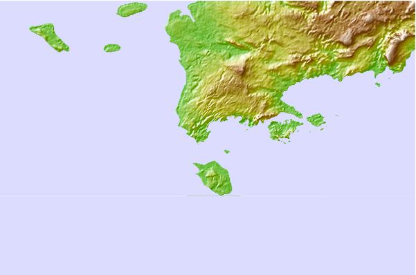
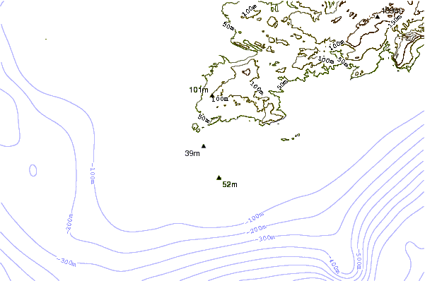
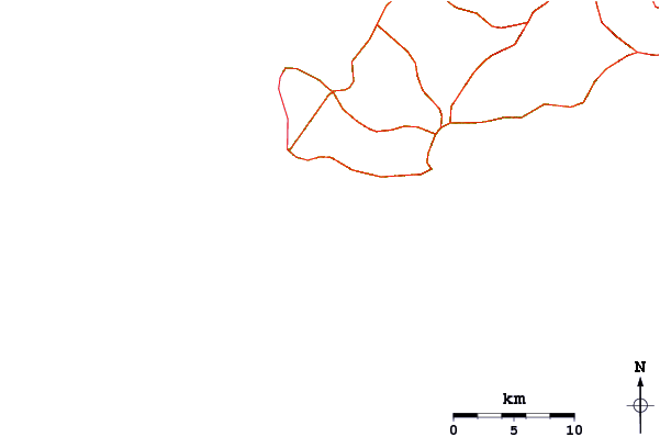
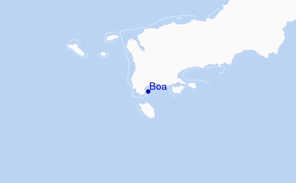
Utilizzare questa mappa sollievo per navigare Timor surf breaks e stazioni di marea che si trovano nella zona diBoa
Onda boe più vicina a Boa:
- Closest Onda boa1280 mi
- Second closest Onda boa1585 mi
- Third closest Onda boa1710 mi
- Fourth closest Onda boa1789 mi
- Fifth closest Onda boa1886 mi
Stazioni di marea più vicina alla Boa:
- Closest marea stazioneKupang65 mi
- Second closest marea stazioneAshmore Reef89 mi
- Third closest marea stazionePee Shoal146 mi
- Fourth closest marea stazioneEndeh165 mi
- Fifth closest marea stazioneMaumere166 mi
Airports
- The nearest passenger airport to Boa is El Tari (Kupang) Airport (KOE) in Indonesia, which is 123 km (76 miles) away (directly).
- The second closest airport to Boa is Wai Oti (Maumere) Airport (MOF), also in Indonesia, 264 km (164 miles) away.
- /breaks/Boa/forecasts/latest


 Nearest