
Previsioni:

Previsione a breve termineQualche pioggerella, più pesante durante giovedì notte. Warm (Max 20°C giovedì pomeriggio, Min 14°C Domenica mattina). Venti in aumento (venti deboli da NE giovedì notte, raffiche di vento da NW per sabato notte). | |||||||||||||||||||||
Gio 16 | Venerdì 17 | Sabato 18 | |||||||||||||||||||
11 AM | 2 PM | 5 PM | 8 PM | 11 PM | 2 AM | 5 AM | 8 AM | 11 AM | 2 PM | 5 PM | 8 PM | 11 PM | 2 AM | 5 AM | 8 AM | 11 AM | 2 PM | 5 PM | 8 PM | 11 PM | |
Mappa dell'altezza del moto ondoso | 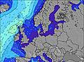 | 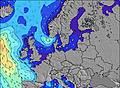 | 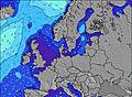 | 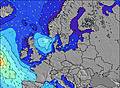 | 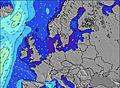 | 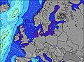 | 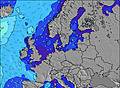 | 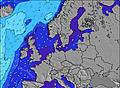 | |||||||||||||
Onda Altezza (m) Direzione Periodo (s) | N 4 | NNW 4 | NNW 4 | NNW 4 | NNW 6 | NNW 6 | NNW 6 | NNW 6 | NNW 5 | NNW 5 | NW 3 | NW 4 | NW 5 | NNW 6 | NNW 6 | NW 6 | NW 7 | NNW 7 | NNW 7 | NNW 8 | NNW 8 |
Grafico delle onde | |||||||||||||||||||||
10 | 6 | 6 | 6 | 6 | 6 | 6 | 6 | 3 | 5 | 4 | 14 | 47 | 105 | 124 | 167 | 220 | 282 | 329 | 515 | 638 | |
Vento (km/h) | |||||||||||||||||||||
Stato del vento onshore cross-onshore cross-shore cross-offshore offshore piatto | cross-off | cross-off | cross | cross | cross-off | cross | cross-on | cross-on | cross-on | on | on | on | on | on | on | on | on | on | on | on | on |
Alta Marea | 12:36PM2.72m | 1:19AM2.36m | 1:28PM2.76m | 2:07AM2.34m | 2:17PM2.74m | ||||||||||||||||
Basso Marea | 7:02PM-0.35m | 7:13AM-0.08m | 7:50PM-0.33m | 7:59AM-0.08m | 8:35PM-0.24m | ||||||||||||||||
— | — | — | — | — | — | 5:24 | — | — | — | — | — | — | — | 5:26 | — | — | — | — | — | — | |
— | — | — | 9:53 | — | — | — | — | — | — | — | 9:52 | — | — | — | — | — | — | — | 9:52 | — | |
mm | — | — | — | — | — | — | 1 | — | — | — | — | — | — | — | — | — | — | — | — | — | — |
Temp. °C | 19 | 19 | 20 | 20 | 20 | 20 | 20 | 19 | 19 | 18 | 18 | 17 | 16 | 16 | 16 | 16 | 16 | 15 | 16 | 16 | 15 |
Gelo °C | 18 | 18 | 18 | 18 | 18 | 19 | 19 | 17 | 18 | 16 | 15 | 12 | 12 | 11 | 11 | 11 | 11 | 10 | 10 | 9 | 8 |
Onda 1 Altezza (m) Direzione Periodo (s) | N 4 | NNW 4 | NNW 4 | NNW 4 | NNW 6 | NNW 6 | NNW 6 | NNW 6 | NNW 5 | — | — | — | — | — | — | — | — | — | — | — | — |
10 | 6 | 6 | 6 | 6 | 6 | 6 | 6 | 3 | — | — | — | — | — | — | — | — | — | — | — | — | |
Onda 2 Altezza (m) Direzione Periodo (s) | N 6 | — | — | — | — | — | ENE 3 | ENE 3 | — | — | — | — | — | — | — | — | — | — | — | — | — |
1 | — | — | — | — | — | 1 | 1 | — | — | — | — | — | — | — | — | — | — | — | — | — | |
Onda 3 Altezza (m) Direzione Periodo (s) | — | N 6 | — | — | — | — | — | — | — | — | — | — | — | — | — | — | — | — | — | — | — |
— | 1 | — | — | — | — | — | — | — | — | — | — | — | — | — | — | — | — | — | — | — | |
onde vento Altezza (m) Direzione Periodo (s) | E 3 | E 3 | — | — | ENE 2 | ENE 3 | — | — | — | NNW 5 | NW 3 | NW 4 | NW 5 | NNW 6 | NNW 6 | NW 6 | NW 7 | NNW 7 | NNW 7 | NNW 8 | NNW 8 |
1 | 1 | — | — | 1 | 1 | — | — | — | 5 | 4 | 14 | 47 | 105 | 124 | 167 | 220 | 282 | 329 | 515 | 638 | |
Il più vicino Offshore or Glassy | |||||||||||||||||||||
Distanza (km) | 937 | 863 | 832 | 832 | 708 | 788 | 909 | 909 | 909 | 1684 | 1684 | 1191 | 550 | 547 | 541 | 546 | 665 | 546 | 546 | 546 | 546 |
Migliori previsioni per le condizioni d'onda in Nordsee (North Sea) | |||||||||||||||||||||
Migliori previsioni per le condizioni d'onda in Germany | |||||||||||||||||||||
Trova Onde Globale | |||||||||||||||||||||
- Map Icons:
 Break
Break Live Wave Height (m)
 Live Wind Speed (km/h)
 Surf Rating (10 Max)
 Ocean Swells (m)
- Wind Speed (km/h)
Widget Free Surf-Forecast.com per il tuo sito
La relazione di surf / widget meteo è disponibile qui sotto per incorporare su siti esterni a titolo gratuito e fornisce una sintesi delle nostre Borkum Nordstrand previsione surf. Basta prendere il frammento di codice html da noi fornito e copiarlo nel proprio sito. È possibile scegliere la lingua preferita e unità metriche / imperiali per il feed delle previsioni surf per soddisfare le esigenze degli utenti del vostro sito .... Clicca qui per ottenere il codice.
 Nearest