
Previsioni:

Aggiornamento in hr min s Forecast update imminent
Previsione a breve terminepioggia leggera (Totale 7mm), per lo più che cade Domenica mattina. Warm (Max 21°C Domenica mattina, Min 17°C Lunedì notte). Vento sarà generalmente leggero. | ||||||||||||||||||||||||
Dom 28 | Lunedì 29 | Martedì 30 | Mer 1 | |||||||||||||||||||||
5 PM | 8 PM | 11 PM | 2 AM | 5 AM | 8 AM | 11 AM | 2 PM | 5 PM | 8 PM | 11 PM | 2 AM | 5 AM | 8 AM | 11 AM | 2 PM | 5 PM | 8 PM | 11 PM | 2 AM | 5 AM | 8 AM | 11 AM | 2 PM | |
Mappa dell'altezza del moto ondoso |  |  |  |  |  |  |  |  | 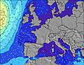 | |||||||||||||||
Onda Altezza (m) Direzione Periodo (s) | WNW 8 | WNW 8 | WNW 8 | WNW 8 | NW 12 | WNW 12 | WNW 12 | WNW 12 | NW 12 | NW 12 | NW 12 | NW 12 | NW 12 | NW 12 | NW 11 | NW 11 | NW 11 | NW 11 | NW 11 | NW 10 | NW 10 | NW 10 | NW 10 | NW 11 |
Grafico delle onde | ||||||||||||||||||||||||
39 | 37 | 37 | 38 | 40 | 101 | 273 | 496 | 706 | 1064 | 1129 | 1042 | 1025 | 851 | 808 | 701 | 627 | 558 | 453 | 369 | 322 | 322 | 520 | 572 | |
Vento (km/h) | ||||||||||||||||||||||||
Stato del vento onshore cross-onshore cross-shore cross-offshore offshore piatto | cross-on | glassy | glassy | cross | cross | cross-off | cross | cross-on | cross-on | cross-on | cross-on | on | on | on | cross-on | cross-on | cross-on | cross-on | on | on | cross-on | cross-on | cross-on | cross-on |
Alta Marea | 4:40PM3.66m | 5:02AM3.52m | 5:17PM3.74m | 5:39AM3.57m | 5:53PM3.79m | 6:14AM3.60m | ||||||||||||||||||
Basso Marea | 11:17PM1.29m | 11:26AM1.35m | 11:54PM1.22m | 12:03PM1.29m | 00:30AM1.17m | 12:39PM1.25m | ||||||||||||||||||
— | — | — | — | 6:26 | — | — | — | — | — | — | — | 6:28 | — | — | — | — | — | — | — | 6:28 | — | — | — | |
— | 9:51 | — | — | — | — | — | — | — | 9:51 | — | — | — | — | — | — | — | 9:51 | — | — | — | — | — | 9:51 | |
mm | 1 | 5 | — | 1 | — | 1 | — | — | — | — | — | — | — | — | — | — | — | — | — | — | — | — | — | — |
Temp. °C | 21 | 20 | 21 | 20 | 20 | 19 | 19 | 19 | 19 | 18 | 18 | 18 | 17 | 17 | 18 | 19 | 19 | 19 | 19 | 18 | 18 | 18 | 19 | 20 |
Gelo °C | 20 | 23 | 23 | 20 | 22 | 19 | 18 | 18 | 18 | 17 | 18 | 18 | 17 | 17 | 17 | 17 | 17 | 18 | 19 | 18 | 18 | 19 | 18 | 18 |
Onda 1 Altezza (m) Direzione Periodo (s) | WNW 8 | WNW 8 | WNW 8 | WNW 8 | WNW 8 | WNW 8 | WNW 12 | WNW 12 | NW 12 | NW 12 | NW 12 | NW 12 | NW 12 | NW 12 | NW 11 | NW 11 | NW 11 | NW 11 | NW 11 | NW 10 | NW 10 | NW 10 | NW 10 | NW 11 |
39 | 37 | 37 | 38 | 40 | 47 | 273 | 496 | 706 | 1064 | 1129 | 1042 | 1025 | 851 | 808 | 701 | 627 | 558 | 453 | 369 | 322 | 322 | 520 | 572 | |
Onda 2 Altezza (m) Direzione Periodo (s) | NW 7 | NNW 4 | NW 14 | NNW 4 | NNW 4 | WNW 12 | WNW 8 | NW 7 | NW 7 | — | — | — | — | — | — | — | — | — | — | — | — | WNW 13 | — | — |
2 | 5 | 7 | 10 | 6 | 101 | 52 | 75 | 102 | — | — | — | — | — | — | — | — | — | — | — | — | 111 | — | — | |
Onda 3 Altezza (m) Direzione Periodo (s) | — | — | — | NW 13 | NW 12 | — | — | — | — | — | — | — | — | — | — | — | — | — | — | — | — | — | — | — |
— | — | — | 7 | 40 | — | — | — | — | — | — | — | — | — | — | — | — | — | — | — | — | — | — | — | |
onde vento Altezza (m) Direzione Periodo (s) | NNW 4 | — | NNW 4 | — | — | N 4 | N 4 | — | — | — | — | — | — | — | — | — | — | — | — | — | — | — | — | — |
5 | — | 10 | — | — | 6 | 9 | — | — | — | — | — | — | — | — | — | — | — | — | — | — | — | — | — | |
Il più vicino Offshore or Glassy | ||||||||||||||||||||||||
Distanza (km) | 589 | 1 | 0 | 95 | 2 | 0 | 24 | 95 | 95 | 95 | 25 | 25 | 20 | 25 | 25 | 95 | 25 | 25 | 25 | 25 | 25 | 25 | 25 | 25 |
Migliori previsioni per le condizioni d'onda in Landes | ||||||||||||||||||||||||
Migliori previsioni per le condizioni d'onda in France | ||||||||||||||||||||||||
Trova Onde Globale | ||||||||||||||||||||||||
- Map Icons:
 Break
Break Live Wave Height (m)
 Live Wind Speed (km/h)
 Surf Rating (10 Max)
 Ocean Swells (m)
- Wind Speed (km/h)
Widget Free Surf-Forecast.com per il tuo sito
La relazione di surf / widget meteo è disponibile qui sotto per incorporare su siti esterni a titolo gratuito e fornisce una sintesi delle nostre Boucau previsione surf. Basta prendere il frammento di codice html da noi fornito e copiarlo nel proprio sito. È possibile scegliere la lingua preferita e unità metriche / imperiali per il feed delle previsioni surf per soddisfare le esigenze degli utenti del vostro sito .... Clicca qui per ottenere il codice.
 Nearest