
Previsioni:

Previsione a breve termineper lo più asciutto. Warm (Max 31°C giovedì pomeriggio, Min 24°C mercoledì notte). Vento sarà generalmente leggero. | ||||||||||||||||||||||||
Mer 15 | Giovedì 16 | Venerdì 17 | 18 | |||||||||||||||||||||
5 PM | 8 PM | 11 PM | 2 AM | 5 AM | 8 AM | 11 AM | 2 PM | 5 PM | 8 PM | 11 PM | 2 AM | 5 AM | 8 AM | 11 AM | 2 PM | 5 PM | 8 PM | 11 PM | 2 AM | 5 AM | 8 AM | 11 AM | 2 PM | |
Mappa dell'altezza del moto ondoso | 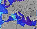 | 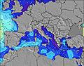 | 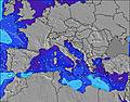 | 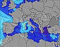 | 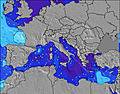 | 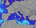 | 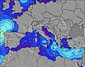 | 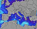 | 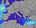 | |||||||||||||||
Onda Altezza (m) Direzione Periodo (s) | S 5 | SSW 5 | SSW 5 | SSW 5 | S 5 | S 5 | S 5 | S 5 | W 3 | W 4 | WNW 4 | WNW 4 | WNW 3 | WNW 3 | — | S 4 | — | SSW 2 | SW 3 | SSW 3 | SW 4 | SW 4 | SW 4 | SW 5 |
Grafico delle onde | ||||||||||||||||||||||||
12 | 9 | 10 | 10 | 8 | 5 | 4 | 2 | 5 | 9 | 11 | 8 | 2 | 1 | 0 | 1 | 0 | 1 | 1 | 1 | 2 | 4 | 5 | 5 | |
Vento (km/h) | ||||||||||||||||||||||||
Stato del vento onshore cross-onshore cross-shore cross-offshore offshore piatto | on | cross-on | glassy | glassy | cross-off | glassy | cross-on | cross-on | cross | cross | cross | cross-off | cross-off | cross | cross-on | cross-on | on | on | glassy | cross-off | cross-off | cross-off | cross-on | on |
Alta Marea | 11:07PM0.40m | 11:07AM0.31m | 11:52PM0.40m | 11:53AM0.30m | 00:36AM0.39m | 12:39PM0.29m | ||||||||||||||||||
Basso Marea | 4:31PM-0.01m | 5:24AM0.05m | 5:15PM-0.01m | 6:11AM0.06m | 5:59PM0.01m | 6:57AM0.06m | ||||||||||||||||||
— | — | — | — | 5:50 | — | — | — | — | — | — | — | 5:50 | — | — | — | — | — | — | — | 5:50 | — | — | — | |
— | 8:45 | — | — | — | — | — | — | — | 8:45 | — | — | — | — | — | — | — | 8:45 | — | — | — | — | — | 8:44 | |
mm | — | — | — | — | — | — | — | — | — | — | — | — | — | — | — | — | — | — | — | — | — | — | — | — |
Temp. °C | 29 | 27 | 26 | 25 | 24 | 26 | 29 | 30 | 31 | 28 | 26 | 26 | 26 | 27 | 29 | 29 | 29 | 27 | 25 | 24 | 24 | 26 | 30 | 30 |
Gelo °C | 32 | 31 | 30 | 29 | 26 | 28 | 32 | 30 | 31 | 29 | 28 | 29 | 28 | 30 | 32 | 31 | 31 | 30 | 29 | 27 | 27 | 28 | 31 | 32 |
Onda 1 Altezza (m) Direzione Periodo (s) | S 5 | SSW 5 | SSW 5 | SSW 5 | S 5 | S 5 | S 5 | S 5 | S 5 | S 5 | — | — | WNW 3 | WNW 3 | — | — | — | — | SSW 3 | SSW 3 | SW 4 | SW 4 | SW 4 | SW 5 |
12 | 9 | 10 | 10 | 8 | 5 | 4 | 2 | 2 | 2 | — | — | 2 | 1 | — | — | — | — | 1 | 1 | 2 | 4 | 5 | 5 | |
Onda 2 Altezza (m) Direzione Periodo (s) | — | — | — | — | — | — | — | WSW 4 | — | — | — | — | — | — | — | — | — | — | — | — | — | — | — | — |
— | — | — | — | — | — | — | 2 | — | — | — | — | — | — | — | — | — | — | — | — | — | — | — | — | |
Onda 3 Altezza (m) Direzione Periodo (s) | — | — | — | — | — | — | — | — | — | — | — | — | — | — | — | — | — | — | — | — | — | — | — | — |
— | — | — | — | — | — | — | — | — | — | — | — | — | — | — | — | — | — | — | — | — | — | — | — | |
onde vento Altezza (m) Direzione Periodo (s) | — | — | — | — | — | — | — | WNW 2 | W 3 | W 4 | WNW 4 | WNW 4 | — | — | — | S 4 | — | SSW 2 | SW 3 | — | — | — | — | — |
— | — | — | — | — | — | — | 1 | 5 | 9 | 11 | 8 | — | — | — | 1 | — | 1 | 1 | — | — | — | — | — | |
Il più vicino Offshore or Glassy | ||||||||||||||||||||||||
Distanza (km) | 1609 | 1342 | 1267 | 1198 | 1198 | 1718 | 1724 | 1621 | 1588 | 1386 | 1341 | 694 | 1265 | 1255 | 1847 | 1263 | 1263 | 429 | 1263 | 1718 | 1682 | 1743 | ||
Migliori previsioni per le condizioni d'onda in West Coast of Italy | ||||||||||||||||||||||||
Migliori previsioni per le condizioni d'onda in Italy | ||||||||||||||||||||||||
Trova Onde Globale | ||||||||||||||||||||||||
- Map Icons:
 Break
Break Live Wave Height (m)
 Live Wind Speed (km/h)
 Surf Rating (10 Max)
 Ocean Swells (m)
- Wind Speed (km/h)
Widget Free Surf-Forecast.com per il tuo sito
La relazione di surf / widget meteo è disponibile qui sotto per incorporare su siti esterni a titolo gratuito e fornisce una sintesi delle nostre Bunker previsione surf. Basta prendere il frammento di codice html da noi fornito e copiarlo nel proprio sito. È possibile scegliere la lingua preferita e unità metriche / imperiali per il feed delle previsioni surf per soddisfare le esigenze degli utenti del vostro sito .... Clicca qui per ottenere il codice.
 Nearest