
Previsioni:

Previsione a breve termineper lo più asciutto. Warm (Max 29°C giovedì mattina, Min 26°C giovedì pomeriggio). Principalmente bufere nelle prossimità. | |||||||||||||||||||||
Gio 16 | Venerdì 17 | Sabato 18 | |||||||||||||||||||
10 AM | 1 PM | 4 PM | 7 PM | 10 PM | 1 AM | 4 AM | 7 AM | 10 AM | 1 PM | 4 PM | 7 PM | 10 PM | 1 AM | 4 AM | 7 AM | 10 AM | 1 PM | 4 PM | 7 PM | 10 PM | |
Mappa dell'altezza del moto ondoso | 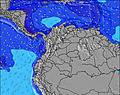 | 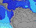 | 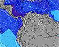 | 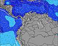 | 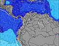 | 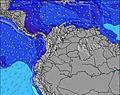 | 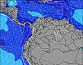 | 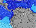 | |||||||||||||
Onda Altezza (m) Direzione Periodo (s) | ENE 6 | ENE 7 | NE 6 | NE 7 | ENE 7 | ENE 7 | ENE 7 | ENE 8 | ENE 8 | ENE 8 | NE 7 | NE 7 | ENE 7 | ENE 8 | ENE 8 | ENE 8 | ENE 7 | ENE 7 | NE 6 | NE 6 | NE 7 |
Grafico delle onde | |||||||||||||||||||||
225 | 261 | 253 | 352 | 372 | 320 | 310 | 319 | 287 | 337 | 312 | 405 | 428 | 337 | 302 | 247 | 234 | 243 | 237 | 269 | 286 | |
Vento (km/h) | |||||||||||||||||||||
Stato del vento onshore cross-onshore cross-shore cross-offshore offshore piatto | cross-off | cross-off | cross-off | cross-off | cross-off | cross-off | cross-off | cross-off | cross-off | cross-off | cross-off | cross-off | cross-off | cross-off | cross-off | cross-off | cross-off | cross-off | cross-off | cross-off | cross-off |
Alta Marea | 2:33PM0.12m | 1:08AM0.34m | 3:44PM0.17m | 1:59AM0.29m | 4:37PM0.22m | ||||||||||||||||
Basso Marea | 8:26AM0.02m | 5:24PM0.11m | 9:00AM0.04m | 7:16PM0.15m | 9:30AM0.06m | 9:25PM0.17m | |||||||||||||||
5:31 | — | — | — | — | — | 5:31 | — | — | — | — | — | — | — | 5:31 | — | — | — | — | — | — | |
— | — | 6:16 | — | — | — | — | — | — | — | 6:16 | — | — | — | — | — | — | — | 6:16 | — | — | |
mm | — | — | — | — | — | — | — | — | — | — | — | — | — | — | — | — | — | — | — | — | — |
Temp. °C | 28 | 29 | 27 | 26 | 26 | 26 | 26 | 26 | 28 | 29 | 27 | 26 | 26 | 26 | 26 | 26 | 29 | 29 | 27 | 26 | 26 |
Gelo °C | 23 | 24 | 22 | 22 | 22 | 22 | 23 | 23 | 24 | 24 | 22 | 22 | 22 | 22 | 23 | 23 | 25 | 25 | 22 | 22 | 21 |
Onda 1 Altezza (m) Direzione Periodo (s) | — | — | — | — | — | — | — | — | — | — | — | — | — | NNE 9 | N 6 | NNE 9 | — | — | — | — | — |
— | — | — | — | — | — | — | — | — | — | — | — | — | 25 | 9 | 16 | — | — | — | — | — | |
Onda 2 Altezza (m) Direzione Periodo (s) | — | — | — | — | — | — | — | — | — | — | — | — | — | — | NNE 9 | N 6 | — | — | — | — | — |
— | — | — | — | — | — | — | — | — | — | — | — | — | — | 15 | 6 | — | — | — | — | — | |
Onda 3 Altezza (m) Direzione Periodo (s) | — | — | — | — | — | — | — | — | — | — | — | — | — | — | — | — | — | — | — | — | — |
— | — | — | — | — | — | — | — | — | — | — | — | — | — | — | — | — | — | — | — | — | |
onde vento Altezza (m) Direzione Periodo (s) | ENE 6 | ENE 7 | NE 6 | NE 7 | ENE 7 | ENE 7 | ENE 7 | ENE 8 | ENE 8 | ENE 8 | NE 7 | NE 7 | ENE 7 | ENE 8 | ENE 8 | ENE 8 | ENE 7 | ENE 7 | NE 6 | NE 6 | NE 7 |
225 | 261 | 253 | 352 | 372 | 320 | 310 | 319 | 287 | 337 | 312 | 405 | 428 | 337 | 302 | 247 | 234 | 243 | 237 | 269 | 286 | |
Il più vicino Offshore or Glassy | |||||||||||||||||||||
Distanza (km) | 534 | 594 | 594 | 594 | 502 | 476 | 421 | 464 | 407 | 594 | 594 | 594 | 502 | 476 | 476 | 407 | 407 | 594 | 594 | 594 | 502 |
Migliori previsioni per le condizioni d'onda in Caribbean Coast | |||||||||||||||||||||
Migliori previsioni per le condizioni d'onda in Colombia | |||||||||||||||||||||
Trova Onde Globale | |||||||||||||||||||||
- Map Icons:
 Break
Break Live Wave Height (m)
 Live Wind Speed (km/h)
 Surf Rating (10 Max)
 Ocean Swells (m)
- Wind Speed (km/h)
Widget Free Surf-Forecast.com per il tuo sito
La relazione di surf / widget meteo è disponibile qui sotto per incorporare su siti esterni a titolo gratuito e fornisce una sintesi delle nostre Cabo de la Vela previsione surf. Basta prendere il frammento di codice html da noi fornito e copiarlo nel proprio sito. È possibile scegliere la lingua preferita e unità metriche / imperiali per il feed delle previsioni surf per soddisfare le esigenze degli utenti del vostro sito .... Clicca qui per ottenere il codice.
 Nearest