
Previsioni:

Previsione a breve terminepioggia leggera (Totale 3mm), per lo più che cade Venerdì pomeriggio. Warm (Max 29°C mercoledì mattina, Min 27°C mercoledì mattina). Vento sarà generalmente leggero. | ||||||||||||||||||||||||
Mercoledì 22 | Giovedì 23 | Venerdì 24 | ||||||||||||||||||||||
2 AM | 5 AM | 8 AM | 11 AM | 2 PM | 5 PM | 8 PM | 11 PM | 2 AM | 5 AM | 8 AM | 11 AM | 2 PM | 5 PM | 8 PM | 11 PM | 2 AM | 5 AM | 8 AM | 11 AM | 2 PM | 5 PM | 8 PM | 11 PM | |
Mappa dell'altezza del moto ondoso |  | 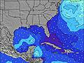 | 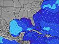 |  | 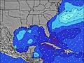 | 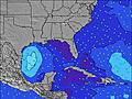 |  | 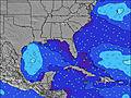 | 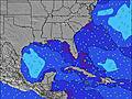 | |||||||||||||||
Onda Altezza (m) Direzione Periodo (s) | ESE 8 | ESE 8 | ESE 8 | ESE 8 | E 8 | ESE 8 | ESE 8 | ESE 8 | ESE 8 | ESE 8 | E 8 | ESE 8 | E 8 | ESE 8 | ESE 8 | E 8 | E 8 | E 8 | E 8 | E 8 | E 8 | E 8 | E 8 | E 8 |
Grafico delle onde | ||||||||||||||||||||||||
16 | 19 | 19 | 11 | 30 | 12 | 12 | 13 | 13 | 13 | 33 | 51 | 33 | 21 | 21 | 45 | 63 | 33 | 63 | 61 | 61 | 63 | 63 | 63 | |
Vento (km/h) | ||||||||||||||||||||||||
Stato del vento onshore cross-onshore cross-shore cross-offshore offshore piatto | cross | cross | cross | cross-on | cross-on | cross-on | cross-on | cross-on | cross-on | cross-on | cross-on | on | on | cross-on | on | on | on | on | cross-on | on | on | on | on | cross-on |
Alta Marea | 2:21AM0.96m | 3:13PM0.96m | 3:14AM0.92m | 4:10PM0.94m | 4:10AM0.90m | 5:07PM0.94m | ||||||||||||||||||
Basso Marea | 9:09AM0.05m | 9:38PM0.24m | 10:02AM0.08m | 10:32PM0.27m | 10:54AM0.09m | |||||||||||||||||||
— | 6:39 | — | — | — | — | — | — | — | 6:39 | — | — | — | — | — | — | — | 6:39 | — | — | — | — | — | — | |
— | — | — | — | — | — | 8:17 | — | — | — | — | — | — | — | 8:16 | — | — | — | — | — | — | — | 8:16 | — | |
mm | — | — | — | — | — | — | — | — | 1 | — | — | — | — | — | — | — | — | — | — | — | 2 | — | — | — |
Temp. °C | 27 | 27 | 27 | 29 | 29 | 29 | 28 | 28 | 28 | 27 | 27 | 28 | 28 | 28 | 28 | 27 | 27 | 27 | 27 | 28 | 28 | 28 | 28 | 28 |
Gelo °C | 29 | 30 | 31 | 32 | 31 | 30 | 29 | 29 | 31 | 31 | 32 | 30 | 30 | 30 | 31 | 29 | 30 | 30 | 31 | 31 | 31 | 31 | 32 | 32 |
Onda 1 Altezza (m) Direzione Periodo (s) | ESE 8 | ESE 8 | ESE 8 | ESE 5 | E 8 | ESE 8 | ESE 8 | ESE 8 | ESE 8 | ESE 4 | E 8 | ESE 8 | E 8 | ESE 8 | ESE 8 | E 9 | E 9 | E 8 | E 8 | E 8 | E 8 | E 8 | E 8 | E 8 |
11 | 11 | 11 | 8 | 30 | 12 | 12 | 13 | 13 | 7 | 33 | 51 | 33 | 21 | 21 | 2 | 2 | 33 | 63 | 61 | 61 | 63 | 63 | 63 | |
Onda 2 Altezza (m) Direzione Periodo (s) | E 11 | ESE 8 | ESE 8 | ESE 8 | ESE 4 | E 10 | — | — | — | ESE 8 | SSE 4 | SSE 4 | SSE 4 | SSE 4 | SSE 4 | — | — | — | — | — | — | — | — | — |
2 | 19 | 19 | 11 | 7 | 2 | — | — | — | 13 | 3 | 4 | 4 | 2 | 2 | — | — | — | — | — | — | — | — | — | |
Onda 3 Altezza (m) Direzione Periodo (s) | E 11 | E 11 | E 10 | E 10 | E 10 | — | — | — | — | — | E 9 | E 9 | E 9 | E 9 | E 9 | — | — | — | — | — | — | — | — | — |
2 | 2 | 2 | 2 | 2 | — | — | — | — | — | 2 | 2 | 2 | 2 | 2 | — | — | — | — | — | — | — | — | — | |
onde vento Altezza (m) Direzione Periodo (s) | SE 4 | ESE 4 | SE 5 | SSE 4 | — | ESE 4 | ESE 5 | SE 4 | SE 4 | SSE 4 | — | — | — | — | — | E 8 | E 8 | — | — | — | — | — | — | — |
16 | 13 | 10 | 7 | — | 12 | 8 | 10 | 9 | 3 | — | — | — | — | — | 45 | 63 | — | — | — | — | — | — | — | |
Il più vicino Offshore or Glassy | ||||||||||||||||||||||||
Distanza (km) | 142 | 190 | 3 | 118 | 1057 | 1023 | 981 | 216 | 126 | 67 | 190 | 216 | 216 | 475 | 1002 | 216 | 242 | 190 | 101 | 259 | 475 | 596 | 705 | 163 |
Migliori previsioni per le condizioni d'onda in North Florida | ||||||||||||||||||||||||
Migliori previsioni per le condizioni d'onda in United States | ||||||||||||||||||||||||
Trova Onde Globale | ||||||||||||||||||||||||
- Map Icons:
 Break
Break Live Wave Height (m)
 Live Wind Speed (km/h)
 Surf Rating (10 Max)
 Ocean Swells (m)
- Wind Speed (km/h)
Widget Free Surf-Forecast.com per il tuo sito
La relazione di surf / widget meteo è disponibile qui sotto per incorporare su siti esterni a titolo gratuito e fornisce una sintesi delle nostre Canova Beach previsione surf. Basta prendere il frammento di codice html da noi fornito e copiarlo nel proprio sito. È possibile scegliere la lingua preferita e unità metriche / imperiali per il feed delle previsioni surf per soddisfare le esigenze degli utenti del vostro sito .... Clicca qui per ottenere il codice.
 Nearest