
Previsioni:

Previsione a breve termineQualche pioggerella, più pesante durante giovedì mattina. Very mild (Max 16°C Venerdì mattina, Min 12°C mercoledì mattina). Vento sarà generalmente leggero. | ||||||||||||||||||||||||
Mercoledì 15 | Giovedì 16 | Venerdì 17 | 18 | |||||||||||||||||||||
8 AM | 11 AM | 2 PM | 5 PM | 8 PM | 11 PM | 2 AM | 5 AM | 8 AM | 11 AM | 2 PM | 5 PM | 8 PM | 11 PM | 2 AM | 5 AM | 8 AM | 11 AM | 2 PM | 5 PM | 8 PM | 11 PM | 2 AM | 5 AM | |
Mappa dell'altezza del moto ondoso |  |  |  | 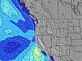 |  |  |  | 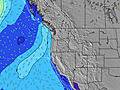 |  | |||||||||||||||
Onda Altezza (m) Direzione Periodo (s) | WNW 10 | WNW 10 | WNW 20 | WNW 20 | WNW 9 | W 19 | W 19 | W 19 | W 19 | W 19 | W 18 | W 18 | W 18 | W 17 | WNW 17 | WNW 17 | WNW 17 | WNW 17 | WNW 16 | WNW 16 | WNW 16 | WNW 16 | WNW 11 | WNW 10 |
Grafico delle onde | ||||||||||||||||||||||||
131 | 128 | 133 | 133 | 158 | 190 | 186 | 182 | 184 | 259 | 174 | 232 | 222 | 293 | 304 | 307 | 390 | 367 | 273 | 269 | 266 | 266 | 352 | 320 | |
Vento (km/h) | ||||||||||||||||||||||||
Stato del vento onshore cross-onshore cross-shore cross-offshore offshore piatto | cross-off | cross | cross | cross | cross | cross | cross-off | glassy | cross-on | cross-on | on | on | cross-on | cross-on | cross | cross-off | cross-off | cross-on | cross-on | cross | cross | cross-off | cross-off | cross-off |
Alta Marea | 2:25PM2.93m | 1:38AM3.49m | 3:07PM3.01m | 2:31AM3.30m | 3:49PM3.06m | 3:24AM3.04m | ||||||||||||||||||
Basso Marea | 7:47AM-0.15m | 7:44PM1.37m | 8:32AM-0.03m | 8:39PM1.27m | 9:14AM0.18m | 9:35PM1.20m | ||||||||||||||||||
5:41 | — | — | — | — | — | — | 5:43 | — | — | — | — | — | — | — | 5:43 | — | — | — | — | — | — | — | 5:43 | |
— | — | — | — | 9:00 | — | — | — | — | — | — | — | 9:00 | — | — | — | — | — | — | — | 8:59 | — | — | 8:58 | |
mm | — | — | — | — | — | — | — | — | 1 | — | — | — | — | — | — | — | — | — | — | — | — | — | — | — |
Temp. °C | 12 | 14 | 15 | 14 | 14 | 13 | 13 | 13 | 14 | 14 | 15 | 15 | 15 | 15 | 14 | 13 | 14 | 16 | 16 | 16 | 15 | 14 | 13 | 13 |
Gelo °C | 11 | 12 | 13 | 11 | 12 | 12 | 12 | 13 | 14 | 12 | 12 | 13 | 14 | 14 | 13 | 12 | 13 | 15 | 14 | 15 | 14 | 13 | 12 | 13 |
Onda 1 Altezza (m) Direzione Periodo (s) | WNW 10 | WNW 10 | WNW 9 | WNW 9 | WNW 9 | WNW 9 | WNW 9 | WNW 8 | WNW 8 | WNW 8 | WNW 8 | WNW 8 | WNW 7 | WNW 8 | WNW 8 | WNW 8 | WNW 8 | WNW 8 | WNW 8 | WNW 8 | WNW 7 | WNW 7 | WNW 11 | WNW 10 |
131 | 128 | 118 | 113 | 158 | 84 | 124 | 113 | 111 | 108 | 108 | 107 | 104 | 107 | 107 | 120 | 126 | 123 | 120 | 98 | 96 | 96 | 352 | 320 | |
Onda 2 Altezza (m) Direzione Periodo (s) | NW 6 | NW 6 | WNW 20 | WNW 20 | WNW 20 | NW 4 | W 19 | W 19 | W 19 | W 19 | W 18 | W 18 | W 18 | W 17 | WNW 17 | WNW 17 | WNW 17 | WNW 17 | WNW 16 | WNW 16 | WNW 16 | WNW 11 | WNW 16 | WNW 16 |
11 | 11 | 133 | 133 | 127 | 13 | 186 | 182 | 184 | 259 | 174 | 232 | 222 | 293 | 304 | 307 | 390 | 367 | 273 | 269 | 266 | 170 | 263 | 263 | |
Onda 3 Altezza (m) Direzione Periodo (s) | W 13 | W 13 | W 13 | SW 18 | SW 18 | W 19 | WNW 13 | WNW 13 | WNW 13 | SW 16 | SW 16 | SW 16 | SW 16 | SW 16 | SW 16 | SW 16 | SW 16 | SW 15 | WNW 12 | WNW 12 | WNW 11 | WNW 16 | SW 14 | SW 14 |
56 | 55 | 55 | 79 | 78 | 190 | 32 | 53 | 53 | 65 | 65 | 64 | 64 | 64 | 64 | 64 | 62 | 58 | 81 | 119 | 143 | 266 | 53 | 53 | |
onde vento Altezza (m) Direzione Periodo (s) | — | — | NW 6 | NW 5 | — | — | — | — | — | — | — | — | — | — | — | — | — | — | — | — | — | — | — | — |
— | — | 11 | 18 | — | — | — | — | — | — | — | — | — | — | — | — | — | — | — | — | — | — | — | — | |
Il più vicino Offshore or Glassy | ||||||||||||||||||||||||
Distanza (km) | 47 | 341 | 947 | 945 | 178 | 47 | 47 | 43 | 43 | 175 | 175 | 175 | 175 | 43 | 43 | 43 | 43 | 137 | 176 | 527 | 226 | 47 | 43 | 43 |
Migliori previsioni per le condizioni d'onda in North Oregon | ||||||||||||||||||||||||
Migliori previsioni per le condizioni d'onda in United States | ||||||||||||||||||||||||
Trova Onde Globale | ||||||||||||||||||||||||
- Map Icons:
 Break
Break Live Wave Height (m)
 Live Wind Speed (km/h)
 Surf Rating (10 Max)
 Ocean Swells (m)
- Wind Speed (km/h)
Widget Free Surf-Forecast.com per il tuo sito
La relazione di surf / widget meteo è disponibile qui sotto per incorporare su siti esterni a titolo gratuito e fornisce una sintesi delle nostre Cape Lookout previsione surf. Basta prendere il frammento di codice html da noi fornito e copiarlo nel proprio sito. È possibile scegliere la lingua preferita e unità metriche / imperiali per il feed delle previsioni surf per soddisfare le esigenze degli utenti del vostro sito .... Clicca qui per ottenere il codice.
 Nearest