
Previsioni:

Previsione a breve terminePioggia moderata (Totale 11mm), più pesante Sabato pomeriggio. Warm (Max 27°C Sabato mattina, Min 25°C Sabato pomeriggio). Venti decrescenti (venti freschi da O Sabato pomeriggio, calma per domenica mattina). | |||||||||||||||||||||
25 | Domenica 26 | Lunedì 27 | |||||||||||||||||||
9 AM | 12 PM | 3 PM | 6 PM | 9 PM | 12 AM | 3 AM | 6 AM | 9 AM | 12 PM | 3 PM | 6 PM | 9 PM | 12 AM | 3 AM | 6 AM | 9 AM | 12 PM | 3 PM | 6 PM | 9 PM | |
Mappa dell'altezza del moto ondoso | 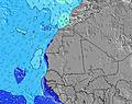 | 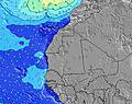 | 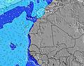 | 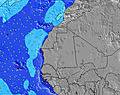 | 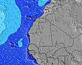 | 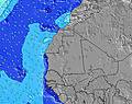 | 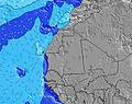 | 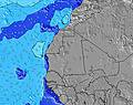 | |||||||||||||
Onda Altezza (m) Direzione Periodo (s) | SSW 9 | S 9 | S 9 | S 9 | SSW 9 | SSW 9 | S 9 | S 9 | S 9 | S 8 | S 8 | S 8 | S 8 | S 8 | S 8 | S 8 | S 8 | S 8 | SSW 7 | SSW 7 | SSW 7 |
Grafico delle onde | |||||||||||||||||||||
68 | 60 | 57 | 57 | 26 | 26 | 56 | 39 | 39 | 34 | 33 | 33 | 33 | 33 | 33 | 32 | 30 | 41 | 42 | 41 | 51 | |
Vento (km/h) | |||||||||||||||||||||
Stato del vento onshore cross-onshore cross-shore cross-offshore offshore piatto | cross-off | cross-off | cross-off | cross-on | cross | cross | cross-on | cross | glassy | glassy | on | cross-on | cross-on | cross | cross | cross-off | cross-off | cross-off | cross-on | cross | cross |
Alta Marea | 6:16AM0.93m | 6:42PM0.83m | 7:13AM0.99m | 7:35PM0.88m | 7:58AM1.06m | 8:17PM0.94m | |||||||||||||||
Basso Marea | 12:30PM0.37m | 00:33AM0.33m | 1:26PM0.31m | 1:25AM0.27m | 2:11PM0.26m | ||||||||||||||||
6:50 | — | — | — | — | — | — | 6:50 | — | — | — | — | — | — | — | 6:50 | — | — | — | — | — | |
— | — | — | 7:40 | — | — | — | — | — | — | — | 7:40 | — | — | — | — | — | — | — | 7:40 | — | |
mm | — | — | 3 | 4 | — | — | — | — | — | — | — | — | — | — | — | — | — | 4 | — | — | — |
Temp. °C | 26 | 27 | 26 | 25 | 27 | 27 | 27 | 27 | 26 | 27 | 27 | 27 | 27 | 27 | 27 | 26 | 26 | 25 | 26 | 27 | 27 |
Gelo °C | 28 | 30 | 27 | 23 | 30 | 31 | 32 | 32 | 31 | 32 | 30 | 30 | 29 | 29 | 29 | 27 | 28 | 28 | 28 | 29 | 29 |
Onda 1 Altezza (m) Direzione Periodo (s) | NNW 8 | NNW 8 | NNW 8 | NNW 8 | NNW 8 | NNW 9 | NNW 9 | NNW 9 | NNW 9 | NNW 9 | NNW 9 | NNW 9 | NNW 9 | NNW 9 | NNW 8 | NNW 8 | NNW 8 | S 8 | SSW 7 | NNW 8 | N 8 |
180 | 147 | 144 | 153 | 169 | 203 | 208 | 213 | 213 | 202 | 166 | 166 | 158 | 158 | 154 | 154 | 160 | 41 | 42 | 90 | 64 | |
Onda 2 Altezza (m) Direzione Periodo (s) | SSW 9 | S 9 | S 9 | S 9 | S 7 | SSW 7 | S 9 | S 9 | S 9 | S 8 | S 8 | S 8 | S 8 | S 8 | S 8 | S 8 | S 8 | SW 12 | SW 12 | SSW 7 | SSW 7 |
68 | 60 | 57 | 57 | 26 | 16 | 56 | 39 | 39 | 34 | 33 | 33 | 33 | 33 | 33 | 32 | 30 | 6 | 6 | 41 | 51 | |
Onda 3 Altezza (m) Direzione Periodo (s) | SSW 13 | SSW 13 | SSW 13 | SSW 13 | SSW 9 | SSW 9 | SW 13 | SW 13 | SSW 13 | SSW 12 | SSW 12 | SSW 12 | SSW 12 | SW 12 | SW 12 | SW 12 | SW 12 | SSW 12 | NW 10 | SW 13 | NW 10 |
17 | 17 | 17 | 17 | 26 | 26 | 7 | 7 | 16 | 15 | 15 | 15 | 15 | 6 | 6 | 6 | 6 | 15 | 4 | 6 | 4 | |
onde vento Altezza (m) Direzione Periodo (s) | NW 3 | — | NW 9 | WNW 3 | WNW 4 | WNW 4 | WNW 4 | — | NW 3 | — | W 3 | — | — | W 2 | WNW 3 | WNW 3 | WNW 3 | NNW 8 | NNW 8 | NW 4 | NW 5 |
3 | — | 28 | 3 | 7 | 6 | 6 | — | 2 | — | 1 | — | — | 1 | 1 | 2 | 4 | 157 | 157 | 31 | 53 | |
Il più vicino Offshore or Glassy | |||||||||||||||||||||
Distanza (km) | 643 | 0 | 1 | 643 | 643 | 614 | 614 | 611 | 1 | 1 | 1 | 1 | 611 | 644 | 614 | 614 | 625 | 0 | 614 | 613 | 611 |
Migliori previsioni per le condizioni d'onda in Senegal | |||||||||||||||||||||
Migliori previsioni per le condizioni d'onda in Senegal | |||||||||||||||||||||
Trova Onde Globale | |||||||||||||||||||||
- Map Icons:
 Break
Break Live Wave Height (m)
 Live Wind Speed (km/h)
 Surf Rating (10 Max)
 Ocean Swells (m)
- Wind Speed (km/h)
Widget Free Surf-Forecast.com per il tuo sito
La relazione di surf / widget meteo è disponibile qui sotto per incorporare su siti esterni a titolo gratuito e fornisce una sintesi delle nostre Club Med previsione surf. Basta prendere il frammento di codice html da noi fornito e copiarlo nel proprio sito. È possibile scegliere la lingua preferita e unità metriche / imperiali per il feed delle previsioni surf per soddisfare le esigenze degli utenti del vostro sito .... Clicca qui per ottenere il codice.
 Nearest