
Previsioni:

Aggiornamento in hr min s Forecast update imminent
Previsione a breve terminePioggia abbondante (Totale 48mm), più pesante durante giovedì notte. Warm (Max 21°C mercoledì mattina, Min 16°C giovedì mattina). Principalmente venti freschi. | ||||||||||||||||||||||||
Mercoledì 1 | Giovedì 2 | Venerdì 3 | 4 | |||||||||||||||||||||
5 AM | 8 AM | 11 AM | 2 PM | 5 PM | 8 PM | 11 PM | 2 AM | 5 AM | 8 AM | 11 AM | 2 PM | 5 PM | 8 PM | 11 PM | 2 AM | 5 AM | 8 AM | 11 AM | 2 PM | 5 PM | 8 PM | 11 PM | 2 AM | |
Mappa dell'altezza del moto ondoso | 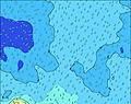 | 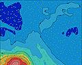 | 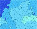 |  | 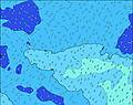 |  |  |  |  | 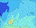 | ||||||||||||||
Onda Altezza (m) Direzione Periodo (s) | SSW 20 | NE 7 | NE 7 | NE 7 | NE 6 | NE 6 | NE 6 | NNE 9 | NNE 9 | NNE 8 | NNE 8 | NNE 8 | NE 8 | NE 8 | E 11 | NE 9 | NNE 9 | NE 9 | ESE 4 | ESE 5 | E 6 | E 6 | E 7 | E 7 |
Grafico delle onde | ||||||||||||||||||||||||
0 | 35 | 35 | 35 | 34 | 20 | 19 | 53 | 25 | 24 | 46 | 45 | 33 | 33 | 26 | 36 | 32 | 21 | 34 | 47 | 55 | 61 | 94 | 97 | |
Vento (km/h) | ||||||||||||||||||||||||
Stato del vento onshore cross-onshore cross-shore cross-offshore offshore piatto | off | off | off | off | off | off | off | cross-off | glassy | glassy | glassy | cross-off | cross-off | cross-off | cross-off | cross-off | cross-off | cross-off | cross | cross-off | cross-off | cross-off | cross-off | cross-off |
Alta Marea | 9:39AM0.57m | 10:10PM0.41m | 10:18AM0.55m | 10:50PM0.42m | 10:59AM0.53m | 11:32PM0.42m | ||||||||||||||||||
Basso Marea | 3:07AM0.05m | 3:52PM-0.03m | 3:44AM0.06m | 4:27PM-0.02m | 4:23AM0.07m | 5:05PM0.00m | ||||||||||||||||||
7:16 | — | — | — | — | — | — | — | 7:16 | — | — | — | — | — | — | — | 7:16 | — | — | — | — | — | — | 7:16 | |
— | — | — | — | 6:07 | — | — | — | — | — | — | — | 6:08 | — | — | — | — | — | — | — | 6:08 | — | — | 6:08 | |
mm | — | — | — | — | — | — | — | — | — | 1 | 6 | 2 | 2 | 8 | 19 | 6 | 3 | 1 | — | — | — | — | — | — |
Temp. °C | 21 | 21 | 21 | 21 | 21 | 21 | 21 | 21 | 21 | 19 | 16 | 17 | 18 | 17 | 17 | 18 | 18 | 18 | 20 | 20 | 21 | 21 | 21 | 20 |
Gelo °C | 18 | 19 | 19 | 20 | 20 | 20 | 20 | 20 | 20 | 19 | 17 | 16 | 15 | 12 | 13 | 14 | 15 | 15 | 17 | 18 | 19 | 19 | 19 | 19 |
Onda 1 Altezza (m) Direzione Periodo (s) | SSW 20 | SSW 19 | SSW 18 | SSW 18 | SSW 17 | SSW 17 | SSW 16 | SSW 16 | SSW 16 | SSW 16 | SSW 15 | SSW 15 | SSW 14 | SSW 14 | SSW 14 | SSW 14 | SSW 14 | SSW 14 | SSW 14 | SSW 14 | SSW 14 | SSW 14 | SSW 13 | SSW 13 |
2683 | 3119 | 3132 | 5221 | 3480 | 3500 | 4081 | 3173 | 4181 | 3816 | 3340 | 2919 | 2840 | 2602 | 2318 | 2318 | 2107 | 2078 | 2078 | 1859 | 1859 | 1665 | 1408 | 1344 | |
Onda 2 Altezza (m) Direzione Periodo (s) | SW 9 | SW 13 | SW 13 | NE 7 | SSW 12 | SSW 12 | SSW 10 | SSW 11 | NE 6 | NE 7 | NNE 8 | NNE 8 | NE 8 | NE 8 | NNE 8 | NE 9 | NNE 9 | NE 9 | NNE 9 | NNE 9 | NNE 9 | E 6 | E 7 | E 7 |
199 | 769 | 746 | 35 | 1062 | 959 | 378 | 550 | 15 | 15 | 46 | 45 | 33 | 33 | 26 | 36 | 32 | 21 | 16 | 16 | 16 | 61 | 94 | 97 | |
Onda 3 Altezza (m) Direzione Periodo (s) | SSW 14 | NE 7 | NE 7 | SSE 12 | NE 6 | NE 6 | NE 6 | NNE 9 | NNE 9 | NNE 8 | ESE 9 | ESE 11 | E 11 | E 11 | E 11 | E 10 | E 10 | ESE 10 | ESE 10 | ESE 10 | ESE 10 | NNE 9 | ESE 10 | ESE 10 |
379 | 35 | 35 | 52 | 34 | 20 | 19 | 53 | 25 | 24 | 17 | 22 | 20 | 20 | 20 | 19 | 19 | 21 | 20 | 20 | 19 | 8 | 18 | 9 | |
onde vento Altezza (m) Direzione Periodo (s) | — | — | — | — | — | — | — | — | — | — | — | — | — | — | — | — | ESE 3 | ESE 4 | ESE 4 | ESE 5 | E 6 | — | — | — |
— | — | — | — | — | — | — | — | — | — | — | — | — | — | — | — | 9 | 24 | 34 | 47 | 55 | — | — | — | |
Il più vicino Offshore or Glassy | ||||||||||||||||||||||||
Distanza (km) | 4 | 4 | 4 | 995 | 4 | 4 | 995 | 0 | 995 | 995 | 995 | 4 | 2 | 1957 | 1114 | 1002 | 2 | 8 | 8 | 8 | 8 | 8 | 8 | 0 |
Migliori previsioni per le condizioni d'onda in Cook-Islands - Rarotonga | ||||||||||||||||||||||||
Migliori previsioni per le condizioni d'onda in Cook Islands | ||||||||||||||||||||||||
Trova Onde Globale | ||||||||||||||||||||||||
- Map Icons:
 Break
Break Live Wave Height (m)
 Live Wind Speed (km/h)
 Surf Rating (10 Max)
 Ocean Swells (m)
- Wind Speed (km/h)
Widget Free Surf-Forecast.com per il tuo sito
La relazione di surf / widget meteo è disponibile qui sotto per incorporare su siti esterni a titolo gratuito e fornisce una sintesi delle nostre Club Raro previsione surf. Basta prendere il frammento di codice html da noi fornito e copiarlo nel proprio sito. È possibile scegliere la lingua preferita e unità metriche / imperiali per il feed delle previsioni surf per soddisfare le esigenze degli utenti del vostro sito .... Clicca qui per ottenere il codice.
 Nearest