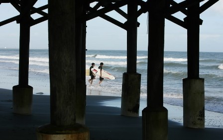

Previsioni:

Previsione a breve terminePioggia abbondante (Totale 68mm), più pesante durante martedì notte. Warm (Max 28°C martedì mattina, Min 23°C martedì notte). Venti in aumento (calma mercoledì notte, venti freschi da NE per giovedì notte). | |||||||||||||||||||||||
Martedì 6 | Mercoledì 7 | Giovedì 8 | |||||||||||||||||||||
5 AM | 8 AM | 11 AM | 2 PM | 5 PM | 8 PM | 11 PM | 2 AM | 5 AM | 8 AM | 11 AM | 2 PM | 5 PM | 8 PM | 11 PM | 2 AM | 5 AM | 8 AM | 11 AM | 2 PM | 5 PM | 8 PM | 11 PM | |
Mappa dell'altezza del moto ondoso | 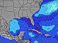 | 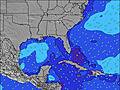 | 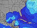 | 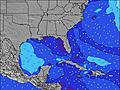 | 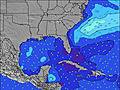 | 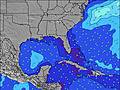 | 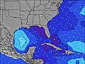 |  |  | ||||||||||||||
Onda Altezza (m) Direzione Periodo (s) | E 9 | E 9 | E 9 | E 9 | E 8 | NE 6 | NE 7 | NE 8 | ENE 9 | ENE 8 | ENE 8 | NE 8 | NE 8 | NE 8 | ENE 8 | NE 8 | ENE 8 | ENE 8 | NE 8 | ENE 8 | ENE 8 | ENE 7 | ENE 7 |
Grafico delle onde  | |||||||||||||||||||||||
 kJ kJ | 14 | 14 | 13 | 6 | 5 | 19 | 84 | 250 | 293 | 217 | 179 | 216 | 206 | 316 | 208 | 346 | 192 | 203 | 229 | 187 | 187 | 207 | 207 |
Vento (km/h) | |||||||||||||||||||||||
Stato del vento onshore cross-onshore cross-shore cross-offshore offshore piatto | glassy | on | on | on | cross | cross-on | on | cross-off | cross | cross | cross-on | cross-on | cross-on | cross-on | glassy | glassy | cross-on | cross-on | cross-on | cross-on | cross-on | cross-on | cross-on |
Alta Marea | 4:43AM1.14m | 5:18PM1.34m | 5:39AM1.22m | 6:07PM1.33m | 6:29AM1.30m | 6:53PM1.30m | |||||||||||||||||
Basso Marea | 10:48AM0.16m | 11:32PM0.21m | 11:46AM0.15m | 00:18AM0.17m | 12:40PM0.14m | ||||||||||||||||||
 |  |  | | |  |  |  |  | | | |  | | | | | | | | | | | |
 | 7:16 | — | — | — | — | — | — | — | 7:18 | — | — | — | — | — | — | — | 7:18 | — | — | — | — | — | — |
 | — | — | — | — | 7:02 | — | — | — | — | — | — | — | 7:00 | — | — | — | — | — | — | — | 7:00 | — | — |
mm | 2 | 3 | — | 1 | 5 | 8 | 2 | 1 | — | 1 | 3 | 5 | 3 | 2 | 3 | 6 | 3 | 2 | 3 | 4 | 4 | 6 | 2 |
Temp. °C | 26 | 27 | 28 | 28 | 25 | 23 | 24 | 24 | 25 | 25 | 26 | 26 | 24 | 24 | 24 | 23 | 24 | 25 | 26 | 26 | 26 | 25 | 25 |
Gelo °C | 30 | 31 | 32 | 31 | 27 | 25 | 27 | 27 | 27 | 27 | 27 | 26 | 24 | 27 | 28 | 27 | 26 | 27 | 27 | 28 | 29 | 25 | 23 |
Onda 1 Altezza (m) Direzione Periodo (s) | E 9 | E 9 | E 9 | NNE 6 | NE 6 | E 6 | E 8 | NE 8 | ENE 9 | ENE 8 | ENE 8 | E 14 | — | NE 8 | ESE 8 | NE 8 | ENE 8 | — | — | — | E 9 | E 9 | — |
| kJ | 14 | 14 | 13 | 4 | 10 | 3 | 6 | 250 | 293 | 217 | 179 | 4 | — | 316 | 6 | 346 | 192 | — | — | — | 2 | 2 | — |
Onda 2 Altezza (m) Direzione Periodo (s) | ESE 6 | E 6 | E 6 | E 6 | E 6 | E 8 | E 12 | — | E 15 | — | E 14 | — | — | E 14 | — | ESE 8 | — | — | — | — | — | — | — |
| kJ | 6 | 6 | 2 | 2 | 3 | 5 | 3 | — | 4 | — | 4 | — | — | 4 | — | 6 | — | — | — | — | — | — | — |
Onda 3 Altezza (m) Direzione Periodo (s) | E 13 | E 13 | N 5 | E 9 | E 8 | E 15 | E 15 | — | — | — | — | — | — | — | — | — | — | — | — | — | — | — | — |
| kJ | 3 | 3 | 1 | 6 | 5 | 4 | 4 | — | — | — | — | — | — | — | — | — | — | — | — | — | — | — | — |
onde vento Altezza (m) Direzione Periodo (s) | — | — | — | — | — | NE 6 | NE 7 | E 6 | — | SW 2 | W 3 | NE 8 | NE 8 | NE 8 | ENE 8 | ENE 8 | — | ENE 8 | NE 8 | ENE 8 | ENE 8 | ENE 7 | ENE 7 |
| kJ | — | — | — | — | — | 19 | 84 | 3 | — | 1 | 1 | 216 | 206 | 178 | 208 | 220 | — | 203 | 229 | 187 | 187 | 207 | 207 |
Il più vicino Offshore or Glassy | |||||||||||||||||||||||
Distanza (km) | 1220 | 46 | 46 | 1904 | 46 | 76 | 42 | 0 | 25 | 11 | 56 | 100 | 124 | 186 | 0 | 0 | 221 | 56 | 72 | 46 | 72 | 114 | 100 |
Migliori previsioni per le condizioni d'onda in North Florida | |||||||||||||||||||||||
Migliori previsioni per le condizioni d'onda in United States | |||||||||||||||||||||||
Trova Onde Globale | |||||||||||||||||||||||
- Map Icons:
 Break
Break Live Wave Height (m)
 Live Wind Speed (km/h)
 Surf Rating (10 Max)
 Ocean Swells (m)
- Wind Speed (km/h)

Widget Free Surf-Forecast.com per il tuo sito
La relazione di surf / widget meteo è disponibile qui sotto per incorporare su siti esterni a titolo gratuito e fornisce una sintesi delle nostre Cocoa Beach Pier previsione surf. Basta prendere il frammento di codice html da noi fornito e copiarlo nel proprio sito. È possibile scegliere la lingua preferita e unità metriche / imperiali per il feed delle previsioni surf per soddisfare le esigenze degli utenti del vostro sito .... Clicca qui per ottenere il codice.

 Nearest