
Previsioni:

Previsione a breve termineper lo più asciutto. Very mild (Max 16°C Venerdì pomeriggio, Min 11°C giovedì notte). Venti in aumento (calma giovedì mattina, venti freschi da N per sabato pomeriggio). | ||||||||||||||||||||||||
Giovedì 16 | Venerdì 17 | Sabato 18 | ||||||||||||||||||||||
2 AM | 5 AM | 8 AM | 11 AM | 2 PM | 5 PM | 8 PM | 11 PM | 2 AM | 5 AM | 8 AM | 11 AM | 2 PM | 5 PM | 8 PM | 11 PM | 2 AM | 5 AM | 8 AM | 11 AM | 2 PM | 5 PM | 8 PM | 11 PM | |
Mappa dell'altezza del moto ondoso |  |  |  |  | 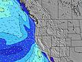 |  |  | 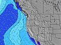 |  | |||||||||||||||
Onda Altezza (m) Direzione Periodo (s) | WNW 19 | WNW 19 | WNW 19 | WNW 19 | WNW 19 | WNW 18 | WNW 18 | WNW 17 | WNW 17 | WNW 17 | WNW 17 | WNW 17 | WNW 16 | WNW 16 | WNW 16 | WNW 16 | WNW 16 | WNW 16 | WNW 16 | NW 10 | NW 10 | WNW 16 | WNW 16 | NNW 7 |
Grafico delle onde | ||||||||||||||||||||||||
212 | 203 | 283 | 283 | 277 | 257 | 326 | 315 | 394 | 394 | 428 | 414 | 475 | 350 | 371 | 371 | 266 | 362 | 362 | 442 | 507 | 324 | 297 | 332 | |
Vento (km/h) | ||||||||||||||||||||||||
Stato del vento onshore cross-onshore cross-shore cross-offshore offshore piatto | cross-on | glassy | glassy | on | on | on | cross-on | cross-on | cross | cross | cross | cross-on | cross-on | cross-on | cross-on | cross-on | cross-on | cross-on | cross-on | cross-on | cross-on | cross-on | cross-on | cross-on |
Alta Marea | 1:37AM2.59m | 3:09PM2.16m | 2:29AM2.44m | 3:49PM2.22m | 3:22AM2.22m | 4:30PM2.26m | ||||||||||||||||||
Basso Marea | 8:31AM-0.57m | 8:38PM0.65m | 9:13AM-0.39m | 9:34PM0.58m | 9:54AM-0.16m | 10:32PM0.52m | ||||||||||||||||||
— | 5:50 | — | — | — | — | — | — | — | 5:52 | — | — | — | — | — | — | — | 5:52 | — | — | — | — | — | — | |
— | — | — | — | — | — | 8:54 | — | — | — | — | — | — | — | 8:53 | — | — | — | — | — | — | — | 8:52 | — | |
mm | — | — | — | — | — | — | — | — | — | — | — | — | — | — | — | — | — | — | — | — | — | — | — | — |
Temp. °C | 13 | 14 | 14 | 15 | 15 | 15 | 15 | 13 | 12 | 11 | 11 | 15 | 16 | 16 | 14 | 13 | 13 | 13 | 13 | 15 | 15 | 15 | 14 | 12 |
Gelo °C | 12 | 14 | 14 | 14 | 13 | 12 | 13 | 12 | 11 | 10 | 9 | 12 | 12 | 13 | 12 | 11 | 11 | 11 | 11 | 11 | 10 | 10 | 10 | 8 |
Onda 1 Altezza (m) Direzione Periodo (s) | WNW 9 | WNW 9 | WNW 9 | WNW 19 | WNW 8 | WNW 8 | WNW 8 | WNW 17 | WNW 17 | WNW 17 | WNW 17 | WNW 17 | WNW 16 | WNW 16 | WNW 16 | WNW 16 | WNW 11 | NW 6 | NW 7 | WNW 16 | WNW 16 | WNW 16 | WNW 16 | WNW 16 |
86 | 84 | 62 | 283 | 80 | 86 | 84 | 315 | 394 | 394 | 428 | 414 | 475 | 350 | 371 | 371 | 157 | 123 | 111 | 357 | 353 | 324 | 277 | 320 | |
Onda 2 Altezza (m) Direzione Periodo (s) | NNW 5 | NNW 5 | WNW 19 | WNW 9 | WNW 19 | WNW 18 | WNW 18 | WNW 8 | WNW 8 | NW 7 | WNW 8 | NW 7 | WNW 8 | WNW 12 | WNW 12 | WNW 12 | WNW 16 | WNW 16 | WNW 11 | SW 14 | SW 17 | WNW 10 | WNW 10 | WSW 18 |
15 | 16 | 283 | 59 | 277 | 257 | 326 | 75 | 75 | 47 | 56 | 52 | 26 | 103 | 125 | 171 | 266 | 362 | 176 | 51 | 77 | 85 | 55 | 126 | |
Onda 3 Altezza (m) Direzione Periodo (s) | WNW 19 | WNW 19 | NNW 5 | NNW 5 | SW 16 | SW 16 | SW 16 | NNW 7 | NNW 7 | WNW 8 | NNW 7 | WNW 8 | SW 19 | WNW 8 | WNW 8 | NW 8 | SW 14 | NW 11 | WNW 16 | WSW 18 | SW 14 | SW 17 | SW 18 | SW 13 |
212 | 203 | 18 | 19 | 64 | 64 | 64 | 42 | 43 | 43 | 42 | 25 | 94 | 25 | 25 | 16 | 53 | 117 | 362 | 30 | 46 | 148 | 152 | 27 | |
onde vento Altezza (m) Direzione Periodo (s) | — | — | — | — | NNW 6 | NNW 7 | NNW 7 | — | — | — | — | — | NNW 7 | NNW 7 | NNW 7 | NNW 6 | NNW 6 | — | — | NW 10 | NW 10 | NNW 6 | NNW 7 | NNW 7 |
— | — | — | — | 28 | 38 | 42 | — | — | — | — | — | 73 | 93 | 93 | 90 | 141 | — | — | 442 | 507 | 241 | 297 | 332 | |
Il più vicino Offshore or Glassy | ||||||||||||||||||||||||
Distanza (km) | 115 | 1 | 1 | 396 | 396 | 396 | 396 | 156 | 30 | 30 | 30 | 176 | 396 | 727 | 176 | 115 | 115 | 115 | 115 | 176 | 176 | 176 | 160 | 115 |
Migliori previsioni per le condizioni d'onda in South Oregon | ||||||||||||||||||||||||
Migliori previsioni per le condizioni d'onda in United States | ||||||||||||||||||||||||
Trova Onde Globale | ||||||||||||||||||||||||
- Map Icons:
 Break
Break Live Wave Height (m)
 Live Wind Speed (km/h)
 Surf Rating (10 Max)
 Ocean Swells (m)
- Wind Speed (km/h)
Widget Free Surf-Forecast.com per il tuo sito
La relazione di surf / widget meteo è disponibile qui sotto per incorporare su siti esterni a titolo gratuito e fornisce una sintesi delle nostre Coos Bay-South Jetty previsione surf. Basta prendere il frammento di codice html da noi fornito e copiarlo nel proprio sito. È possibile scegliere la lingua preferita e unità metriche / imperiali per il feed delle previsioni surf per soddisfare le esigenze degli utenti del vostro sito .... Clicca qui per ottenere il codice.
 Nearest