
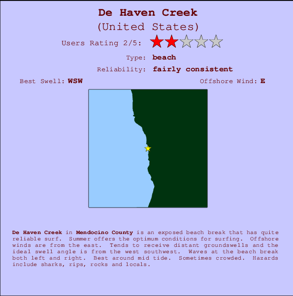
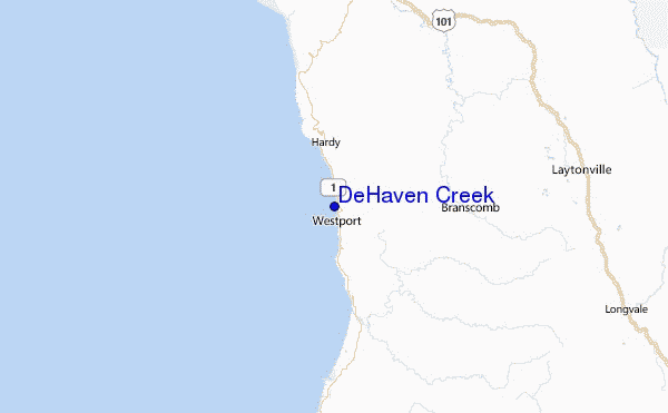
De Haven Creek Surf Guide
DeHaven Creek in Mendocino County is an exposed beach break that has reasonably consistent surf. Summer offers the favoured conditions for surfing. Offshore winds blow from the east. Most of the surf here comes from groundswells and the best swell direction is from the west southwest. The beach break offers both left and right hand waves. Best around mid tide. When the surf is up, it can get quite busy in the water. Take care of sharks, rips, rocks and locals.
De Haven Creek Spot Info
| Type: | Rating: | Reliability: | Todays Sea Temp*: |
|---|---|---|---|
| fairly consistent | 13.0°C*ocean temperature recorded from satellite |
Surfing De Haven Creek:
The best conditions reported for surf at De Haven Creek occur when a West-southwest swell combines with an offshore wind direction from the East.

Previsioni Energia d'onda (Potenza): 12hrs


De Haven Creek Surf:
Thursday, 16 July 2026, 17:08 Local time| Giovedì 16 | ||||
| 2PM | 5PM | 8PM | 11PM | |
| Wave (m) | ||||
| Periodo (s) | 19 | 6 | 7 | 18 |
| Vento (km/h) | ||||
| Stato del vento | cross- on |
cross- on |
cross- on |
cross |
- /breaks/De-Haven-Creek/forecasts/latest
De Haven Creek Surf Guide
DeHaven Creek in Mendocino County is an exposed beach break that has reasonably consistent surf. Summer offers the favoured conditions for surfing. Offshore winds blow from the east. Most of the surf here comes from groundswells and the best swell direction is from the west southwest. The beach break offers both left and right hand waves. Best around mid tide. When the surf is up, it can get quite busy in the water. Take care of sharks, rips, rocks and locals.
De Haven Creek Spot Info
Type: Rating: Reliability: Todays Sea Temp*:  Beach
Beach 2
2fairly consistent 13.0°C*ocean temperature recorded from satelliteSurfing De Haven Creek:
The best conditions reported for surf at De Haven Creek occur when a West-southwest swell combines with an offshore wind direction from the East.
Previsioni Energia d'onda (Potenza): 12hrs
Utilizzare la scheda di navigazione in alto per visualizzare De Haven Creek temperatura del mare, De Haven Creek fotografie, De Haven Creek dettagliate previsioni onde, il vento e le previsioni meteo, De Haven Creek webcam, vento corrente da CAL - Mendocino County stazioni meteo e De Haven Creek previsioni marea. Il link United States mappe maree apre l'immagine grande, che mostra United States e dei mari circostanti. Queste mappe possono essere animate per mostrare le diverse componenti del moto ondoso, energia delle onde, periodo d'onda, altezza delle onde, insieme con le previsioni del vento e meteo, meteo corrente e osservazioni sullo stato del mare dal United States onda-boe, le navi passanti e stazioni meteo costiere. Ciascuna delle pagine di previsioni per questo surf break rappresenta uno strumento di wavefinder globale e regionale per individuare le migliori condizioni di surf nella zona intorno De Haven Creek.
De Haven Creek Surf:
Thursday, 16 July 2026, 17:08 Local timeGiovedì 16 2PM 5PM 8PM 11PM Wave (m) Periodo (s) 19 6 7 18 Vento (km/h) Stato del vento cross-
oncross-
oncross-
oncross - /breaks/De-Haven-Creek/forecasts/latest
- /breaks/De-Haven-Creek/forecasts/latest/six_day
De Haven Creek Surf Guide
DeHaven Creek in Mendocino County is an exposed beach break that has reasonably consistent surf. Summer offers the favoured conditions for surfing. Offshore winds blow from the east. Most of the surf here comes from groundswells and the best swell direction is from the west southwest. The beach break offers both left and right hand waves. Best around mid tide. When the surf is up, it can get quite busy in the water. Take care of sharks, rips, rocks and locals.
De Haven Creek Spot Info
Type: Rating: Reliability: Todays Sea Temp*: Beach2fairly consistent 13.0°C*ocean temperature recorded from satelliteSurfing De Haven Creek:
The best conditions reported for surf at De Haven Creek occur when a West-southwest swell combines with an offshore wind direction from the East.
Previsioni Energia d'onda (Potenza): 12hrs
Utilizzare la scheda di navigazione in alto per visualizzare De Haven Creek temperatura del mare, De Haven Creek fotografie, De Haven Creek dettagliate previsioni onde, il vento e le previsioni meteo, De Haven Creek webcam, vento corrente da CAL - Mendocino County stazioni meteo e De Haven Creek previsioni marea. Il link United States mappe maree apre l'immagine grande, che mostra United States e dei mari circostanti. Queste mappe possono essere animate per mostrare le diverse componenti del moto ondoso, energia delle onde, periodo d'onda, altezza delle onde, insieme con le previsioni del vento e meteo, meteo corrente e osservazioni sullo stato del mare dal United States onda-boe, le navi passanti e stazioni meteo costiere. Ciascuna delle pagine di previsioni per questo surf break rappresenta uno strumento di wavefinder globale e regionale per individuare le migliori condizioni di surf nella zona intorno De Haven Creek.
De Haven Creek Surf:
Thursday, 16 July 2026, 17:08 Local timeGiovedì 16 2PM 5PM 8PM 11PM Wave (m) Periodo (s) 19 6 7 18 Vento (km/h) Stato del vento cross-
oncross-
oncross-
oncross - /breaks/De-Haven-Creek/forecasts/latest
De Haven Creek Surf Guide
DeHaven Creek in Mendocino County is an exposed beach break that has reasonably consistent surf. Summer offers the favoured conditions for surfing. Offshore winds blow from the east. Most of the surf here comes from groundswells and the best swell direction is from the west southwest. The beach break offers both left and right hand waves. Best around mid tide. When the surf is up, it can get quite busy in the water. Take care of sharks, rips, rocks and locals.
De Haven Creek Spot Info
Type: Rating: Reliability: Todays Sea Temp*: Beach2fairly consistent 13.0°C*ocean temperature recorded from satelliteSurfing De Haven Creek:
The best conditions reported for surf at De Haven Creek occur when a West-southwest swell combines with an offshore wind direction from the East.
Previsioni Energia d'onda (Potenza): 12hrs
Utilizzare la scheda di navigazione in alto per visualizzare De Haven Creek temperatura del mare, De Haven Creek fotografie, De Haven Creek dettagliate previsioni onde, il vento e le previsioni meteo, De Haven Creek webcam, vento corrente da CAL - Mendocino County stazioni meteo e De Haven Creek previsioni marea. Il link United States mappe maree apre l'immagine grande, che mostra United States e dei mari circostanti. Queste mappe possono essere animate per mostrare le diverse componenti del moto ondoso, energia delle onde, periodo d'onda, altezza delle onde, insieme con le previsioni del vento e meteo, meteo corrente e osservazioni sullo stato del mare dal United States onda-boe, le navi passanti e stazioni meteo costiere. Ciascuna delle pagine di previsioni per questo surf break rappresenta uno strumento di wavefinder globale e regionale per individuare le migliori condizioni di surf nella zona intorno De Haven Creek.
De Haven Creek Surf:
Thursday, 16 July 2026, 17:08 Local timeGiovedì 16 2PM 5PM 8PM 11PM Wave (m) Periodo (s) 19 6 7 18 Vento (km/h) Stato del vento cross-
oncross-
oncross-
oncross Tide Times:
Per Westport, California, %{dist} %{km} da %{location}.
PROSSIMA È ALLE (ora locale) rimanente alta marea bassa marea De Haven Creek Tide Times and Tide Chart
Live Weather:
At Willits, 36 km from De Haven Creek.
calm
(km/h)
dryAir temperature
22°COverall De Haven Creek Surf Consistency and Wind Distribution in Luglio


Wind stats for De Haven Creek: see the variation in direction and stength by month.
foto dall' album
Contorni: Strade e fiumi: seleziona un surf break dal menu 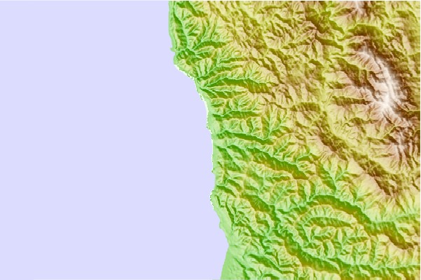
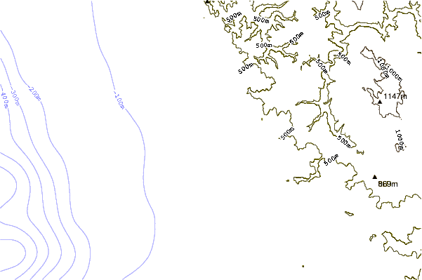
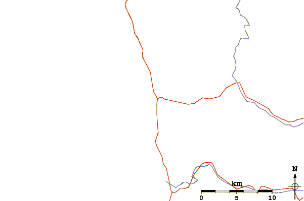
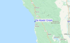
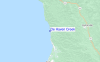
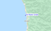
Utilizzare questa mappa sollievo per navigare CAL - Mendocino County surf breaks e stazioni di marea che si trovano nella zona diDe Haven Creek
Altri surf breaks più vicini al De Haven Creek:
(clicca sul nome del luogo per maggiori informazioni)- Closest località surf3 mi
- Second closest località surf6 mi
- Third closest località surf10 mi
- Fourth closest località surf12 mi
- Fifth closest località surf12 mi
Onda boe più vicina a De Haven Creek:
- Closest Onda boa21 mi
- Second closest Onda boa33 mi
- Third closest Onda boa67 mi
- Fourth closest Onda boa86 mi
- Fifth closest Onda boa91 mi
Stazioni di marea più vicina alla De Haven Creek:
- Closest marea stazioneWestport1 mi
- Second closest marea stazioneFort Bragg Landing14 mi
- Third closest marea stazioneNoyo River16 mi
- Fourth closest marea stazioneMendocino, Mendocino Bay24 mi
- Fifth closest marea stazioneShelter Cove30 mi
Airports
- The nearest passenger airport to DeHaven Creek is Chico Muni Airport (CIC) in USA, which is 166 km (103 miles) away (directly).
- The second closest airport to DeHaven Creek is Beale Afb (Marysville) Airport (BAB), also in USA, 210 km (130 miles) away.
- /breaks/De-Haven-Creek/forecasts/latest

 Nearest