
Previsioni:

Previsione a breve termineper lo più asciutto. Very mild (Max 19°C Domenica mattina, Min 13°C Venerdì notte). Vento sarà generalmente leggero. | ||||||||||||||||||||||||
Venerdì 17 | Sabato 18 | Domenica 19 | ||||||||||||||||||||||
2 AM | 5 AM | 8 AM | 11 AM | 2 PM | 5 PM | 8 PM | 11 PM | 2 AM | 5 AM | 8 AM | 11 AM | 2 PM | 5 PM | 8 PM | 11 PM | 2 AM | 5 AM | 8 AM | 11 AM | 2 PM | 5 PM | 8 PM | 11 PM | |
Mappa dell'altezza del moto ondoso |  |  |  |  | 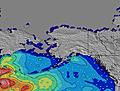 | 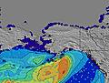 | 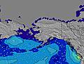 | 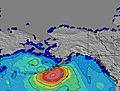 | 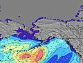 | |||||||||||||||
Onda Altezza (m) Direzione Periodo (s) | W 16 | W 16 | W 16 | W 16 | W 16 | W 16 | W 16 | W 16 | W 16 | W 16 | W 15 | W 15 | W 15 | W 15 | W 15 | W 15 | W 15 | W 8 | W 8 | W 8 | W 8 | W 8 | W 8 | W 8 |
Grafico delle onde | ||||||||||||||||||||||||
192 | 190 | 252 | 249 | 178 | 176 | 176 | 174 | 121 | 119 | 116 | 113 | 113 | 112 | 112 | 110 | 107 | 103 | 117 | 124 | 124 | 120 | 124 | 130 | |
Vento (km/h) | ||||||||||||||||||||||||
Stato del vento onshore cross-onshore cross-shore cross-offshore offshore piatto | cross-off | cross | cross | cross | cross | cross | cross | cross-off | cross-off | cross-off | cross | cross-on | cross | cross | cross | cross-off | cross-off | cross-off | glassy | glassy | glassy | cross | cross | cross-off |
Alta Marea | 3:43AM2.26m | 5:14PM1.91m | 4:35AM2.01m | 5:53PM1.94m | 5:30AM1.74m | 6:33PM1.96m | ||||||||||||||||||
Basso Marea | 10:55AM-0.66m | 11:09PM0.80m | 11:33AM-0.32m | 00:09AM0.72m | 12:08PM0.07m | |||||||||||||||||||
— | 5:33 | — | — | — | — | — | — | — | 5:33 | — | — | — | — | — | — | — | 5:35 | — | — | — | — | — | — | |
— | — | — | — | — | — | 9:09 | — | — | — | — | — | — | — | 9:08 | — | — | — | — | — | — | — | 9:07 | — | |
mm | — | — | — | — | — | — | — | — | — | — | — | — | — | — | — | — | — | — | — | — | — | — | — | — |
Temp. °C | 14 | 14 | 15 | 16 | 17 | 17 | 17 | 14 | 13 | 13 | 15 | 17 | 18 | 17 | 15 | 13 | 13 | 13 | 15 | 17 | 19 | 17 | 17 | 15 |
Gelo °C | 13 | 13 | 14 | 15 | 15 | 14 | 14 | 13 | 12 | 12 | 14 | 15 | 14 | 13 | 12 | 11 | 12 | 12 | 15 | 17 | 19 | 16 | 16 | 14 |
Onda 1 Altezza (m) Direzione Periodo (s) | W 8 | W 8 | W 16 | W 16 | W 16 | W 11 | W 11 | WNW 11 | WNW 10 | W 10 | W 10 | W 10 | W 10 | W 9 | W 9 | W 9 | W 9 | W 8 | W 8 | W 8 | W 8 | W 8 | W 8 | W 8 |
60 | 58 | 252 | 249 | 178 | 125 | 114 | 119 | 110 | 100 | 96 | 94 | 90 | 63 | 81 | 78 | 99 | 93 | 117 | 124 | 124 | 120 | 124 | 130 | |
Onda 2 Altezza (m) Direzione Periodo (s) | W 16 | W 16 | W 8 | W 8 | W 8 | W 16 | W 16 | W 16 | W 16 | W 16 | W 15 | W 15 | W 15 | W 15 | W 15 | W 15 | W 15 | W 14 | W 14 | W 14 | W 14 | W 14 | W 14 | W 14 |
192 | 190 | 42 | 41 | 32 | 176 | 176 | 174 | 121 | 119 | 116 | 113 | 113 | 112 | 112 | 110 | 107 | 103 | 65 | 64 | 64 | 64 | 64 | 63 | |
Onda 3 Altezza (m) Direzione Periodo (s) | SW 16 | SW 16 | SW 16 | SW 16 | WNW 11 | SW 16 | SW 15 | SW 14 | SW 14 | SW 14 | SW 14 | SW 14 | SW 14 | SW 14 | SW 14 | SW 17 | SW 17 | SW 18 | SW 18 | SW 18 | SW 16 | WSW 13 | WSW 13 | SW 16 |
40 | 40 | 39 | 39 | 23 | 62 | 35 | 33 | 33 | 33 | 33 | 33 | 33 | 33 | 33 | 47 | 107 | 109 | 79 | 50 | 42 | 17 | 18 | 39 | |
onde vento Altezza (m) Direzione Periodo (s) | — | — | — | — | — | — | — | — | — | — | — | — | — | W 3 | — | — | — | — | — | — | — | — | — | — |
— | — | — | — | — | — | — | — | — | — | — | — | — | 3 | — | — | — | — | — | — | — | — | — | — | |
Il più vicino Offshore or Glassy | ||||||||||||||||||||||||
Distanza (km) | 0 | 6 | 6 | 6 | 6 | 140 | 94 | 0 | 0 | 0 | 6 | 712 | 712 | 712 | 696 | 0 | 0 | 0 | 0 | 0 | 0 | 25 | 94 | 0 |
Migliori previsioni per le condizioni d'onda in Washington State | ||||||||||||||||||||||||
Migliori previsioni per le condizioni d'onda in United States | ||||||||||||||||||||||||
Trova Onde Globale | ||||||||||||||||||||||||
- Map Icons:
 Break
Break Live Wave Height (m)
 Live Wind Speed (km/h)
 Surf Rating (10 Max)
 Ocean Swells (m)
- Wind Speed (km/h)
Widget Free Surf-Forecast.com per il tuo sito
La relazione di surf / widget meteo è disponibile qui sotto per incorporare su siti esterni a titolo gratuito e fornisce una sintesi delle nostre Deep Creek previsione surf. Basta prendere il frammento di codice html da noi fornito e copiarlo nel proprio sito. È possibile scegliere la lingua preferita e unità metriche / imperiali per il feed delle previsioni surf per soddisfare le esigenze degli utenti del vostro sito .... Clicca qui per ottenere il codice.
 Nearest