
Previsioni:

Previsione a breve termineper lo più asciutto. Warm (Max 27°C Venerdì pomeriggio, Min 26°C Venerdì mattina). Principalmente raffiche di vento. | ||||||||||||||||||||||
Venerdì 17 | Sabato 18 | Domenica 19 | ||||||||||||||||||||
7 AM | 10 AM | 1 PM | 4 PM | 7 PM | 10 PM | 1 AM | 4 AM | 7 AM | 10 AM | 1 PM | 4 PM | 7 PM | 10 PM | 1 AM | 4 AM | 7 AM | 10 AM | 1 PM | 4 PM | 7 PM | 10 PM | |
Mappa dell'altezza del moto ondoso |  | 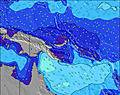 | 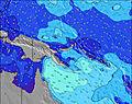 | 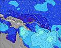 | 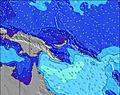 | 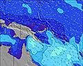 | 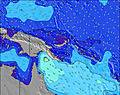 | 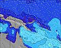 | ||||||||||||||
Onda Altezza (m) Direzione Periodo (s) | SSE 8 | SSE 8 | SSE 5 | SSE 6 | SSE 6 | SSE 8 | S 8 | S 8 | S 8 | S 8 | S 5 | S 5 | S 5 | S 8 | S 8 | S 7 | S 7 | SSE 7 | SSE 7 | SSE 7 | SSE 7 | SSE 7 |
Grafico delle onde | ||||||||||||||||||||||
207 | 212 | 128 | 173 | 148 | 229 | 190 | 190 | 157 | 181 | 117 | 146 | 129 | 253 | 253 | 269 | 329 | 346 | 383 | 346 | 310 | 310 | |
Vento (km/h) | ||||||||||||||||||||||
Stato del vento onshore cross-onshore cross-shore cross-offshore offshore piatto | on | on | on | on | on | on | on | on | on | on | on | on | on | on | on | on | on | on | on | on | on | on |
Alta Marea | 4:00AM0.85m | 3:59AM0.76m | 7:08PM0.53m | |||||||||||||||||||
Basso Marea | 12:36PM0.11m | 12:15PM0.19m | 11:47AM0.23m | 9:55PM0.50m | ||||||||||||||||||
5:58 | — | — | — | — | — | — | 5:58 | — | — | — | — | — | — | — | 5:58 | — | — | — | — | — | — | |
— | — | — | 5:52 | — | — | — | — | — | — | — | 5:52 | — | — | — | — | — | — | — | 5:52 | — | — | |
mm | — | — | — | — | — | — | — | — | — | — | — | — | — | — | — | — | — | — | — | — | — | — |
Temp. °C | 26 | 26 | 26 | 27 | 26 | 26 | 26 | 26 | 26 | 27 | 27 | 27 | 26 | 26 | 26 | 26 | 26 | 26 | 26 | 26 | 26 | 26 |
Gelo °C | 22 | 22 | 22 | 23 | 22 | 22 | 22 | 23 | 23 | 24 | 23 | 24 | 22 | 23 | 22 | 22 | 22 | 21 | 21 | 21 | 21 | 22 |
Onda 1 Altezza (m) Direzione Periodo (s) | — | — | W 9 | W 8 | — | — | — | — | — | — | — | — | — | — | — | — | — | — | S 21 | S 21 | S 20 | S 19 |
— | — | 1 | 1 | — | — | — | — | — | — | — | — | — | — | — | — | — | — | 9 | 8 | 8 | 7 | |
Onda 2 Altezza (m) Direzione Periodo (s) | — | — | — | — | E 9 | — | — | — | — | E 10 | E 10 | — | — | — | — | — | S 21 | S 21 | S 21 | S 20 | S 19 | SE 20 |
— | — | — | — | 2 | — | — | — | — | 2 | 2 | — | — | — | — | — | 9 | 9 | 9 | 8 | 7 | 15 | |
Onda 3 Altezza (m) Direzione Periodo (s) | — | — | — | — | — | — | — | — | — | — | — | — | — | — | — | — | — | — | — | — | SE 20 | — |
— | — | — | — | — | — | — | — | — | — | — | — | — | — | — | — | — | — | — | — | 16 | — | |
onde vento Altezza (m) Direzione Periodo (s) | SSE 8 | SSE 8 | SSE 5 | SSE 6 | SSE 6 | SSE 8 | S 8 | S 8 | S 8 | S 8 | S 5 | S 5 | S 5 | S 8 | S 8 | S 7 | S 7 | SSE 7 | SSE 7 | SSE 7 | SSE 7 | SSE 7 |
207 | 212 | 128 | 173 | 148 | 229 | 190 | 190 | 157 | 181 | 117 | 146 | 129 | 253 | 253 | 269 | 329 | 346 | 383 | 346 | 310 | 310 | |
Il più vicino Offshore or Glassy | ||||||||||||||||||||||
Distanza (km) | 700 | 2290 | 2291 | 2291 | 2387 | 2387 | 190 | 700 | 983 | 983 | 700 | 2290 | 190 | 2290 | 2290 | 2225 | 1901 | 2225 | 780 | 2387 | 2291 | 2288 |
Migliori previsioni per le condizioni d'onda in New Britain and Duke of York | ||||||||||||||||||||||
Migliori previsioni per le condizioni d'onda in Papua New Guinea | ||||||||||||||||||||||
Trova Onde Globale | ||||||||||||||||||||||
- Map Icons:
 Break
Break Live Wave Height (m)
 Live Wind Speed (km/h)
 Surf Rating (10 Max)
 Ocean Swells (m)
- Wind Speed (km/h)
Widget Free Surf-Forecast.com per il tuo sito
La relazione di surf / widget meteo è disponibile qui sotto per incorporare su siti esterni a titolo gratuito e fornisce una sintesi delle nostre Duke of York previsione surf. Basta prendere il frammento di codice html da noi fornito e copiarlo nel proprio sito. È possibile scegliere la lingua preferita e unità metriche / imperiali per il feed delle previsioni surf per soddisfare le esigenze degli utenti del vostro sito .... Clicca qui per ottenere il codice.
 Nearest