
Previsioni:

Previsione a breve terminePioggia abbondante (Totale 30mm), più pesante durante venerdì notte. Warm (Max 21°C Venerdì notte, Min 8°C Domenica mattina). Venti decrescenti (raffiche di vento da NNE Venerdì notte, venti deboli da E per domenica mattina). | ||||||||||||||||||||
Gio 30 | Venerdì 31 | Sabato 1 | ||||||||||||||||||
12 PM | 3 PM | 6 PM | 9 PM | 12 AM | 3 AM | 6 AM | 9 AM | 12 PM | 3 PM | 6 PM | 9 PM | 12 AM | 3 AM | 6 AM | 9 AM | 12 PM | 3 PM | 6 PM | 9 PM | |
Mappa dell'altezza del moto ondoso |  | 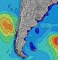 |  | 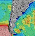 | 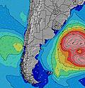 |  | 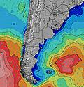 |  | ||||||||||||
Onda Altezza (m) Direzione Periodo (s) | S 12 | S 12 | S 11 | S 11 | S 11 | S 10 | S 10 | S 10 | S 10 | S 9 | E 8 | E 8 | E 8 | E 9 | E 9 | E 10 | E 11 | E 11 | E 11 | E 11 |
Grafico delle onde | ||||||||||||||||||||
112 | 101 | 64 | 61 | 58 | 19 | 17 | 17 | 16 | 15 | 111 | 129 | 140 | 130 | 113 | 128 | 108 | 84 | 89 | 57 | |
Vento (km/h) | ||||||||||||||||||||
Stato del vento onshore cross-onshore cross-shore cross-offshore offshore piatto | cross-off | cross | cross-off | cross-off | cross-off | cross-off | cross-off | cross-off | cross-off | cross-off | off | off | off | cross | cross-off | cross-off | on | cross-on | cross-on | on |
Alta Marea | 1:49PM0.18m | 8:24PM0.31m | 8:55AM0.23m | 2:13PM0.18m | 9:06PM0.30m | 9:28AM0.24m | 2:42PM0.17m | |||||||||||||
Basso Marea | 11:35AM0.17m | 4:00PM0.16m | 4:52AM0.09m | 12:17PM0.16m | 4:50PM0.15m | 5:32AM0.11m | 1:02PM0.16m | 5:37PM0.13m | ||||||||||||
— | — | — | — | — | — | 7:35 | — | — | — | — | — | — | — | 7:33 | — | — | — | — | — | |
— | 5:55 | — | — | — | — | — | — | — | 5:57 | — | — | — | — | — | — | — | 5:58 | — | — | |
mm | — | — | — | — | — | — | — | — | — | 1 | 1 | 1 | — | 5 | 16 | 1 | 4 | 1 | — | — |
Temp. °C | 12 | 13 | 11 | 10 | 10 | 11 | 12 | 13 | 17 | 19 | 20 | 20 | 21 | 17 | 16 | 17 | 13 | 12 | 11 | 10 |
Gelo °C | 7 | 7 | 5 | 4 | 4 | 5 | 5 | 6 | 11 | 15 | 17 | 15 | 17 | 12 | 15 | 16 | 9 | 8 | 8 | 6 |
Onda 1 Altezza (m) Direzione Periodo (s) | S 12 | S 12 | S 11 | S 11 | S 11 | S 10 | S 10 | S 10 | S 10 | S 9 | E 8 | E 8 | E 8 | E 9 | E 9 | E 10 | E 11 | E 11 | E 11 | SSW 5 |
112 | 101 | 64 | 61 | 58 | 19 | 17 | 17 | 16 | 15 | 111 | 129 | 140 | 130 | 113 | 128 | 108 | 84 | 89 | 36 | |
Onda 2 Altezza (m) Direzione Periodo (s) | SE 8 | SSE 8 | — | — | SSE 7 | SSE 7 | S 7 | S 7 | SE 8 | S 8 | S 9 | S 9 | S 9 | NE 4 | W 3 | W 3 | E 11 | S 8 | — | E 11 |
2 | 6 | — | — | 15 | 9 | 4 | 4 | 3 | 1 | 6 | 6 | 6 | 4 | 3 | 2 | 61 | 1 | — | 57 | |
Onda 3 Altezza (m) Direzione Periodo (s) | E 8 | — | — | — | — | SE 8 | SE 8 | SE 8 | — | — | — | — | — | S 9 | S 9 | S 9 | S 8 | — | — | S 8 |
5 | — | — | — | — | 2 | 2 | 2 | — | — | — | — | — | 6 | 6 | 1 | 1 | — | — | 1 | |
onde vento Altezza (m) Direzione Periodo (s) | E 3 | E 3 | E 4 | ENE 4 | ENE 5 | ENE 5 | ENE 6 | ENE 6 | ENE 6 | ENE 7 | NNE 4 | NNE 4 | NNE 4 | NW 4 | — | — | WSW 3 | SSW 4 | SSW 5 | — |
2 | 7 | 24 | 31 | 48 | 72 | 87 | 100 | 140 | 158 | 8 | 21 | 29 | 5 | — | — | 7 | 22 | 33 | — | |
Il più vicino Offshore or Glassy | ||||||||||||||||||||
Distanza (km) | 120 | 120 | 120 | 160 | 786 | 817 | 523 | 523 | 1003 | 523 | 523 | 272 | 237 | 225 | 0 | 1 | 73 | 163 | 126 | 38 |
Migliori previsioni per le condizioni d'onda in Uruguay - South | ||||||||||||||||||||
Migliori previsioni per le condizioni d'onda in Uruguay | ||||||||||||||||||||
Trova Onde Globale | ||||||||||||||||||||
- Map Icons:
 Break
Break Live Wave Height (m)
 Live Wind Speed (km/h)
 Surf Rating (10 Max)
 Ocean Swells (m)
- Wind Speed (km/h)
Widget Free Surf-Forecast.com per il tuo sito
La relazione di surf / widget meteo è disponibile qui sotto per incorporare su siti esterni a titolo gratuito e fornisce una sintesi delle nostre El Barco previsione surf. Basta prendere il frammento di codice html da noi fornito e copiarlo nel proprio sito. È possibile scegliere la lingua preferita e unità metriche / imperiali per il feed delle previsioni surf per soddisfare le esigenze degli utenti del vostro sito .... Clicca qui per ottenere il codice.
 Nearest